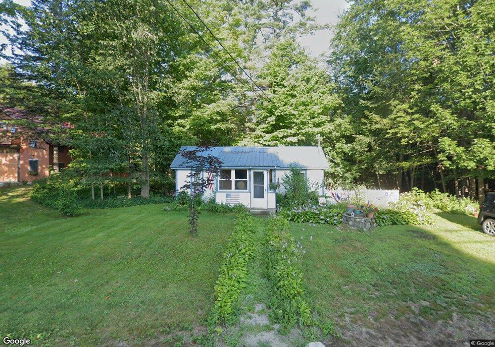
175 S High St Bridgton, ME 04009
Estimated Value: $120,267 - $304,000
3
Beds
2
Baths
552
Sq Ft
$418/Sq Ft
Est. Value
About This Home
This home is located at 175 S High St, Bridgton, ME 04009 and is currently estimated at $230,817, approximately $418 per square foot. 175 S High St is a home with nearby schools including Lake Region High School and Bridgton Academy.
Ownership History
Date
Name
Owned For
Owner Type
Purchase Details
Closed on
Oct 29, 2025
Sold by
Clt Com
Bought by
Cousins Karen J
Current Estimated Value
Purchase Details
Closed on
Mar 6, 2025
Sold by
Cousins Karen J
Bought by
Cousins Ryan and Cousins Casey
Purchase Details
Closed on
May 20, 2005
Sold by
Cousins Karen J
Bought by
Cousins Merle W
Create a Home Valuation Report for This Property
The Home Valuation Report is an in-depth analysis detailing your home's value as well as a comparison with similar homes in the area
Home Values in the Area
Average Home Value in this Area
Purchase History
| Date | Buyer | Sale Price | Title Company |
|---|---|---|---|
| Cousins Karen J | -- | -- | |
| Cousins Ryan | -- | None Available | |
| Cousins Ryan | -- | None Available | |
| Cousins Merle W | -- | -- | |
| Cousins Karen J | -- | -- | |
| Cousins Karen J | -- | -- | |
| Cousins Merle W | -- | -- | |
| Cousins Karen J | -- | -- |
Source: Public Records
Mortgage History
| Date | Status | Borrower | Loan Amount |
|---|---|---|---|
| Previous Owner | Cousins Karen J | $15,000 |
Source: Public Records
Tax History Compared to Growth
Tax History
| Year | Tax Paid | Tax Assessment Tax Assessment Total Assessment is a certain percentage of the fair market value that is determined by local assessors to be the total taxable value of land and additions on the property. | Land | Improvement |
|---|---|---|---|---|
| 2024 | $745 | $43,698 | $18,420 | $25,278 |
| 2023 | $752 | $43,698 | $18,420 | $25,278 |
| 2022 | $664 | $43,698 | $18,420 | $25,278 |
| 2021 | $647 | $43,698 | $18,420 | $25,278 |
| 2020 | $653 | $43,698 | $18,420 | $25,278 |
| 2019 | $655 | $43,698 | $18,420 | $25,278 |
| 2018 | $647 | $43,698 | $18,420 | $25,278 |
| 2017 | $669 | $43,698 | $18,420 | $25,278 |
| 2016 | -- | $43,698 | $18,420 | $25,278 |
| 2015 | -- | $59,747 | $21,788 | $37,959 |
| 2014 | $840 | $59,747 | $21,788 | $37,959 |
Source: Public Records
Map
Nearby Homes
- 0 Tuttle Ln Unit 1628227
- 220 S High St
- 3 A St
- 4 C St
- Lot 23 G Smally Way
- Lot 23 - F Smally Way
- 209 Portland Rd
- Lot 23 - D Smally Way
- 236 Portland Rd Unit A
- 3 Fowler St
- 161 Swamp Rd
- 20 Bennett St
- 6 School St
- Lot 3 Wildwood Rd
- 10 Gallinari Way
- 27 Stonehedge Dr
- 64-74 Portland Rd
- 323 Portland Rd
- 70 Plummers Landing Rd
- 222 N High St