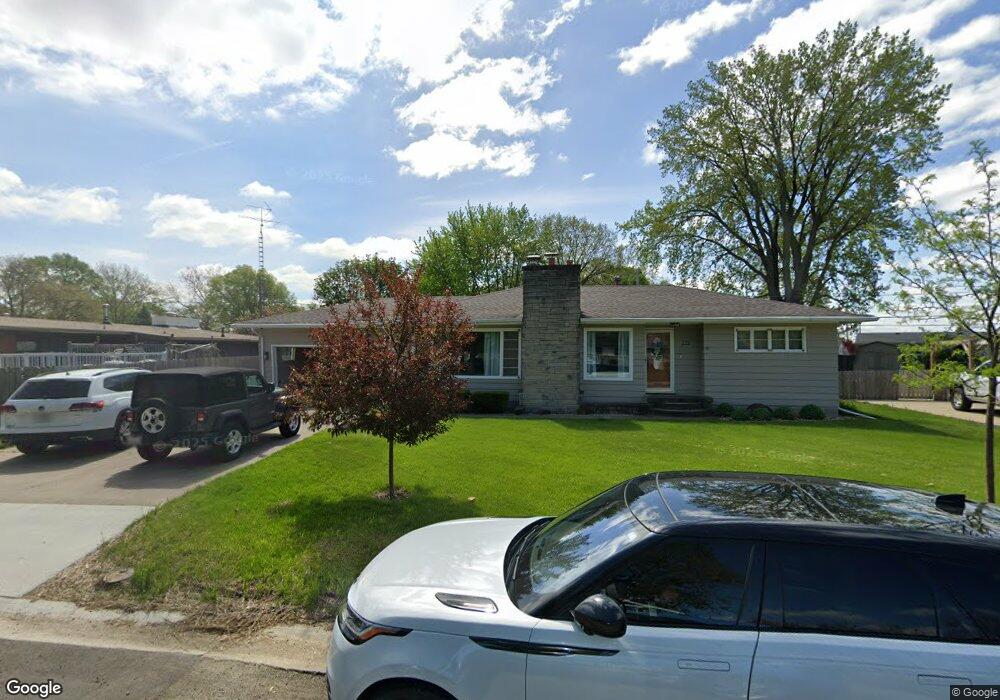
175 Southgate St Lincoln, IL 62656
Estimated Value: $166,000 - $431,972
4
Beds
2
Baths
1,796
Sq Ft
$148/Sq Ft
Est. Value
About This Home
This home is located at 175 Southgate St, Lincoln, IL 62656 and is currently estimated at $265,991, approximately $148 per square foot. 175 Southgate St is a home located in Logan County with nearby schools including Washington-Monroe Elementary School, Adams Elementary School, and Lincoln Junior High School.
Ownership History
Date
Name
Owned For
Owner Type
Purchase Details
Closed on
Nov 1, 2024
Sold by
Wells Brian Bill and Wells Marcia J
Bought by
Bailey Aleck and Elsas Brooklynn
Current Estimated Value
Home Financials for this Owner
Home Financials are based on the most recent Mortgage that was taken out on this home.
Original Mortgage
$211,500
Interest Rate
6.09%
Mortgage Type
New Conventional
Purchase Details
Closed on
Oct 17, 2006
Sold by
Wells Barney B and Wells Marcia J
Bought by
Wells Barney B and Wells Marcia J
Create a Home Valuation Report for This Property
The Home Valuation Report is an in-depth analysis detailing your home's value as well as a comparison with similar homes in the area
Home Values in the Area
Average Home Value in this Area
Purchase History
| Date | Buyer | Sale Price | Title Company |
|---|---|---|---|
| Bailey Aleck | -- | None Available | |
| Bailey Aleck | $470,000 | None Available | |
| Wells Barney B | $133,500 | -- |
Source: Public Records
Mortgage History
| Date | Status | Borrower | Loan Amount |
|---|---|---|---|
| Previous Owner | Bailey Aleck | $211,500 |
Source: Public Records
Tax History
| Year | Tax Paid | Tax Assessment Tax Assessment Total Assessment is a certain percentage of the fair market value that is determined by local assessors to be the total taxable value of land and additions on the property. | Land | Improvement |
|---|---|---|---|---|
| 2024 | $4,196 | $56,770 | $10,470 | $46,300 |
| 2023 | $3,930 | $52,560 | $9,690 | $42,870 |
| 2022 | $3,763 | $49,130 | $9,060 | $40,070 |
| 2021 | $3,581 | $47,170 | $8,700 | $38,470 |
| 2020 | $3,519 | $46,470 | $8,570 | $37,900 |
| 2019 | $3,918 | $45,560 | $8,400 | $37,160 |
| 2018 | $3,877 | $44,670 | $8,240 | $36,430 |
| 2017 | $3,854 | $44,670 | $8,240 | $36,430 |
| 2016 | $3,754 | $44,620 | $8,230 | $36,390 |
| 2015 | $3,484 | $41,830 | $7,950 | $33,880 |
| 2014 | $3,484 | $41,830 | $7,950 | $33,880 |
| 2013 | $3,484 | $39,710 | $7,550 | $32,160 |
| 2012 | $3,484 | $40,430 | $7,690 | $32,740 |
Source: Public Records
Map
Nearby Homes
- 180 Regent St
- 130 Half Moon St
- 1708 Rutledge Dr
- 1431 N Ottawa St
- 1208 N Kankakee St
- 1109 N Logan St
- 2294 Railsplitter Ave
- 2344 Railsplitter Ave
- 906 Peoria St
- 620 Tremont St
- 1412 N Union St
- 703 N Union St
- 1214 Pekin St
- 310 Pekin St
- 113 N Kickapoo St
- 417 N Union St
- 435 N Union St
- 123 20th St
- 628 Grand Ave
- 218 18th St
- 185 Southgate St
- 165 Southgate St
- 115 Bond St
- 170 Southgate St
- 180 Southgate St
- 155 Southgate St
- 250 Mayfair Dr
- 150 Southgate St
- 240 Mayfair Dr
- 125 Bond St
- 190 Southgate St
- 110 Bond St
- 195 Southgate St
- 260 Mayfair Dr
- 230 Mayfair Dr
- 115 Regent St
- 270 Mayfair Dr
- 135 Regent St
- 120 Bond St
- 200 Southgate St
Your Personal Tour Guide
Ask me questions while you tour the home.