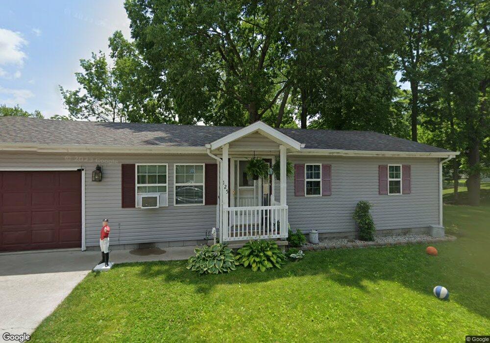
175 W Hoover Ln Markle, IN 46770
Estimated Value: $119,000 - $131,000
3
Beds
1
Bath
988
Sq Ft
$128/Sq Ft
Est. Value
About This Home
This home is located at 175 W Hoover Ln, Markle, IN 46770 and is currently estimated at $126,839, approximately $128 per square foot. 175 W Hoover Ln is a home located in Huntington County with nearby schools including Salamonie School and Huntington North High School.
Ownership History
Date
Name
Owned For
Owner Type
Purchase Details
Closed on
Aug 16, 2021
Sold by
Marshall Ernest
Bought by
Bitzer Jonathan and Delaney Tyler
Current Estimated Value
Home Financials for this Owner
Home Financials are based on the most recent Mortgage that was taken out on this home.
Original Mortgage
$83,460
Outstanding Balance
$75,777
Interest Rate
2.8%
Mortgage Type
FHA
Estimated Equity
$51,062
Purchase Details
Closed on
Nov 29, 2010
Sold by
Osborn Chris Melvin
Bought by
Marshall Ronald D
Create a Home Valuation Report for This Property
The Home Valuation Report is an in-depth analysis detailing your home's value as well as a comparison with similar homes in the area
Purchase History
| Date | Buyer | Sale Price | Title Company |
|---|---|---|---|
| Bitzer Jonathan | -- | Fidelity National Title (Aka | |
| Marshall Ronald D | $45,000 | -- |
Source: Public Records
Mortgage History
| Date | Status | Borrower | Loan Amount |
|---|---|---|---|
| Open | Bitzer Jonathan | $83,460 |
Source: Public Records
Tax History
| Year | Tax Paid | Tax Assessment Tax Assessment Total Assessment is a certain percentage of the fair market value that is determined by local assessors to be the total taxable value of land and additions on the property. | Land | Improvement |
|---|---|---|---|---|
| 2024 | $570 | $103,400 | $9,700 | $93,700 |
| 2023 | $511 | $92,000 | $9,700 | $82,300 |
| 2022 | $458 | $90,500 | $9,700 | $80,800 |
| 2021 | $171 | $51,300 | $9,700 | $41,600 |
| 2020 | $1,059 | $47,900 | $9,700 | $38,200 |
| 2019 | $998 | $45,600 | $9,700 | $35,900 |
| 2018 | $517 | $45,600 | $9,700 | $35,900 |
| 2017 | $500 | $45,900 | $9,700 | $36,200 |
| 2016 | $464 | $44,900 | $9,700 | $35,200 |
| 2014 | $438 | $42,800 | $9,700 | $33,100 |
| 2013 | $438 | $43,600 | $9,700 | $33,900 |
Source: Public Records
Map
Nearby Homes
Your Personal Tour Guide
Ask me questions while you tour the home.