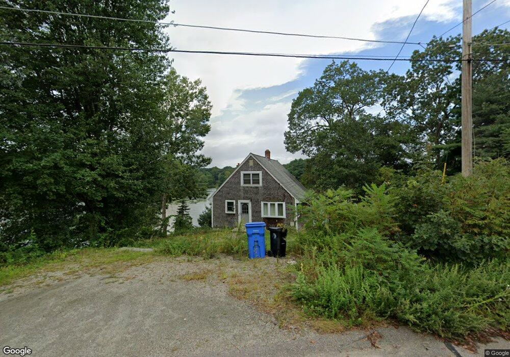
175 Walnut Rd Wrentham, MA 02093
Estimated Value: $485,000 - $573,000
2
Beds
1
Bath
936
Sq Ft
$560/Sq Ft
Est. Value
About This Home
This home is located at 175 Walnut Rd, Wrentham, MA 02093 and is currently estimated at $523,958, approximately $559 per square foot. 175 Walnut Rd is a home located in Norfolk County with nearby schools including Delaney Elementary School and Charles E Roderick.
Ownership History
Date
Name
Owned For
Owner Type
Purchase Details
Closed on
Sep 26, 2007
Sold by
Savoy Felicia A
Bought by
Kuplast Felicia A
Current Estimated Value
Home Financials for this Owner
Home Financials are based on the most recent Mortgage that was taken out on this home.
Original Mortgage
$260,000
Interest Rate
6.65%
Mortgage Type
Purchase Money Mortgage
Purchase Details
Closed on
Aug 29, 1996
Sold by
Redman John F and Redman Kathleen K
Bought by
Savoy Felicia A
Purchase Details
Closed on
Mar 23, 1990
Sold by
Thompson Leonard J
Bought by
Redman John F
Create a Home Valuation Report for This Property
The Home Valuation Report is an in-depth analysis detailing your home's value as well as a comparison with similar homes in the area
Purchase History
| Date | Buyer | Sale Price | Title Company |
|---|---|---|---|
| Kuplast Felicia A | -- | -- | |
| Savoy Felicia A | $149,000 | -- | |
| Redman John F | $152,500 | -- |
Source: Public Records
Mortgage History
| Date | Status | Borrower | Loan Amount |
|---|---|---|---|
| Open | Redman John F | $258,100 | |
| Closed | Kuplast Felicia A | $260,000 | |
| Previous Owner | Redman John F | $175,000 | |
| Previous Owner | Redman John F | $144,192 |
Source: Public Records
Tax History
| Year | Tax Paid | Tax Assessment Tax Assessment Total Assessment is a certain percentage of the fair market value that is determined by local assessors to be the total taxable value of land and additions on the property. | Land | Improvement |
|---|---|---|---|---|
| 2025 | $5,461 | $471,200 | $277,100 | $194,100 |
| 2024 | $5,428 | $452,300 | $288,200 | $164,100 |
| 2023 | $5,028 | $398,400 | $262,000 | $136,400 |
| 2022 | $4,793 | $350,600 | $238,200 | $112,400 |
| 2021 | $4,853 | $344,900 | $238,200 | $106,700 |
| 2020 | $4,416 | $309,900 | $195,800 | $114,100 |
| 2019 | $4,095 | $290,000 | $181,800 | $108,200 |
| 2018 | $4,151 | $291,500 | $182,400 | $109,100 |
| 2017 | $3,942 | $276,600 | $178,900 | $97,700 |
| 2016 | $3,866 | $270,700 | $173,700 | $97,000 |
| 2015 | $3,779 | $252,300 | $167,000 | $85,300 |
| 2014 | $4,095 | $267,500 | $185,300 | $82,200 |
Source: Public Records
Map
Nearby Homes
- 246 Forest Grove Ave
- 0 W Birch Rd
- 8 Ridgefield Rd
- 11 Weber Farm Rd Unit 11
- 8 Weber Farm Rd Unit 8
- 45 Joshua Rd
- 30 Weber Farm Rd Unit 30
- 287 Park St
- 576 Dedham St
- 50 Reed Fulton Ave Unit Lot 61
- 11 Sharon Ave
- 9 Sharon Ave
- 500 Franklin St
- 10 Nature View Dr
- 15 Nature View Dr
- 23 Fredrickson Rd
- 7 Hill St Unit 12
- 7 Hill St Unit 16
- 20 Waites Crossing
- 19 Waites Crossing
Your Personal Tour Guide
Ask me questions while you tour the home.