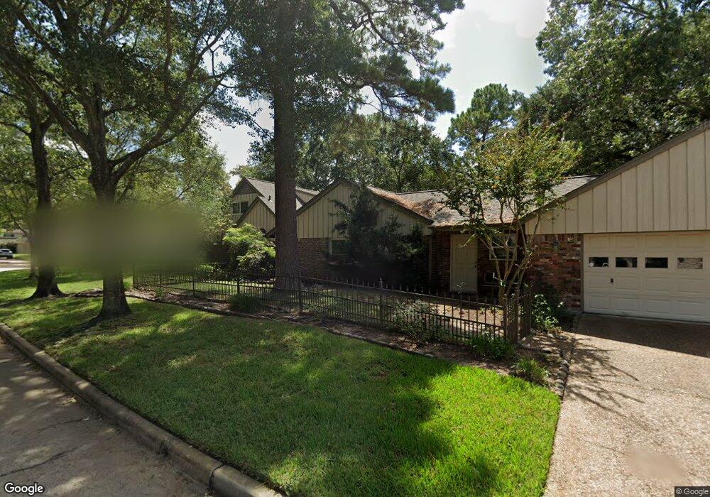
175 Warrenton Dr Houston, TX 77024
Memorial NeighborhoodEstimated Value: $1,520,417 - $1,829,000
4
Beds
5
Baths
4,244
Sq Ft
$392/Sq Ft
Est. Value
About This Home
This home is located at 175 Warrenton Dr, Houston, TX 77024 and is currently estimated at $1,662,854, approximately $391 per square foot. 175 Warrenton Dr is a home located in Harris County with nearby schools including Frostwood Elementary School, Memorial Middle, and Memorial High School.
Ownership History
Date
Name
Owned For
Owner Type
Purchase Details
Closed on
May 14, 2009
Sold by
Leach Kathleen Elizabeth Randle and Leach Kathleen R
Bought by
Shoaf Jeffrey D and Shoaf Catherine M
Current Estimated Value
Home Financials for this Owner
Home Financials are based on the most recent Mortgage that was taken out on this home.
Original Mortgage
$417,000
Outstanding Balance
$263,328
Interest Rate
4.84%
Mortgage Type
Purchase Money Mortgage
Estimated Equity
$1,399,526
Create a Home Valuation Report for This Property
The Home Valuation Report is an in-depth analysis detailing your home's value as well as a comparison with similar homes in the area
Home Values in the Area
Average Home Value in this Area
Purchase History
| Date | Buyer | Sale Price | Title Company |
|---|---|---|---|
| Shoaf Jeffrey D | -- | Stewart Title Houston Divisi |
Source: Public Records
Mortgage History
| Date | Status | Borrower | Loan Amount |
|---|---|---|---|
| Open | Shoaf Jeffrey D | $417,000 |
Source: Public Records
Tax History Compared to Growth
Tax History
| Year | Tax Paid | Tax Assessment Tax Assessment Total Assessment is a certain percentage of the fair market value that is determined by local assessors to be the total taxable value of land and additions on the property. | Land | Improvement |
|---|---|---|---|---|
| 2025 | $20,473 | $1,426,181 | $780,943 | $645,238 |
| 2024 | $20,473 | $1,322,000 | $660,798 | $661,202 |
| 2023 | $20,473 | $1,312,501 | $660,798 | $651,703 |
| 2022 | $7,756 | $1,056,167 | $660,798 | $395,369 |
| 2021 | $25,695 | $934,918 | $660,798 | $274,120 |
| 2020 | $24,232 | $870,832 | $660,798 | $210,034 |
| 2019 | $32,492 | $1,122,367 | $660,798 | $461,569 |
| 2018 | $9,136 | $1,071,700 | $660,798 | $410,902 |
| 2017 | $27,687 | $1,071,700 | $660,798 | $410,902 |
| 2016 | $25,170 | $870,000 | $660,798 | $209,202 |
| 2015 | $15,039 | $870,000 | $660,798 | $209,202 |
| 2014 | $15,039 | $1,059,245 | $480,580 | $578,665 |
Source: Public Records
Map
Nearby Homes
- 170 Haversham Dr
- 150 Gessner Rd Unit 5A
- 0 Gessner Rd
- 234 Plantation Rd
- 12327 Tunbridge Ln
- 201 Vanderpool Ln Unit 103
- 201 Vanderpool Ln Unit 65
- 201 Vanderpool Ln Unit 64
- 8 Woodstone St
- 10 Warrenton Dr
- 3 Plantation Rd
- 1 Woodstone St
- 354 Tealwood Dr
- 241 Litchfield Ln
- 6 Gessner Rd
- 358 Tealwood Dr
- 271 Litchfield Ln
- 259 Litchfield Ln Unit 66
- 12334 Beauregard Dr
- 201 Litchfield Ln
- 171 Warrenton Dr
- 174 Haversham Dr
- 12210 Valley Star Dr
- 167 Warrenton Dr
- 12214 Valley Star Dr
- 12218 Valley Star Dr
- 170 Warrenton Dr
- 166 Haversham Dr
- 178 Warrenton Dr
- 163 Warrenton Dr
- 166 Warrenton Dr
- 182 Warrenton Dr
- 12222 Valley Star Dr
- 162 Haversham Dr
- 203 Kilts Dr
- 207 Kilts Dr
- 162 Warrenton Dr
- 171 Haversham Dr
- 159 Warrenton Dr
- 171 Plantation Rd