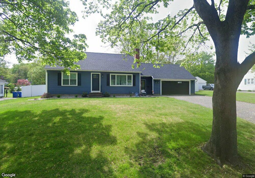
175 Wolcott Ave West Springfield, MA 01089
Estimated Value: $339,490 - $358,000
4
Beds
1
Bath
1,187
Sq Ft
$292/Sq Ft
Est. Value
About This Home
This home is located at 175 Wolcott Ave, West Springfield, MA 01089 and is currently estimated at $346,123, approximately $291 per square foot. 175 Wolcott Ave is a home located in Hampden County with nearby schools including West Springfield High School and St Thomas The Apostle School.
Ownership History
Date
Name
Owned For
Owner Type
Purchase Details
Closed on
Feb 15, 2007
Sold by
Farnsworth Kurt S and Farnsworth Julia A
Bought by
Dacosta Sandra P and Silva Jeffrey M
Current Estimated Value
Home Financials for this Owner
Home Financials are based on the most recent Mortgage that was taken out on this home.
Original Mortgage
$206,000
Interest Rate
6.24%
Mortgage Type
Purchase Money Mortgage
Purchase Details
Closed on
Dec 29, 1999
Sold by
Maloney James J and Maloney Gina S
Bought by
Farnsworth Julia A and Farnsworth Kurt S
Home Financials for this Owner
Home Financials are based on the most recent Mortgage that was taken out on this home.
Original Mortgage
$142,127
Interest Rate
7.71%
Mortgage Type
Purchase Money Mortgage
Purchase Details
Closed on
Aug 29, 1995
Sold by
Salvatore Frederick and Salvatore Judith
Bought by
Maloney James J and Salvatore Gina
Create a Home Valuation Report for This Property
The Home Valuation Report is an in-depth analysis detailing your home's value as well as a comparison with similar homes in the area
Home Values in the Area
Average Home Value in this Area
Purchase History
| Date | Buyer | Sale Price | Title Company |
|---|---|---|---|
| Dacosta Sandra P | $206,000 | -- | |
| Farnsworth Julia A | $147,000 | -- | |
| Maloney James J | $127,000 | -- |
Source: Public Records
Mortgage History
| Date | Status | Borrower | Loan Amount |
|---|---|---|---|
| Open | Maloney James J | $210,635 | |
| Closed | Dacosta Sandra P | $206,000 | |
| Previous Owner | Maloney James J | $142,127 |
Source: Public Records
Tax History
| Year | Tax Paid | Tax Assessment Tax Assessment Total Assessment is a certain percentage of the fair market value that is determined by local assessors to be the total taxable value of land and additions on the property. | Land | Improvement |
|---|---|---|---|---|
| 2025 | $4,242 | $285,300 | $111,000 | $174,300 |
| 2024 | $4,246 | $286,700 | $111,000 | $175,700 |
| 2023 | $3,854 | $248,000 | $111,000 | $137,000 |
| 2022 | $3,519 | $223,300 | $100,800 | $122,500 |
| 2021 | $3,419 | $202,300 | $94,000 | $108,300 |
| 2020 | $3,366 | $198,100 | $94,000 | $104,100 |
| 2019 | $3,360 | $198,100 | $94,000 | $104,100 |
| 2018 | $3,378 | $198,100 | $94,000 | $104,100 |
| 2017 | $3,378 | $198,100 | $94,000 | $104,100 |
| 2016 | $3,339 | $196,500 | $90,400 | $106,100 |
| 2015 | $3,276 | $192,800 | $88,700 | $104,100 |
| 2014 | $795 | $192,800 | $88,700 | $104,100 |
Source: Public Records
Map
Nearby Homes
- 1996 Westfield St
- 117 Sibley Ave
- 62 Talcott Ave
- 88 Verdugo St
- 65 Verdugo St
- 240 Morton St
- 61 Clarence St
- 32 Glenview Dr
- 0 Ahiska Rd Unit 73477754
- 34 High Meadow Dr
- 132 Lincoln St
- 81 Chestnut St
- 791 Morgan Rd
- 32 Maple St
- 24 E View Dr
- 128 Hampden St
- 120 Hampden St
- 24-26 Howard St
- 1012 River St
- 0 E Mountain Rd
- 185 Wolcott Ave
- 168 Greystone Ave
- 161 Wolcott Ave
- 193 Wolcott Ave
- 174 Wolcott Ave
- 186 Greystone Ave
- 155 Wolcott Ave
- 158 Greystone Ave
- 192 Wolcott Ave
- 162 Wolcott Ave
- 196 Wolcott Ave
- 203 Wolcott Ave
- 198 Wolcott Ave
- 149 Wolcott Ave
- 202 Greystone Ave
- 173 Greystone Ave
- 183 Greystone Ave
- 167 Greystone Ave
- 206 Wolcott Ave
- 146 Greystone Ave
Your Personal Tour Guide
Ask me questions while you tour the home.