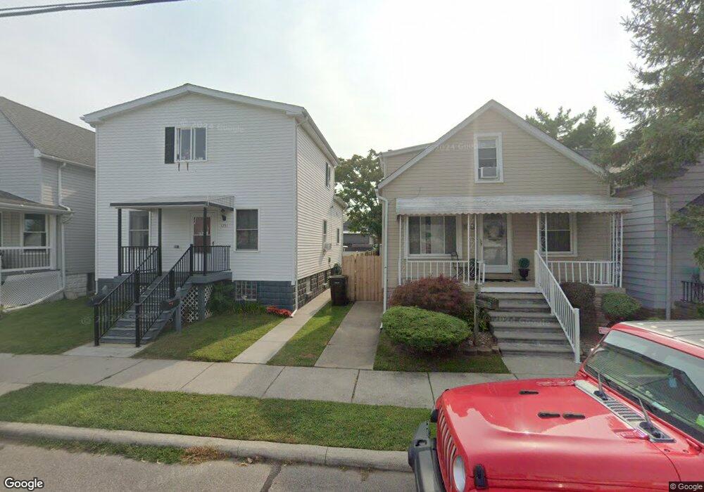
1750 3rd St Wyandotte, MI 48192
Estimated Value: $200,704 - $226,000
--
Bed
--
Bath
1,232
Sq Ft
$174/Sq Ft
Est. Value
About This Home
This home is located at 1750 3rd St, Wyandotte, MI 48192 and is currently estimated at $214,176, approximately $173 per square foot. 1750 3rd St is a home located in Wayne County with nearby schools including James A. Garfield Elementary School, Woodrow Wilson School, and Roosevelt High School.
Ownership History
Date
Name
Owned For
Owner Type
Purchase Details
Closed on
Oct 17, 2007
Sold by
Miller Gary and Miller Catherine
Bought by
Miller Gary
Current Estimated Value
Home Financials for this Owner
Home Financials are based on the most recent Mortgage that was taken out on this home.
Original Mortgage
$72,000
Outstanding Balance
$45,630
Interest Rate
6.5%
Mortgage Type
New Conventional
Estimated Equity
$168,546
Purchase Details
Closed on
Sep 17, 2001
Sold by
Demick Eugene G
Bought by
Miller Gary
Create a Home Valuation Report for This Property
The Home Valuation Report is an in-depth analysis detailing your home's value as well as a comparison with similar homes in the area
Home Values in the Area
Average Home Value in this Area
Purchase History
| Date | Buyer | Sale Price | Title Company |
|---|---|---|---|
| Miller Gary | -- | None Available | |
| Miller Gary | $79,000 | -- |
Source: Public Records
Mortgage History
| Date | Status | Borrower | Loan Amount |
|---|---|---|---|
| Open | Miller Gary | $72,000 |
Source: Public Records
Tax History Compared to Growth
Tax History
| Year | Tax Paid | Tax Assessment Tax Assessment Total Assessment is a certain percentage of the fair market value that is determined by local assessors to be the total taxable value of land and additions on the property. | Land | Improvement |
|---|---|---|---|---|
| 2025 | $1,337 | $89,800 | $0 | $0 |
| 2024 | $1,337 | $82,600 | $0 | $0 |
| 2023 | $1,275 | $72,600 | $0 | $0 |
| 2022 | $1,477 | $66,200 | $0 | $0 |
| 2021 | $1,448 | $64,300 | $0 | $0 |
| 2020 | $1,428 | $51,900 | $0 | $0 |
| 2019 | $1,408 | $52,200 | $0 | $0 |
| 2018 | $1,124 | $30,500 | $0 | $0 |
| 2017 | $492 | $30,500 | $0 | $0 |
| 2016 | $1,359 | $27,700 | $0 | $0 |
| 2015 | $2,426 | $25,700 | $0 | $0 |
| 2013 | $2,350 | $23,500 | $0 | $0 |
| 2012 | $1,080 | $24,200 | $4,300 | $19,900 |
Source: Public Records
Map
Nearby Homes