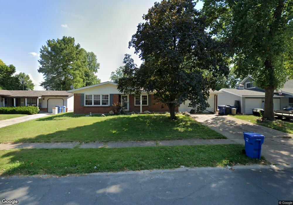
1750 Arundel Dr Florissant, MO 63033
Estimated Value: $191,343 - $237,000
3
Beds
2
Baths
1,596
Sq Ft
$132/Sq Ft
Est. Value
About This Home
This home is located at 1750 Arundel Dr, Florissant, MO 63033 and is currently estimated at $210,586, approximately $131 per square foot. 1750 Arundel Dr is a home located in St. Louis County with nearby schools including Commons Lane Elementary School, Cross Keys Middle School, and McCluer North High School.
Ownership History
Date
Name
Owned For
Owner Type
Purchase Details
Closed on
Dec 15, 2008
Sold by
Deutsche Bank National Trust Company
Bought by
Kirchner Frank S and Kirchner Sheila J
Current Estimated Value
Home Financials for this Owner
Home Financials are based on the most recent Mortgage that was taken out on this home.
Original Mortgage
$85,373
Outstanding Balance
$54,417
Interest Rate
5.42%
Mortgage Type
FHA
Estimated Equity
$156,169
Purchase Details
Closed on
May 29, 2008
Sold by
Ashwood Michelle and Ashwood Michelle D
Bought by
Deutsche Bank National Trust Co and Registered Holders Ameriquest Mortgage S
Purchase Details
Closed on
Nov 12, 1999
Sold by
Rattini Ivy Marie
Bought by
Ashwood Michelle and Ashwood Michelle D
Home Financials for this Owner
Home Financials are based on the most recent Mortgage that was taken out on this home.
Original Mortgage
$81,458
Interest Rate
7.83%
Mortgage Type
FHA
Create a Home Valuation Report for This Property
The Home Valuation Report is an in-depth analysis detailing your home's value as well as a comparison with similar homes in the area
Home Values in the Area
Average Home Value in this Area
Purchase History
| Date | Buyer | Sale Price | Title Company |
|---|---|---|---|
| Kirchner Frank S | $86,500 | Town & Country | |
| Deutsche Bank National Trust Co | $119,155 | None Available | |
| Ashwood Michelle | $81,500 | -- |
Source: Public Records
Mortgage History
| Date | Status | Borrower | Loan Amount |
|---|---|---|---|
| Open | Kirchner Frank S | $85,373 | |
| Previous Owner | Ashwood Michelle | $81,458 |
Source: Public Records
Tax History Compared to Growth
Tax History
| Year | Tax Paid | Tax Assessment Tax Assessment Total Assessment is a certain percentage of the fair market value that is determined by local assessors to be the total taxable value of land and additions on the property. | Land | Improvement |
|---|---|---|---|---|
| 2025 | $2,372 | $34,960 | $5,400 | $29,560 |
| 2024 | $2,372 | $30,660 | $3,550 | $27,110 |
| 2023 | $2,363 | $30,660 | $3,550 | $27,110 |
| 2022 | $2,229 | $25,420 | $3,550 | $21,870 |
| 2021 | $2,191 | $25,420 | $3,550 | $21,870 |
| 2020 | $2,044 | $22,270 | $4,640 | $17,630 |
| 2019 | $2,004 | $22,270 | $4,640 | $17,630 |
| 2018 | $1,722 | $17,060 | $1,650 | $15,410 |
| 2017 | $1,713 | $17,060 | $1,650 | $15,410 |
| 2016 | $1,543 | $14,950 | $2,410 | $12,540 |
| 2015 | $1,552 | $14,950 | $2,410 | $12,540 |
| 2014 | $1,989 | $19,870 | $4,140 | $15,730 |
Source: Public Records
Map
Nearby Homes
- 100 Broadmere Dr
- 1945 Pohlman Rd
- 1606 Willow Wren Ct Unit 109
- 2320 Greenberry Dr
- 1609 Willow Wren Ct Unit 203
- 265 Waterford Dr
- 190 Coteau Ln
- 3435 Saint Catherine St
- 3515 Saint Catherine St
- 3140 Saint Catherine St
- 2255 Wheatfield Dr
- 375 Waterford Dr
- 2520 Greenberry Dr
- 415 Waterford Dr
- 2 Carson Ct
- 11830 7 Hills Dr
- 670 Hargrove Ln
- 3921 Max-Weich Place
- 3905 Max-Weich Place
- 3475 Stonehaven Dr
- 1760 Arundel Dr
- 1740 Arundel Dr
- 1755 Derhake Rd
- 1735 Derhake Rd
- 1765 Derhake Rd
- 1720 Arundel Dr
- 1770 Arundel Dr
- 1755 Arundel Dr
- 1715 Derhake Rd
- 1775 Derhake Rd
- 75 Birchlawn Dr
- 1780 Arundel Dr
- 1775 Arundel Dr
- 90 Birchlawn Dr
- 1715 Arundel Dr
- 30 Bon Aire Dr
- 1785 Derhake Rd
- 1705 Derhake Rd
- 1750 Derhake Rd
- 1800 Arundel Dr