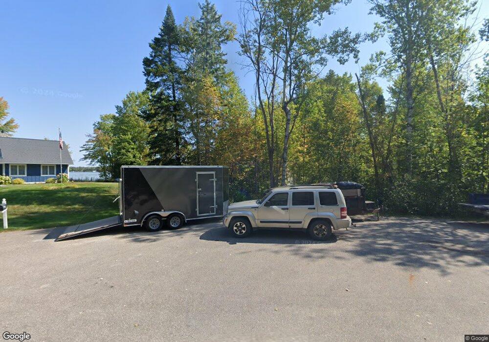
1750 Cove Rd Petoskey, MI 49770
Estimated Value: $1,049,000 - $1,050,155
3
Beds
1
Bath
1,425
Sq Ft
$737/Sq Ft
Est. Value
About This Home
This home is located at 1750 Cove Rd, Petoskey, MI 49770 and is currently estimated at $1,049,578, approximately $736 per square foot. 1750 Cove Rd is a home located in Emmet County with nearby schools including Petoskey High School.
Ownership History
Date
Name
Owned For
Owner Type
Purchase Details
Closed on
Sep 4, 2009
Sold by
Mussio James A and Mussio Lisa M
Bought by
Hayes Jerry M and Hayes Lea Ann
Current Estimated Value
Home Financials for this Owner
Home Financials are based on the most recent Mortgage that was taken out on this home.
Original Mortgage
$158,000
Outstanding Balance
$104,012
Interest Rate
5.32%
Estimated Equity
$945,566
Purchase Details
Closed on
Aug 27, 2004
Sold by
Sheridan Dennis and Smith Michele
Bought by
Mussio James A and Mussio Lisa M
Purchase Details
Closed on
Jun 1, 1987
Sold by
Glass Gt Info
Bought by
Sheridan
Create a Home Valuation Report for This Property
The Home Valuation Report is an in-depth analysis detailing your home's value as well as a comparison with similar homes in the area
Home Values in the Area
Average Home Value in this Area
Purchase History
| Date | Buyer | Sale Price | Title Company |
|---|---|---|---|
| Hayes Jerry M | $279,900 | -- | |
| Mussio James A | $317,000 | -- | |
| Sheridan | $72,900 | -- |
Source: Public Records
Mortgage History
| Date | Status | Borrower | Loan Amount |
|---|---|---|---|
| Open | Hayes Jerry M | $158,000 |
Source: Public Records
Tax History Compared to Growth
Tax History
| Year | Tax Paid | Tax Assessment Tax Assessment Total Assessment is a certain percentage of the fair market value that is determined by local assessors to be the total taxable value of land and additions on the property. | Land | Improvement |
|---|---|---|---|---|
| 2025 | $8,158 | $517,100 | $517,100 | $0 |
| 2024 | $8,158 | $464,000 | $464,000 | $0 |
| 2023 | $7,509 | $332,600 | $332,600 | $0 |
| 2022 | $7,509 | $291,700 | $291,700 | $0 |
| 2021 | $6,130 | $142,300 | $142,300 | $0 |
| 2020 | $5,800 | $140,700 | $140,700 | $0 |
| 2019 | -- | $156,300 | $156,300 | $0 |
| 2018 | -- | $140,400 | $140,400 | $0 |
| 2017 | -- | $137,700 | $137,700 | $0 |
| 2016 | -- | $131,300 | $131,300 | $0 |
| 2015 | -- | $127,500 | $0 | $0 |
| 2014 | -- | $121,100 | $0 | $0 |
Source: Public Records
Map
Nearby Homes
- Lot 2 Leeward Dr
- Lot 3 Leeward Dr
- 796 Bellmer Rd
- 4700 Rd
- 3608 Cincinnati St Unit 5
- 1616 Pond Cir Unit 65
- 4766 Cypress Ct
- 5177 Graham Rd
- 4742 Cypress Ct
- 3734 Oden Rd
- 2067 Bluestem Dr Unit 264
- 3670 Oden Rd Unit 9
- 3670 Oden Rd Unit 5
- 3670 Oden Rd Unit 2
- 3670 Oden Rd Unit 2
- 547 Franklin Estates
- 4337 High St
- 5076 Oden Rd
- 5096 Oden Rd
- 4838 Keaton Ln
- 1766 Cove Rd
- 6746 Driftwood Dr
- 1490 Cove Rd
- 6763 Driftwood Dr
- 6823 Driftwood Dr Unit Lots 7, 8, & Pt of 9
- 6823 Driftwood Dr
- 6851 Driftwood Dr
- 6879 Driftwood Dr
- 6933 Driftwood Dr
- 2022 Hency Rd
- 1720 Hency Rd
- 6817 Channel Rd
- 7017 Stanley Ct
- 7025 Stanley Ct
- 6109 Pickerel Lake Rd
- 7031 Stanley Ct
- 1769 Hency Rd
- 7043 Stanley Ct
- 1724 Hency Rd
- 7057 Stanley Ct
