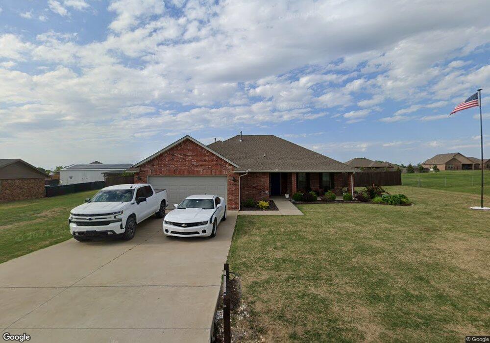
1750 Ken Dr Guthrie, OK 73044
Estimated Value: $256,042 - $284,000
3
Beds
2
Baths
1,597
Sq Ft
$167/Sq Ft
Est. Value
About This Home
This home is located at 1750 Ken Dr, Guthrie, OK 73044 and is currently estimated at $267,261, approximately $167 per square foot. 1750 Ken Dr is a home with nearby schools including Central Elementary School, Fogarty Elementary School, and Cotteral Elementary School.
Ownership History
Date
Name
Owned For
Owner Type
Purchase Details
Closed on
Feb 12, 2018
Sold by
C Stewart Construction Co Llc
Bought by
Williams Rhyan
Current Estimated Value
Home Financials for this Owner
Home Financials are based on the most recent Mortgage that was taken out on this home.
Original Mortgage
$156,268
Outstanding Balance
$131,905
Interest Rate
3.95%
Mortgage Type
New Conventional
Estimated Equity
$135,356
Purchase Details
Closed on
Sep 26, 2017
Sold by
Tp Real Estate Llc
Bought by
C Stewart Construction Co Llc
Home Financials for this Owner
Home Financials are based on the most recent Mortgage that was taken out on this home.
Original Mortgage
$123,710
Interest Rate
3.89%
Mortgage Type
Future Advance Clause Open End Mortgage
Create a Home Valuation Report for This Property
The Home Valuation Report is an in-depth analysis detailing your home's value as well as a comparison with similar homes in the area
Purchase History
| Date | Buyer | Sale Price | Title Company |
|---|---|---|---|
| Williams Rhyan | $155,000 | First American Title | |
| C Stewart Construction Co Llc | $15,000 | First American Title |
Source: Public Records
Mortgage History
| Date | Status | Borrower | Loan Amount |
|---|---|---|---|
| Open | Williams Rhyan | $156,268 | |
| Previous Owner | C Stewart Construction Co Llc | $123,710 |
Source: Public Records
Tax History
| Year | Tax Paid | Tax Assessment Tax Assessment Total Assessment is a certain percentage of the fair market value that is determined by local assessors to be the total taxable value of land and additions on the property. | Land | Improvement |
|---|---|---|---|---|
| 2025 | $1,846 | $19,293 | $1,020 | $18,273 |
| 2024 | $1,731 | $18,374 | $971 | $17,403 |
| 2023 | $1,731 | $17,499 | $729 | $16,770 |
| 2022 | $1,612 | $17,499 | $729 | $16,770 |
| 2021 | $1,622 | $17,499 | $729 | $16,770 |
| 2020 | $1,568 | $16,887 | $494 | $16,393 |
| 2019 | $1,574 | $16,887 | $494 | $16,393 |
| 2018 | $1 | $16 | $16 | $0 |
Source: Public Records
Map
Nearby Homes
- 1925 Kyle Dr
- 1620 Prairie Vista
- 1580 Prairie Vista
- 1600 Prairie Vista
- 1926 Cattle Dr
- 1500 Prairie Vista
- 3421 Prairie Vista
- 1641 Prairie Vista
- 1581 Prairie Vista
- 8930 Tall Oaks Dr
- 4005 Whitetail Cir
- 1201 Stallion Dr
- 1217 Stallion Dr
- 1116 Colt Dr
- 1609 E Roosevelt Ave
- 1221 Colt Dr
- 1219 Colt Dr
- 1215 Colt Dr
- 1213 Colt Dr
- 1211 Colt Dr
Your Personal Tour Guide
Ask me questions while you tour the home.