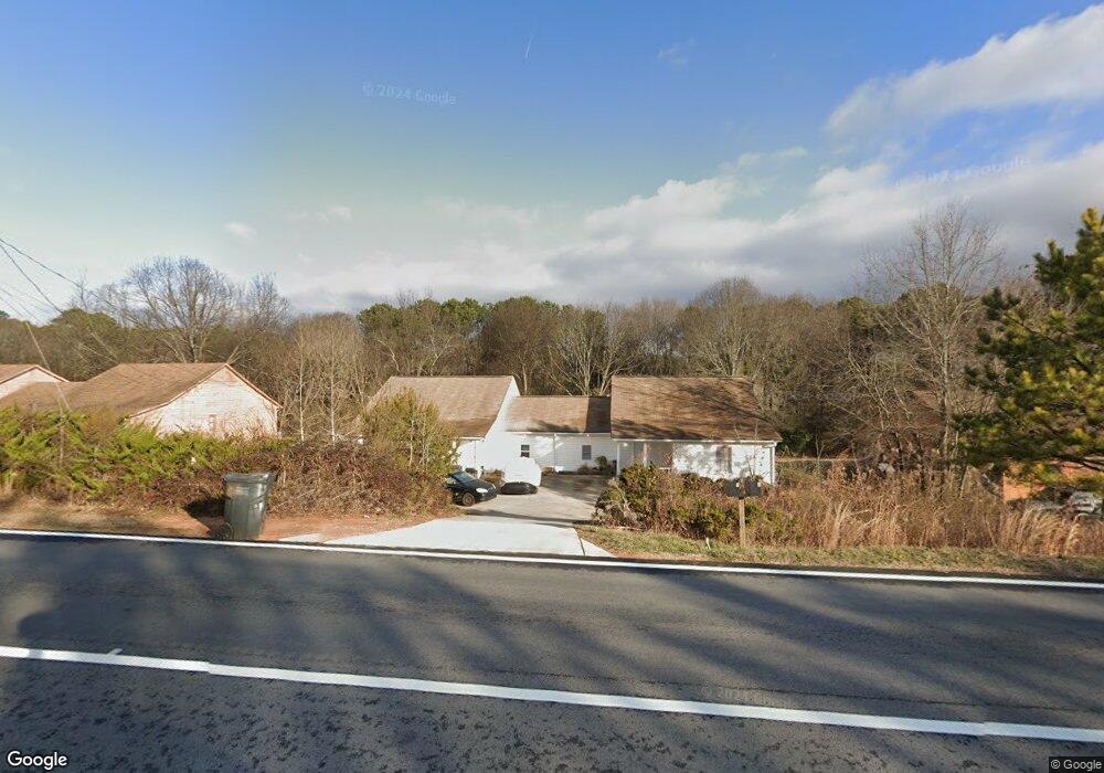
1750 Kirkland Rd Covington, GA 30016
Estimated Value: $235,000 - $300,877
--
Bed
2
Baths
2,856
Sq Ft
$93/Sq Ft
Est. Value
About This Home
This home is located at 1750 Kirkland Rd, Covington, GA 30016 and is currently estimated at $266,719, approximately $93 per square foot. 1750 Kirkland Rd is a home located in Newton County with nearby schools including West Newton Elementary School, Liberty Middle School, and Newton High School.
Ownership History
Date
Name
Owned For
Owner Type
Purchase Details
Closed on
Jun 20, 2021
Sold by
Mahmmod Hina
Bought by
Basi Gulbarg Singh and Basi Rev Liv Trust
Current Estimated Value
Purchase Details
Closed on
Nov 2, 2007
Sold by
Basi Ents Inc
Bought by
Mahmood Hina
Home Financials for this Owner
Home Financials are based on the most recent Mortgage that was taken out on this home.
Original Mortgage
$101,150
Interest Rate
6.5%
Mortgage Type
New Conventional
Purchase Details
Closed on
Apr 2, 2003
Sold by
Wire Charles R
Bought by
Basi Gulbarg S
Create a Home Valuation Report for This Property
The Home Valuation Report is an in-depth analysis detailing your home's value as well as a comparison with similar homes in the area
Home Values in the Area
Average Home Value in this Area
Purchase History
| Date | Buyer | Sale Price | Title Company |
|---|---|---|---|
| Basi Gulbarg Singh | $100,000 | -- | |
| Mahmood Hina | $134,900 | -- | |
| Basi Gulbarg S | $60,100 | -- |
Source: Public Records
Mortgage History
| Date | Status | Borrower | Loan Amount |
|---|---|---|---|
| Previous Owner | Mahmood Hina | $101,150 |
Source: Public Records
Tax History Compared to Growth
Tax History
| Year | Tax Paid | Tax Assessment Tax Assessment Total Assessment is a certain percentage of the fair market value that is determined by local assessors to be the total taxable value of land and additions on the property. | Land | Improvement |
|---|---|---|---|---|
| 2024 | $2,194 | $84,760 | $6,400 | $78,360 |
| 2023 | $2,172 | $78,320 | $6,400 | $71,920 |
| 2022 | $1,271 | $45,120 | $6,400 | $38,720 |
| 2021 | $1,244 | $39,480 | $6,400 | $33,080 |
| 2020 | $1,294 | $38,520 | $6,400 | $32,120 |
| 2019 | $1,284 | $37,640 | $6,400 | $31,240 |
| 2018 | $1,247 | $36,320 | $6,400 | $29,920 |
| 2017 | $600 | $17,480 | $4,400 | $13,080 |
| 2016 | $538 | $15,680 | $2,600 | $13,080 |
| 2015 | $552 | $16,080 | $2,600 | $13,480 |
| 2014 | $550 | $16,080 | $0 | $0 |
Source: Public Records
Map
Nearby Homes
- 1762 Kirkland Rd
- 1738 Kirkland Rd
- 1774 Kirkland Rd
- 95 Plum Orchard Rd
- 1726 Kirkland Rd
- 85 Plum Orchard Rd
- 105 Plum Orchard Rd
- 105 Plum Orchard Rd Unit B
- 105 Plum Orchard Rd Unit A
- 105 Plum Orchard Rd Unit 54
- 215 Mackenzie Ct
- 225 Mackenzie Ct
- 235 Mackenzie Ct
- 205 Mackenzie Ct
- 1714 Kirkland Rd Unit A/B
- 1714 Kirkland Rd
- 75 Plum Orchard Rd
- 1786 Kirkland Rd
- 115 Plum Orchard Rd
- 245 Mackenzie Ct