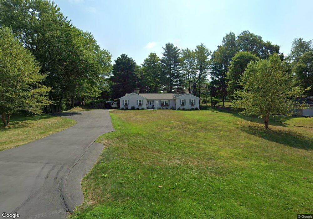
1750 Red Oak Dr NE Lancaster, OH 43130
Estimated Value: $358,000 - $449,000
4
Beds
4
Baths
2,461
Sq Ft
$163/Sq Ft
Est. Value
About This Home
This home is located at 1750 Red Oak Dr NE, Lancaster, OH 43130 and is currently estimated at $401,909, approximately $163 per square foot. 1750 Red Oak Dr NE is a home located in Fairfield County with nearby schools including Medill Elementary School, Thomas Ewing Junior High School, and Lancaster High School.
Ownership History
Date
Name
Owned For
Owner Type
Purchase Details
Closed on
Nov 5, 2003
Sold by
Wood David R
Bought by
Wood Kristy K
Current Estimated Value
Home Financials for this Owner
Home Financials are based on the most recent Mortgage that was taken out on this home.
Original Mortgage
$182,400
Outstanding Balance
$83,443
Interest Rate
5.81%
Mortgage Type
Purchase Money Mortgage
Estimated Equity
$318,466
Purchase Details
Closed on
Mar 26, 1997
Sold by
Gorsuch Linda K
Bought by
Wood David R and Wood Kristy K
Home Financials for this Owner
Home Financials are based on the most recent Mortgage that was taken out on this home.
Original Mortgage
$202,500
Interest Rate
7.73%
Mortgage Type
New Conventional
Purchase Details
Closed on
Jan 1, 1990
Create a Home Valuation Report for This Property
The Home Valuation Report is an in-depth analysis detailing your home's value as well as a comparison with similar homes in the area
Home Values in the Area
Average Home Value in this Area
Purchase History
| Date | Buyer | Sale Price | Title Company |
|---|---|---|---|
| Wood Kristy K | -- | Landsel Title Agency Inc | |
| Wood David R | $225,000 | -- | |
| -- | $183,000 | -- |
Source: Public Records
Mortgage History
| Date | Status | Borrower | Loan Amount |
|---|---|---|---|
| Open | Wood Kristy K | $182,400 | |
| Closed | Wood David R | $202,500 |
Source: Public Records
Tax History Compared to Growth
Tax History
| Year | Tax Paid | Tax Assessment Tax Assessment Total Assessment is a certain percentage of the fair market value that is determined by local assessors to be the total taxable value of land and additions on the property. | Land | Improvement |
|---|---|---|---|---|
| 2024 | $8,381 | $86,310 | $19,390 | $66,920 |
| 2023 | $3,470 | $86,310 | $19,390 | $66,920 |
| 2022 | $3,513 | $86,310 | $19,390 | $66,920 |
| 2021 | $2,804 | $67,010 | $16,150 | $50,860 |
| 2020 | $2,695 | $67,010 | $16,150 | $50,860 |
| 2019 | $2,572 | $67,010 | $16,150 | $50,860 |
| 2018 | $2,330 | $57,370 | $16,150 | $41,220 |
| 2017 | $2,331 | $57,370 | $16,150 | $41,220 |
| 2016 | $2,161 | $57,370 | $16,150 | $41,220 |
| 2015 | $2,238 | $57,610 | $16,150 | $41,460 |
| 2014 | $2,135 | $57,610 | $16,150 | $41,460 |
| 2013 | $2,135 | $57,610 | $16,150 | $41,460 |
Source: Public Records
Map
Nearby Homes
- 1700 Rosewood Dr NE
- 1801 Pleasantview Dr NE
- 1916 Country Place
- 2149 Pleasantview Dr NE
- 706 Sherman Bluff Way Unit 1706
- 715 Sherman Bluff Way Unit 14715
- 0 Declaration Dr W Unit 219044159
- 1760 Rainbow Dr NE
- 1523 Fuller Ct
- 0 Old Millersport Rd NE Unit Lot 10 225033491
- 0 Old Millersport Rd NE Unit 225010386
- 0 Old Millersport Rd NE Unit Tract 8 224028101
- 1189 Ridge Rd NE
- 2444 Sheridan Dr
- 1976 Breed Hill Ct
- 1669 Lexington Dr
- 173 Lakeview Dr NE
- 1804 Pleasantville Rd
- 1415 Epworth Forest Dr
- 0 Lucille Dr NE
- 1776 Red Oak Dr NE
- 1722 Red Oak Dr NE
- 1350 Hemlock Ct NE
- 1342 Pinecrest Dr NE
- 1735 Red Oak Dr NE
- 1775 Red Oak Dr NE
- 1810 Red Oak Dr NE
- 375 Hemlock Ct NE
- 1684 Red Oak Dr NE
- 1715 Red Oak Dr NE
- 1346 Hemlock Ct NE
- 1805 Red Oak Dr NE
- 1754 Rosewood Dr NE
- 1732 Rosewood Dr NE
- 0 Pinecrest Dr NE
- 1788 Rosewood Dr NE
- 1362 Hemlock Ct NE
- 1850 Red Oak Dr NE
- 1358 Hemlock Ct NE
- 1649 Longwood Dr NE