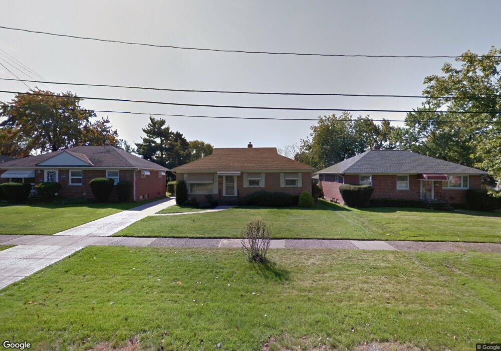
17504 Mccracken Rd Maple Heights, OH 44137
Estimated Value: $115,777 - $168,000
3
Beds
1
Bath
1,160
Sq Ft
$117/Sq Ft
Est. Value
About This Home
This home is located at 17504 Mccracken Rd, Maple Heights, OH 44137 and is currently estimated at $135,944, approximately $117 per square foot. 17504 Mccracken Rd is a home located in Cuyahoga County with nearby schools including Abraham Lincoln Elementary School, Rockside/ J.F. Kennedy School, and Barack Obama School.
Ownership History
Date
Name
Owned For
Owner Type
Purchase Details
Closed on
Jun 11, 2024
Sold by
Whye Brenda and Whye Linda C
Bought by
Whye Linda C
Current Estimated Value
Purchase Details
Closed on
May 22, 2023
Sold by
Whye Eldora
Bought by
Eldora Whye Irrevocable Asset Protection Trus
Purchase Details
Closed on
Jun 23, 2000
Sold by
Sukhjeet Gill and Balwinder Gill
Bought by
Whye Eldora
Purchase Details
Closed on
Oct 2, 1990
Sold by
Jorkasky Ii Richard J
Bought by
Gill Sukhjeet
Purchase Details
Closed on
Feb 24, 1981
Bought by
Jorkasky Ii Richard J
Purchase Details
Closed on
Jan 1, 1975
Bought by
Beach Russell H & Helen L
Create a Home Valuation Report for This Property
The Home Valuation Report is an in-depth analysis detailing your home's value as well as a comparison with similar homes in the area
Home Values in the Area
Average Home Value in this Area
Purchase History
| Date | Buyer | Sale Price | Title Company |
|---|---|---|---|
| Whye Linda C | -- | None Listed On Document | |
| Whye Linda C | -- | None Listed On Document | |
| Eldora Whye Irrevocable Asset Protection Trus | -- | None Listed On Document | |
| Whye Eldora | $90,000 | -- | |
| Gill Sukhjeet | $65,500 | -- | |
| Jorkasky Ii Richard J | $50,000 | -- | |
| Beach Russell H & Helen L | -- | -- |
Source: Public Records
Tax History Compared to Growth
Tax History
| Year | Tax Paid | Tax Assessment Tax Assessment Total Assessment is a certain percentage of the fair market value that is determined by local assessors to be the total taxable value of land and additions on the property. | Land | Improvement |
|---|---|---|---|---|
| 2024 | $3,298 | $47,285 | $7,910 | $39,375 |
| 2023 | $1,737 | $25,100 | $4,760 | $20,340 |
| 2022 | $1,769 | $25,095 | $4,760 | $20,335 |
| 2021 | $1,884 | $25,100 | $4,760 | $20,340 |
| 2020 | $1,388 | $19,010 | $3,610 | $15,400 |
| 2019 | $1,374 | $54,300 | $10,300 | $44,000 |
| 2018 | $1,365 | $19,010 | $3,610 | $15,400 |
| 2017 | $1,119 | $16,520 | $3,360 | $13,160 |
| 2016 | $1,076 | $16,520 | $3,360 | $13,160 |
| 2015 | $1,154 | $16,520 | $3,360 | $13,160 |
| 2014 | $1,154 | $18,170 | $3,680 | $14,490 |
Source: Public Records
Map
Nearby Homes
- 5061 Philip Ave
- 5031 Cato St
- 5082 Philip Ave
- 5110 Philip Ave
- 5199 Arch St
- 5185 Clement Ave
- 5231 Philip Ave
- 16712 Kollin Ave
- 5208 Clement Ave
- 5239 Arch St
- 5257 Philip Ave
- 5212 Catherine St
- 5234 Erwin St
- 5210 Theodore St
- 4737 E 174th St
- 5320 Clement Ave
- 16241 Glenburn Ave
- 17806 Tarkington Ave
- 17916 North Blvd
- 17912 North Blvd
- 17508 Mccracken Rd
- 17500 Mccracken Rd
- 5033 Philip Ave
- 17512 Mccracken Rd
- 5037 Philip Ave
- 5032 Thomas St
- 17496 Mccracken Rd
- 5041 Philip Ave
- 17516 Mccracken Rd
- 5036 Thomas St
- 17492 Mccracken Rd
- 5045 Philip Ave
- 5040 Thomas St
- 5034 Philip Ave
- 17509 Mccracken Rd
- 17513 Mccracken Rd
- 17505 Mccracken Rd
- 5038 Philip Ave
- 5046 Thomas St
- 17501 Mccracken Rd