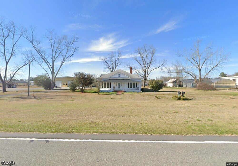
1751 Old Highway 250 Claxton, GA 30417
Estimated Value: $165,000 - $345,000
4
Beds
2
Baths
2,469
Sq Ft
$104/Sq Ft
Est. Value
About This Home
This home is located at 1751 Old Highway 250, Claxton, GA 30417 and is currently estimated at $256,000, approximately $103 per square foot. 1751 Old Highway 250 is a home located in Evans County with nearby schools including Claxton Elementary School, Second Chance, and Claxton Middle School.
Ownership History
Date
Name
Owned For
Owner Type
Purchase Details
Closed on
Nov 25, 2019
Sold by
Crosby Judy D
Bought by
Evans Growers Llc
Current Estimated Value
Home Financials for this Owner
Home Financials are based on the most recent Mortgage that was taken out on this home.
Original Mortgage
$405,900
Interest Rate
3.75%
Mortgage Type
New Conventional
Purchase Details
Closed on
Nov 7, 1994
Sold by
Gordy Jim P
Bought by
Crosby Judy D
Create a Home Valuation Report for This Property
The Home Valuation Report is an in-depth analysis detailing your home's value as well as a comparison with similar homes in the area
Home Values in the Area
Average Home Value in this Area
Purchase History
| Date | Buyer | Sale Price | Title Company |
|---|---|---|---|
| Evans Growers Llc | $435,900 | -- | |
| Crosby Judy D | -- | -- |
Source: Public Records
Mortgage History
| Date | Status | Borrower | Loan Amount |
|---|---|---|---|
| Closed | Evans Growers Llc | $405,900 |
Source: Public Records
Tax History Compared to Growth
Tax History
| Year | Tax Paid | Tax Assessment Tax Assessment Total Assessment is a certain percentage of the fair market value that is determined by local assessors to be the total taxable value of land and additions on the property. | Land | Improvement |
|---|---|---|---|---|
| 2024 | $1,835 | $71,400 | $1,840 | $69,560 |
| 2023 | $839 | $27,120 | $4,880 | $22,240 |
| 2022 | $696 | $27,120 | $4,880 | $22,240 |
| 2021 | $848 | $27,120 | $4,880 | $22,240 |
| 2020 | $851 | $27,120 | $4,880 | $22,240 |
| 2019 | $814 | $27,080 | $4,840 | $22,240 |
| 2018 | $971 | $26,680 | $4,840 | $21,840 |
| 2017 | $943 | $27,080 | $4,840 | $22,240 |
| 2016 | $769 | $25,480 | $3,120 | $22,360 |
| 2015 | -- | $26,880 | $4,200 | $22,680 |
| 2014 | -- | $26,880 | $4,200 | $22,680 |
| 2013 | -- | $27,240 | $4,200 | $23,040 |
Source: Public Records
Map
Nearby Homes
- 3772 US Highway 301
- 8893 Sunbury Rd
- 13320 Sunbury Rd
- 7307 Blocker Rd
- 0 Bay Branch Church Rd Unit 25551331
- 87.21 AC Bay Branch Church Rd
- 12444 U S 301
- 00 Sharpe Ln
- 4164 Perry Rd
- 0 Sunbury Rd Unit Tract 6
- 0 Sunbury Rd Unit Tract 4
- 0 Sunbury Rd Unit TRACT 6 10599356
- 0 Sunbury Rd Unit TRACT 4 10599355
- 2386 Beards Creek Church Rd
- 0 Gus Tippins Rd Unit 25437413
- 4909 Perry Rd
- 12 Wisteria Ln
- 12 Wysteria Ln
- 3 Honeysuckle Dr
- 7 Honeysuckle Dr