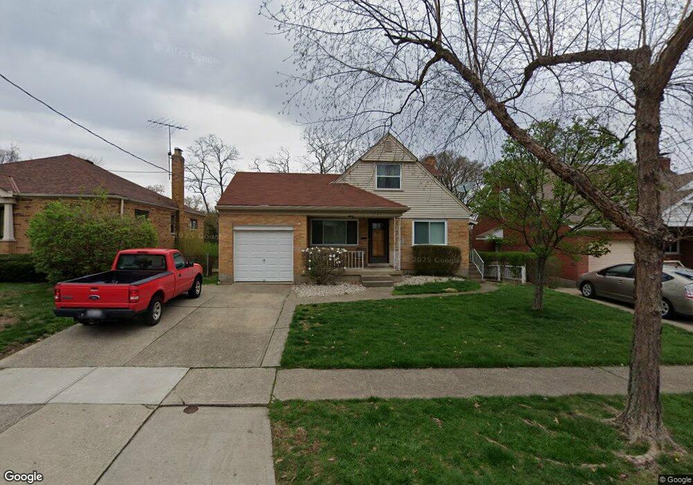
1751 Tuxworth Ave Cincinnati, OH 45238
West Price Hill NeighborhoodEstimated Value: $200,000 - $240,000
5
Beds
2
Baths
1,167
Sq Ft
$194/Sq Ft
Est. Value
About This Home
This home is located at 1751 Tuxworth Ave, Cincinnati, OH 45238 and is currently estimated at $226,275, approximately $193 per square foot. 1751 Tuxworth Ave is a home located in Hamilton County with nearby schools including Carson School, Gilbert A. Dater High School, and Western Hills High School.
Ownership History
Date
Name
Owned For
Owner Type
Purchase Details
Closed on
Jun 3, 2005
Sold by
Lambing Eric D and Lambing Kelly L
Bought by
Walsh Diane M
Current Estimated Value
Home Financials for this Owner
Home Financials are based on the most recent Mortgage that was taken out on this home.
Original Mortgage
$121,150
Outstanding Balance
$63,857
Interest Rate
5.91%
Mortgage Type
Unknown
Estimated Equity
$162,418
Purchase Details
Closed on
May 26, 1995
Sold by
Tallarigo Mary Ann
Bought by
Lambing Eric D and Lambing Kelly L
Home Financials for this Owner
Home Financials are based on the most recent Mortgage that was taken out on this home.
Original Mortgage
$75,256
Interest Rate
8.26%
Mortgage Type
FHA
Create a Home Valuation Report for This Property
The Home Valuation Report is an in-depth analysis detailing your home's value as well as a comparison with similar homes in the area
Home Values in the Area
Average Home Value in this Area
Purchase History
| Date | Buyer | Sale Price | Title Company |
|---|---|---|---|
| Walsh Diane M | $124,900 | Advanced Land Title Agency | |
| Lambing Eric D | $75,500 | -- |
Source: Public Records
Mortgage History
| Date | Status | Borrower | Loan Amount |
|---|---|---|---|
| Open | Walsh Diane M | $121,150 | |
| Previous Owner | Lambing Eric D | $75,256 |
Source: Public Records
Tax History Compared to Growth
Tax History
| Year | Tax Paid | Tax Assessment Tax Assessment Total Assessment is a certain percentage of the fair market value that is determined by local assessors to be the total taxable value of land and additions on the property. | Land | Improvement |
|---|---|---|---|---|
| 2024 | $3,222 | $53,824 | $5,590 | $48,234 |
| 2023 | $3,295 | $53,824 | $5,590 | $48,234 |
| 2022 | $2,207 | $32,267 | $5,551 | $26,716 |
| 2021 | $2,121 | $32,267 | $5,551 | $26,716 |
| 2020 | $2,184 | $32,267 | $5,551 | $26,716 |
| 2019 | $2,170 | $29,334 | $5,047 | $24,287 |
| 2018 | $2,173 | $29,334 | $5,047 | $24,287 |
| 2017 | $2,064 | $29,334 | $5,047 | $24,287 |
| 2016 | $2,400 | $33,664 | $5,394 | $28,270 |
| 2015 | $2,164 | $33,664 | $5,394 | $28,270 |
| 2014 | $2,180 | $33,664 | $5,394 | $28,270 |
| 2013 | $2,519 | $38,252 | $6,129 | $32,123 |
Source: Public Records
Map
Nearby Homes
- 1774 Ashbrook Dr
- 4764 Clevesdale Dr
- 1803 Ashbrook Dr
- 1861 Ashbrook Dr
- 1869 Ashbrook Dr
- 4769 Hardwick Dr
- 4798 Prosperity Place
- 4826 Prosperity Place
- 4885 N Overlook Ave
- 4965 Glenway Ave
- 4934 Relleum Ave
- 1131 Olivia Ln
- 4910 Ferguson Place
- 4638 Glenway Ave
- 5020 Sidney Rd
- 4925 Shirley Place
- 5027 Sidney Rd
- 5009 Relleum Ave
- 4975 Heuwerth Ave
- 1225 Amanda Place
- 1755 Tuxworth Ave
- 1747 Tuxworth Ave
- 1743 Tuxworth Ave
- 1759 Tuxworth Ave
- 1739 Tuxworth Ave
- 1790 Ashbrook Dr
- 1786 Ashbrook Dr
- 1763 Tuxworth Ave
- 1782 Ashbrook Dr
- 1802 Ashbrook Dr
- 1806 Ashbrook Dr
- 1778 Ashbrook Dr
- 1750 Tuxworth Ave
- 1754 Tuxworth Ave
- 1746 Tuxworth Ave
- 1735 Tuxworth Ave
- 1810 Ashbrook Dr
- 1742 Tuxworth Ave
- 1767 Tuxworth Ave
- 1770 Ashbrook Dr