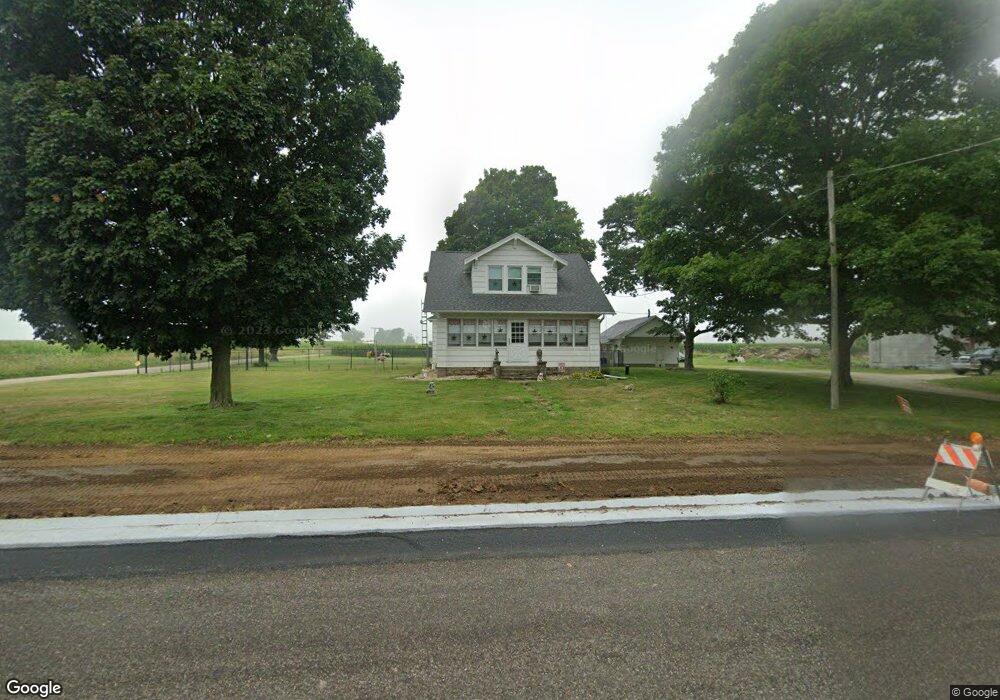
17519 Carroll Rd Morrison, IL 61270
Estimated Value: $157,531 - $235,000
Studio
--
Bath
--
Sq Ft
117,612
Sq Ft
About This Home
This home is located at 17519 Carroll Rd, Morrison, IL 61270 and is currently estimated at $204,133. 17519 Carroll Rd is a home located in Whiteside County with nearby schools including Northside School, Southside School, and Morrison Junior High School.
Ownership History
Date
Name
Owned For
Owner Type
Purchase Details
Closed on
Nov 1, 2024
Sold by
Kuehl Kelly A
Bought by
Kuehl Douglas H
Current Estimated Value
Purchase Details
Closed on
Nov 23, 2020
Sold by
Kuehl Douglas H and Kuehl Kelly A
Bought by
Illinois State Of
Purchase Details
Closed on
Aug 27, 2012
Sold by
Brondyke Paul M and Brondyke Edward L
Bought by
Kuehl Douglas H and Kuehl Kelly A
Home Financials for this Owner
Home Financials are based on the most recent Mortgage that was taken out on this home.
Original Mortgage
$68,800
Interest Rate
3.52%
Mortgage Type
New Conventional
Purchase Details
Closed on
Jan 26, 2007
Sold by
Brondyke Paul M
Bought by
Brondyke Jon P and Brondyke Edward L
Create a Home Valuation Report for This Property
The Home Valuation Report is an in-depth analysis detailing your home's value as well as a comparison with similar homes in the area
Purchase History
| Date | Buyer | Sale Price | Title Company |
|---|---|---|---|
| Kuehl Douglas H | -- | First American Title | |
| Illinois State Of | $1,200 | None Available | |
| Kuehl Douglas H | $95,000 | None Available | |
| Brondyke Jon P | -- | None Available |
Source: Public Records
Mortgage History
| Date | Status | Borrower | Loan Amount |
|---|---|---|---|
| Previous Owner | Kuehl Douglas H | $68,800 |
Source: Public Records
Tax History
| Year | Tax Paid | Tax Assessment Tax Assessment Total Assessment is a certain percentage of the fair market value that is determined by local assessors to be the total taxable value of land and additions on the property. | Land | Improvement |
|---|---|---|---|---|
| 2024 | $2,215 | $41,455 | $9,731 | $31,724 |
| 2023 | $2,001 | $37,839 | $8,859 | $28,980 |
| 2022 | $1,834 | $35,232 | $8,227 | $27,005 |
| 2021 | $1,779 | $34,500 | $8,056 | $26,444 |
| 2020 | $1,850 | $34,330 | $7,385 | $26,945 |
| 2019 | $1,950 | $36,158 | $8,259 | $27,899 |
| 2018 | $2,419 | $35,996 | $8,222 | $27,774 |
| 2017 | $2,265 | $34,578 | $7,898 | $26,680 |
| 2016 | $2,164 | $33,351 | $7,618 | $25,733 |
| 2015 | $2,294 | $34,165 | $7,803 | $26,362 |
| 2014 | $2,263 | $33,779 | $7,715 | $26,064 |
| 2013 | $2,294 | $34,165 | $7,803 | $26,362 |
Source: Public Records
Map
Nearby Homes
- 13629 Garden Plain Rd
- 12719 Garden Plain Rd
- 0 Garden Plain Rd Unit NOC6335284
- 604 Hillandale Ct
- 620 Hillandale Dr
- 624 W Lincolnway
- 617 W Lincolnway
- 814 W Park St
- 701 W Wall St
- Lot 17 Masters Dr
- Lot 19 Masters Dr
- Lot 18 Masters Dr
- Lot 20 Masters Dr
- Lot 21 Masters Dr
- 15344 Norrish Rd
- 402 W Lincolnway
- 306 S Heaton St
- 805 Keith Dr
- 208 Johnson St
- 411 W Park St
- 13520 Damen Rd
- 13564 Damen Rd
- 13656 Rockwood Ct
- 13680 Rockwood Ct
- 13728 Rockwood Ct
- 13688 Damen Rd
- 13239 Ward Rd
- 13774 Rockwood Ct
- 13730 Damen Rd
- 13795 Rockwood Ct
- 13804 Rockwood Ct
- 13790 Damen Rd
- 13830 Damen Rd
- 13860 Damen Rd
- 13980 Damen Rd
- 17001 Carroll Rd
- 18112 Carroll Rd
- 000 Damen Rd
- 00 Damen Rd
- 0 Damen Rd
Your Personal Tour Guide
Ask me questions while you tour the home.