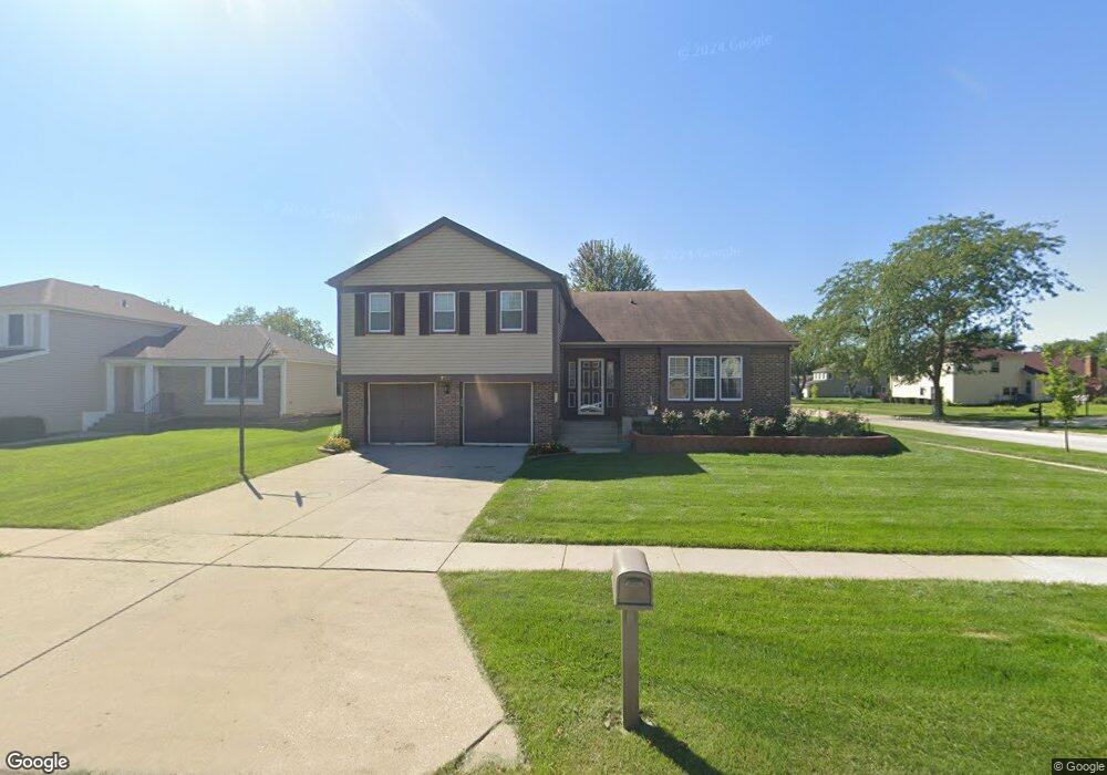
1752 Scottdale Cir Wheaton, IL 60189
Estimated Value: $516,881 - $612,000
4
Beds
3
Baths
2,179
Sq Ft
$262/Sq Ft
Est. Value
About This Home
This home is located at 1752 Scottdale Cir, Wheaton, IL 60189 and is currently estimated at $571,470, approximately $262 per square foot. 1752 Scottdale Cir is a home located in DuPage County with nearby schools including Arbor View Elementary School, Glen Crest Middle School, and Glenbard South High School.
Ownership History
Date
Name
Owned For
Owner Type
Purchase Details
Closed on
Jul 18, 2019
Sold by
Desai Rajiv and Desai Jayati
Bought by
Desai Rajiv and Desai Jayati
Current Estimated Value
Purchase Details
Closed on
Jun 19, 2000
Sold by
Shah Niranjan K and Shah Robini N
Bought by
Desai Rajiv and Desai Jayati
Home Financials for this Owner
Home Financials are based on the most recent Mortgage that was taken out on this home.
Original Mortgage
$160,000
Outstanding Balance
$57,771
Interest Rate
8.56%
Estimated Equity
$513,699
Create a Home Valuation Report for This Property
The Home Valuation Report is an in-depth analysis detailing your home's value as well as a comparison with similar homes in the area
Home Values in the Area
Average Home Value in this Area
Purchase History
| Date | Buyer | Sale Price | Title Company |
|---|---|---|---|
| Desai Rajiv | -- | Attorney | |
| Desai Rajiv | $234,500 | Law Title |
Source: Public Records
Mortgage History
| Date | Status | Borrower | Loan Amount |
|---|---|---|---|
| Open | Desai Rajiv | $160,000 |
Source: Public Records
Tax History
| Year | Tax Paid | Tax Assessment Tax Assessment Total Assessment is a certain percentage of the fair market value that is determined by local assessors to be the total taxable value of land and additions on the property. | Land | Improvement |
|---|---|---|---|---|
| 2024 | $10,279 | $152,074 | $36,970 | $115,104 |
| 2023 | $9,765 | $139,980 | $34,030 | $105,950 |
| 2022 | $9,193 | $127,740 | $32,160 | $95,580 |
| 2021 | $9,185 | $124,710 | $31,400 | $93,310 |
| 2020 | $9,270 | $123,550 | $31,110 | $92,440 |
| 2019 | $9,019 | $120,290 | $30,290 | $90,000 |
| 2018 | $8,520 | $113,010 | $28,540 | $84,470 |
| 2017 | $7,914 | $108,840 | $27,490 | $81,350 |
| 2016 | $8,192 | $104,490 | $26,390 | $78,100 |
| 2015 | $8,130 | $99,690 | $25,180 | $74,510 |
| 2014 | $8,773 | $105,530 | $25,150 | $80,380 |
| 2013 | $8,507 | $105,850 | $25,230 | $80,620 |
Source: Public Records
Map
Nearby Homes
- 23W070 Mulberry Ln
- 23W100 Kings Ct
- 23W302 Cambridge Ct
- 1265 Windsor Dr
- 1926 Cheshire Ln
- 3S481 Osage Dr
- 1733 Harrow Ct Unit B
- 371 W Arboretum Cir
- 1682 Monticello Ct Unit D
- 1230 Bunker Hill Ct Unit A
- 1135 Mount Vernon Ct Unit B
- 1675 Valley Forge Ct Unit A
- 1120 Mount Vernon Ct Unit C
- 1016 Middleton Place Unit 1016
- 1551 Briarcliffe Blvd
- 30 Danada Dr
- 453 Raintree Dr Unit 5A
- 2019 Middleton Ave
- 470 Fawell Blvd Unit 510
- 570 Riva Ct
- 1770 Scottdale Cir
- 1784 Scottdale Cir
- 1715 Jasper Ct
- 1725 Jasper Ct
- 2266 Richmond Dr
- 2262 Richmond Dr
- 1763 Scottdale Cir
- 2242 Stirrup Ln
- 1731 Scottdale Cir
- 1804 Scottdale Cir
- 1735 Jasper Ct
- 1643 Jasper Dr
- 1805 Jasper Ct
- 1814 Scottdale Cir
- 2236 Stirrup Ln Unit 4B
- 1709 Scottdale Cir
- 1633 Jasper Dr
- 2247 Hiram Dr
- 2227 Hiram Ct
- 2230 Stirrup Ln
Your Personal Tour Guide
Ask me questions while you tour the home.