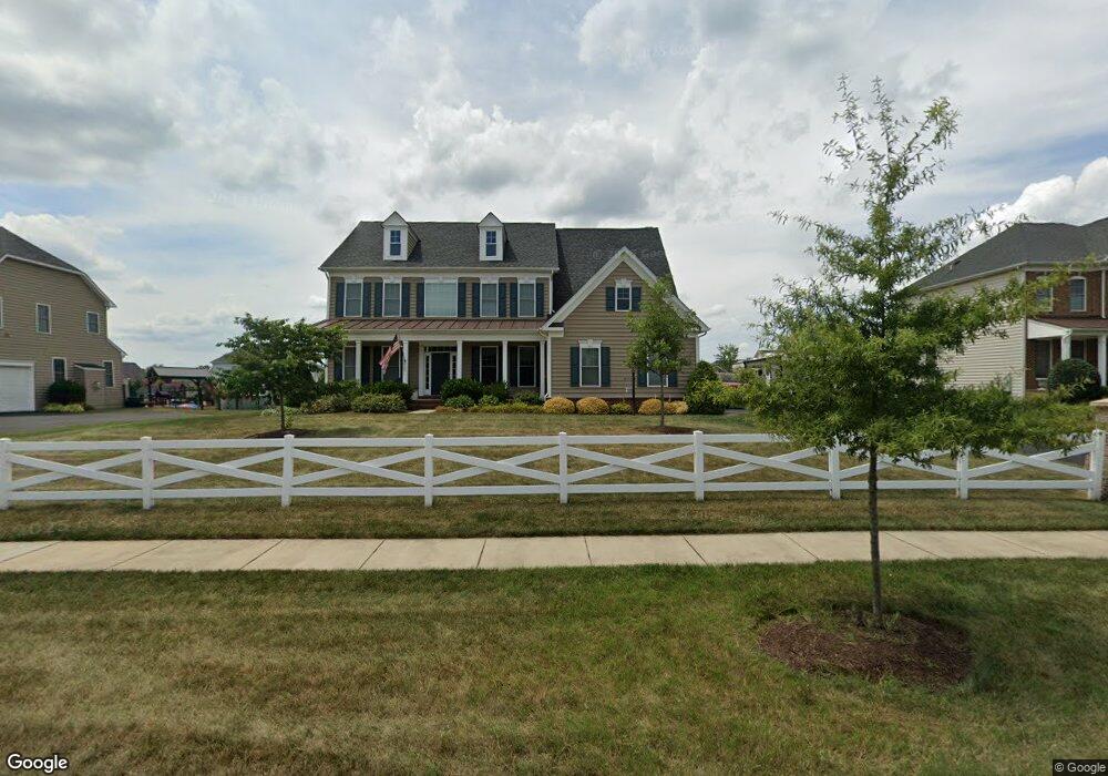
17526 W Willard Rd Poolesville, MD 20837
Estimated Value: $945,504 - $1,020,000
Studio
1
Bath
3,820
Sq Ft
$260/Sq Ft
Est. Value
About This Home
This home is located at 17526 W Willard Rd, Poolesville, MD 20837 and is currently estimated at $991,376, approximately $259 per square foot. 17526 W Willard Rd is a home located in Montgomery County with nearby schools including Poolesville Elementary School, John H. Poole Middle School, and Poolesville High School.
Ownership History
Date
Name
Owned For
Owner Type
Purchase Details
Closed on
Apr 14, 2014
Sold by
Winchester Homes Inc
Bought by
Taylor Robert C and Taylor Kathleen E
Current Estimated Value
Home Financials for this Owner
Home Financials are based on the most recent Mortgage that was taken out on this home.
Original Mortgage
$561,195
Outstanding Balance
$426,934
Interest Rate
4.36%
Mortgage Type
New Conventional
Estimated Equity
$564,442
Create a Home Valuation Report for This Property
The Home Valuation Report is an in-depth analysis detailing your home's value as well as a comparison with similar homes in the area
Home Values in the Area
Average Home Value in this Area
Purchase History
| Date | Buyer | Sale Price | Title Company |
|---|---|---|---|
| Taylor Robert C | $623,551 | Commonwealth Land Title Insu |
Source: Public Records
Mortgage History
| Date | Status | Borrower | Loan Amount |
|---|---|---|---|
| Open | Taylor Robert C | $561,195 |
Source: Public Records
Tax History
| Year | Tax Paid | Tax Assessment Tax Assessment Total Assessment is a certain percentage of the fair market value that is determined by local assessors to be the total taxable value of land and additions on the property. | Land | Improvement |
|---|---|---|---|---|
| 2025 | $9,747 | $799,267 | -- | -- |
| 2024 | $9,747 | $751,100 | $201,100 | $550,000 |
| 2023 | $8,613 | $725,533 | $0 | $0 |
| 2022 | $7,998 | $699,967 | $0 | $0 |
| 2021 | $7,429 | $674,400 | $201,100 | $473,300 |
| 2020 | $8,846 | $654,200 | $0 | $0 |
| 2019 | $8,753 | $634,000 | $0 | $0 |
| 2018 | $6,980 | $613,800 | $201,100 | $412,700 |
| 2017 | $6,885 | $597,633 | $0 | $0 |
| 2016 | -- | $581,467 | $0 | $0 |
| 2015 | $1,421 | $565,300 | $0 | $0 |
| 2014 | $1,421 | $179,767 | $0 | $0 |
Source: Public Records
Map
Nearby Homes
- 19821 Spurrier Ave
- 19110 Tatie Way
- 17100 Evans Way
- 17403 Fyffe Rd
- 19656 Wootton Ave
- 19716 Selby Ave
- 17116 Chiswell Rd
- 19509 Fisher Ave Unit (LOT 2)
- 19507 Fisher Ave Unit (LOT 3)
- 19505 Fisher Ave Unit (LOT 1)
- 19405 Wootton Ave
- 0 Beallsville Rd Unit MDMC2136882
- 18524 Beallsville Rd
- 17108 Wild Turkey Way
- 0 Wild Turkey Way
- 21331 Big Woods Rd
- 17112 Wild Turkey Way
- 0 Peach Tree Rd Unit MDMC2210762
- 21100 W Offutt Rd
- 18820 Wasche Rd
- 17524 W Willard Rd
- 17528 W Willard Rd
- 17607 Cobb Ave
- 17605 Cobb Ave
- 17520 W Willard Rd
- 17530 W Willard Rd
- 17603 Cobb Ave
- 17609 Cobb Ave
- 17601 Cobb Ave
- 17532 W Willard Rd
- 19949 Spurrier Ave
- 17611 Cobb Ave
- 17604 Cobb Ave
- 17606 Cobb Ave
- 17600 Cobb Ave
- 17613 Cobb Ave
- 19945 Spurrier Ave
- 17608 Cobb Ave
- 19954 Spurrier Ave
- 20217 Mcnamara Rd
Your Personal Tour Guide
Ask me questions while you tour the home.