

1753 Leland Ave Lima, OH 45805
Westgate NeighborhoodEstimated payment $997/month
Highlights
- Ranch Style House
- No HOA
- 1 Car Attached Garage
- Sun or Florida Room
- Home Office
- Living Room
About This Home
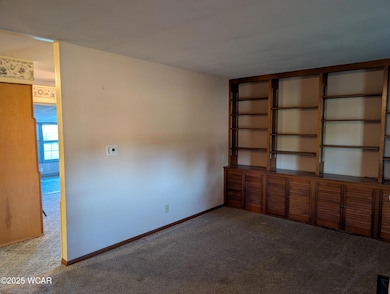
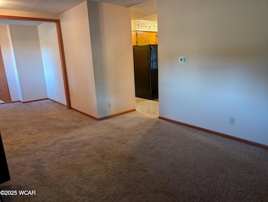
Welcome to this charming one-story brick & siding ranch located in Lima's desirable Westgate neighborhood on the west end. Built with comfort and functionality in mind, this home offers a ranch-style design with over 1,668 square feet of living space and sits on a generous lot with a fenced yard, perfect for outdoor enjoyment. With some interior paint and updates to the flooring, it can truly be transformed into something spectacular!
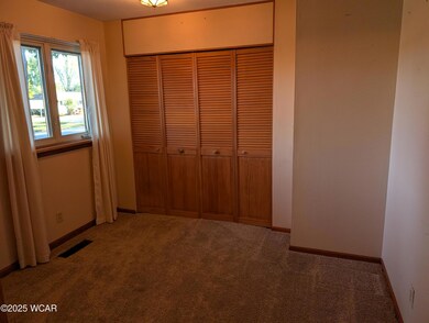
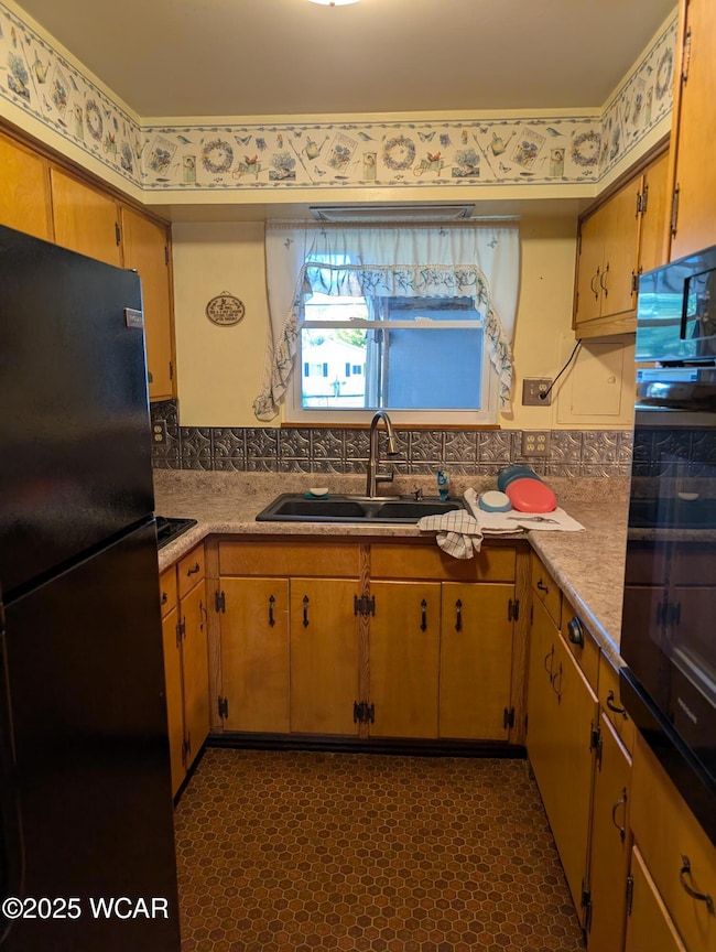
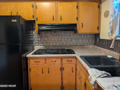
Inside, you'll find three bedrooms and one and a half baths, complemented by replacement windows that fill the rooms with natural light. The spacious sunroom spans nearly 1/3 of the back of the home, creating a bright and versatile living area that feels like an indoor retreat with stunning outdoor views. The kitchen and dining/family room areas seamlessly connect with the living space, creating a warm and practical flow for everyday living.
Additional highlights include a storage shed, ideal for storing tools or hobbies, and a deep, one-car attached garage with a workshop area, providing extra space for projects or storage. Situated in a well-established community with sidewalks and mature trees, this Westgate home is just minutes from shopping, dining, and schools.
Don't miss your chance to make 1753 Leland Ave your new home!
*Sale contingent upon Probate Court approval
Home Details
Home Type
- Single Family
Est. Annual Taxes
- $1,229
Year Built
- Built in 1960
Lot Details
- 0.28 Acre Lot
- Lot Dimensions are 80 x 140
Parking
- 1 Car Attached Garage
Home Design
- Ranch Style House
- Fixer Upper
- Brick Exterior Construction
- Frame Construction
- Vinyl Siding
Interior Spaces
- 1,668 Sq Ft Home
- Living Room
- Family or Dining Combination
- Home Office
- Sun or Florida Room
- Carpet
- Crawl Space
Kitchen
- Oven
- Range
- Dishwasher
Bedrooms and Bathrooms
- 3 Bedrooms
Outdoor Features
- Shed
Utilities
- Forced Air Heating and Cooling System
- Heating System Uses Natural Gas
- Natural Gas Connected
Community Details
- No Home Owners Association
Listing and Financial Details
- Property Available on 9/8/25
- Assessor Parcel Number 36-2610-07-014.000
Map
Home Values in the Area
Average Home Value in this Area
Tax History
| Year | Tax Paid | Tax Assessment Tax Assessment Total Assessment is a certain percentage of the fair market value that is determined by local assessors to be the total taxable value of land and additions on the property. | Land | Improvement |
|---|---|---|---|---|
| 2024 | $1,229 | $43,650 | $9,170 | $34,480 |
| 2023 | $957 | $31,640 | $6,650 | $24,990 |
| 2022 | $978 | $31,640 | $6,650 | $24,990 |
| 2021 | $1,033 | $31,640 | $6,650 | $24,990 |
| 2020 | $994 | $28,250 | $6,370 | $21,880 |
| 2019 | $994 | $28,250 | $6,370 | $21,880 |
| 2018 | $980 | $28,250 | $6,370 | $21,880 |
| 2017 | $948 | $27,200 | $6,370 | $20,830 |
| 2016 | $956 | $27,200 | $6,370 | $20,830 |
| 2015 | $796 | $27,200 | $6,370 | $20,830 |
| 2014 | $796 | $23,740 | $6,760 | $16,980 |
| 2013 | $775 | $23,740 | $6,760 | $16,980 |
Property History
| Date | Event | Price | List to Sale | Price per Sq Ft |
|---|---|---|---|---|
| 09/08/2025 09/08/25 | For Sale | $169,900 | -- | $102 / Sq Ft |
Purchase History
| Date | Type | Sale Price | Title Company |
|---|---|---|---|
| Deed | $60,000 | -- | |
| Deed | $56,500 | -- | |
| Deed | -- | -- |
Mortgage History
| Date | Status | Loan Amount | Loan Type |
|---|---|---|---|
| Previous Owner | $25,750 | New Conventional | |
| Previous Owner | $32,000 | New Conventional |
Source: West Central Association of REALTORS® (OH)
MLS Number: 308162
APN: 36-26-10-07-014.000
- 1719 Latham Ave
- 918 Cornell Dr
- 858 Mackenzie Dr
- 2100 University Blvd
- 514 N Cable Rd
- 621 Fairfield Dr
- 1703 W Wayne St
- 102 Charwood Dr
- 1113 Crestwood Dr
- 209 N Dale Dr
- 1517 Allentown Rd
- 1132 Crestwood Dr
- 109 N Pears Ave
- 391 N Fernwood Dr
- 2050 W Market St
- 1630 W Market St
- 1912 Hillcrest Dr
- 234 S Westwood Dr
- 1459 W Market St
- 1206 Rice Ave
- 1220 Hazel Ave
- 1411 W High St
- 819 E College Ave
- 232 S Rosedale Ave
- 2650 W Market St
- 901 W Market St
- 152 Pierre Place Unit 152
- 123 Pierre Place Unit 123
- 2275 N Cable Rd Unit 194
- 2275 N Cable Rd Unit 8
- 706 W State St Unit 706
- 160 Hartford Ct
- 527 Haller St
- 106 Hartford Ct Unit 106 Hartford Court
- 510 Cortlandt Ave
- 656 W Spring St
- 446 W Grand Ave
- 2916 Cletus Pkwy
- 2260 Lake Circle Dr
- 2901 Elijah Pkwy Unit B
