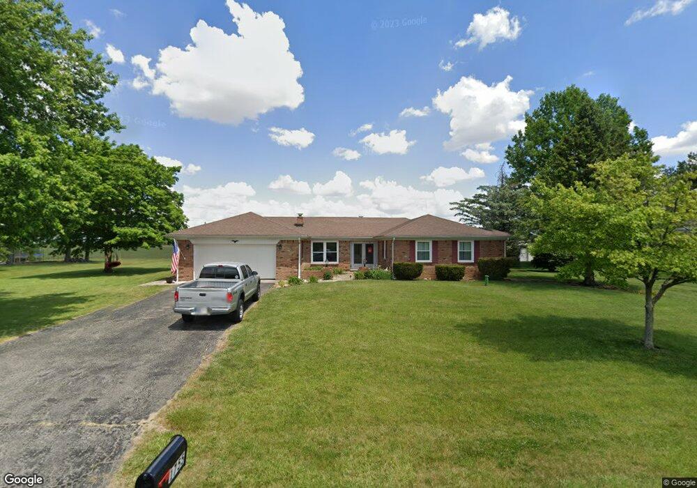
1755 John-Bart Rd Lebanon, IN 46052
Estimated Value: $296,000 - $362,000
3
Beds
2
Baths
1,408
Sq Ft
$232/Sq Ft
Est. Value
About This Home
This home is located at 1755 John-Bart Rd, Lebanon, IN 46052 and is currently estimated at $326,130, approximately $231 per square foot. 1755 John-Bart Rd is a home located in Boone County with nearby schools including Central Elementary School, Lebanon Middle School, and Lebanon Senior High School.
Ownership History
Date
Name
Owned For
Owner Type
Purchase Details
Closed on
Jul 18, 2018
Sold by
Staton Randall L and Heffner Andrew
Bought by
Staton Family Farm Llc
Current Estimated Value
Purchase Details
Closed on
Apr 24, 2007
Sold by
Graham Buford E and Graham Sharon K
Bought by
Hightower Melinda B
Home Financials for this Owner
Home Financials are based on the most recent Mortgage that was taken out on this home.
Original Mortgage
$30,500
Interest Rate
6.18%
Mortgage Type
Stand Alone Second
Create a Home Valuation Report for This Property
The Home Valuation Report is an in-depth analysis detailing your home's value as well as a comparison with similar homes in the area
Home Values in the Area
Average Home Value in this Area
Purchase History
| Date | Buyer | Sale Price | Title Company |
|---|---|---|---|
| Staton Family Farm Llc | -- | None Available | |
| Hightower Melinda B | -- | -- |
Source: Public Records
Mortgage History
| Date | Status | Borrower | Loan Amount |
|---|---|---|---|
| Previous Owner | Hightower Melinda B | $30,500 |
Source: Public Records
Tax History
| Year | Tax Paid | Tax Assessment Tax Assessment Total Assessment is a certain percentage of the fair market value that is determined by local assessors to be the total taxable value of land and additions on the property. | Land | Improvement |
|---|---|---|---|---|
| 2025 | $1,764 | $257,400 | $17,200 | $240,200 |
| 2024 | $1,764 | $244,600 | $17,200 | $227,400 |
| 2023 | $1,799 | $234,500 | $17,200 | $217,300 |
| 2022 | $1,789 | $228,000 | $17,200 | $210,800 |
| 2021 | $1,570 | $196,800 | $17,200 | $179,600 |
| 2020 | $1,375 | $179,300 | $17,200 | $162,100 |
| 2019 | $1,255 | $176,800 | $17,200 | $159,600 |
| 2018 | $1,208 | $160,400 | $17,200 | $143,200 |
| 2017 | $1,166 | $160,500 | $17,200 | $143,300 |
| 2016 | $1,153 | $152,300 | $17,200 | $135,100 |
| 2014 | $1,020 | $142,300 | $19,100 | $123,200 |
| 2013 | $996 | $142,300 | $19,100 | $123,200 |
Source: Public Records
Map
Nearby Homes
- 2101 Elizaville Rd
- 1444 150 N
- 2018 Elizaville Rd
- 908 Sorrell Ct
- 1919 Elizaville Rd
- 1142 Brookside Dr
- 2114 Elmwood Dr
- 1134 Brookside Dr
- 2314 Grant Blvd
- 923 Beverly Dr
- 1515 Park Dr
- 929 Angilee Way
- 921 Angilee Way
- 930 Angilee Way
- 917 Angilee Way
- 920 Angilee Way
- 914 Angilee Way
- 912 Angilee Way
- 2004 Terrace Ln
- 948 Foxglove St
- 1755 John Bart Rd
- 1735 John Bart Rd
- 1775 John Bart Rd
- 1715 John Bart Rd
- 1815 John Bart Rd
- 1815 John-Bart Rd
- 1820 John Bart Rd
- 1695 John Bart Rd
- 1825 John Bart Rd
- 1680 John Bart Rd
- 1675 John Bart Rd
- 1850 John Bart Rd
- 1855 John Bart Rd
- 1855 John-Bart Rd
- 1655 John Bart Rd
- 1660 John Bart Rd
- 1895 John Bart Rd
- 1890 John Bart Rd
- 1635 John Bart Rd
- 1925 John Bart Rd
Your Personal Tour Guide
Ask me questions while you tour the home.