Estimated Value: $470,000 - $597,557
4
Beds
3
Baths
3,130
Sq Ft
$176/Sq Ft
Est. Value
About This Home
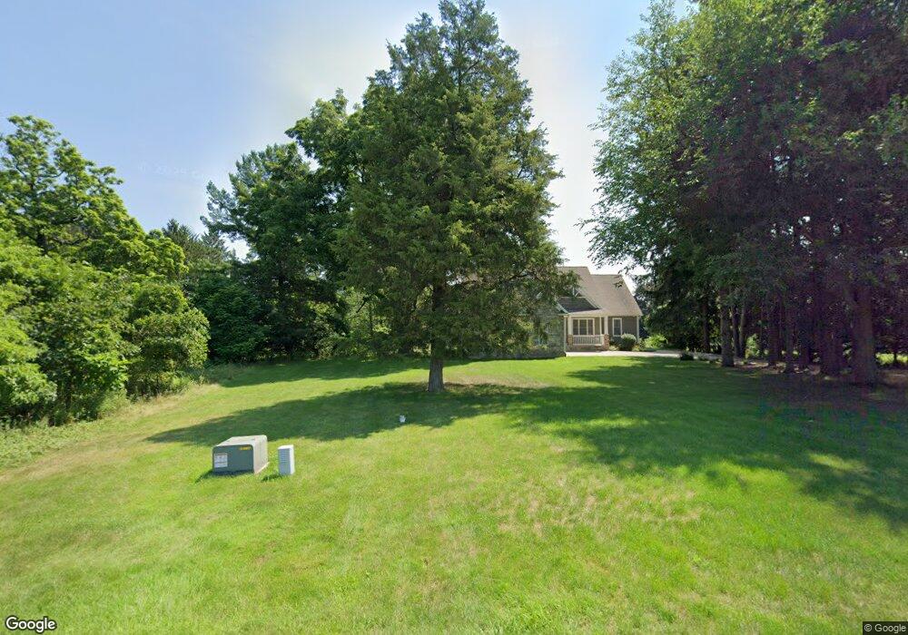
This home is located at 1755 W River Rd, Niles, MI 49120 and is currently estimated at $550,139, approximately $175 per square foot. 1755 W River Rd is a home located in Berrien County with nearby schools including Ballard Elementary School, Oak Manor Sixth Grade Center, and Ring Lardner Middle School.
Ownership History
Date
Name
Owned For
Owner Type
Purchase Details
Closed on
Nov 18, 2010
Sold by
Chemical Bank
Bought by
Stevens Claire and Okrusko Gary
Current Estimated Value
Home Financials for this Owner
Home Financials are based on the most recent Mortgage that was taken out on this home.
Original Mortgage
$184,000
Outstanding Balance
$120,780
Interest Rate
4.17%
Mortgage Type
New Conventional
Estimated Equity
$429,359
Purchase Details
Closed on
Jun 16, 2009
Sold by
Hildebrand Hills Llc
Bought by
Chemical Bank
Create a Home Valuation Report for This Property
The Home Valuation Report is an in-depth analysis detailing your home's value as well as a comparison with similar homes in the area
Home Values in the Area
Average Home Value in this Area
Purchase History
| Date | Buyer | Sale Price | Title Company |
|---|---|---|---|
| Stevens Claire | $230,000 | Meridian Title Corp | |
| Chemical Bank | -- | None Available |
Source: Public Records
Mortgage History
| Date | Status | Borrower | Loan Amount |
|---|---|---|---|
| Open | Stevens Claire | $184,000 |
Source: Public Records
Tax History Compared to Growth
Tax History
| Year | Tax Paid | Tax Assessment Tax Assessment Total Assessment is a certain percentage of the fair market value that is determined by local assessors to be the total taxable value of land and additions on the property. | Land | Improvement |
|---|---|---|---|---|
| 2025 | $7,038 | $297,000 | $0 | $0 |
| 2024 | $2,202 | $260,500 | $0 | $0 |
| 2023 | $2,098 | $213,800 | $0 | $0 |
| 2022 | $1,998 | $179,000 | $0 | $0 |
| 2021 | $6,163 | $176,800 | $5,400 | $171,400 |
| 2020 | $6,080 | $176,900 | $0 | $0 |
| 2019 | $5,968 | $144,000 | $24,800 | $119,200 |
| 2018 | $5,829 | $144,000 | $0 | $0 |
| 2017 | $5,709 | $144,700 | $0 | $0 |
| 2016 | $5,593 | $159,900 | $0 | $0 |
| 2015 | $5,577 | $159,700 | $0 | $0 |
| 2014 | $1,439 | $140,000 | $0 | $0 |
Source: Public Records
Map
Nearby Homes
- 1695 Signal Point Dr
- 1010 Tomahawk Ln
- 1630 S 3rd St
- V/L Wesaw Rd
- 1639 Sioux Trail
- 2019 S 3rd St
- 2120 S 3rd St
- 1108 Brandywine St
- 1831 S 12th St
- 1225 Country Club Dr
- 300 Carefree Ct
- 1950 S 13th St Unit lot 213
- Integrity 1610 Plan at Carefree Villas
- Integrity 1605 Plan at Carefree Villas
- Integrity 1250 Plan at Carefree Villas
- Integrity 1530 Plan at Carefree Villas
- 413 S Street Joseph Ave
- 340 Carefree Ct
- 144 Poppy Ct
- 139 Poppy Ct
- 1705 W River Rd
- 1705 Signal Point Dr
- 1845 W River Rd
- 1840 W River Rd Unit 81
- 1035 Joliet Dr
- 1025 Joliet Dr
- 1045 Joliet Dr
- 1055 Joliet Dr
- 1015 Joliet Dr
- 1065 Joliet Dr
- 1005 Joliet Dr
- 1865 W River Rd
- 1010 Joliet Dr
- 1020 Joliet Dr
- 1815 Champlain Dr
- 1660 Signal Point Dr
- 1040 Joliet Dr
- 1675 Signal Point Dr
- 1639 W River Rd
- 1050 Joliet Dr