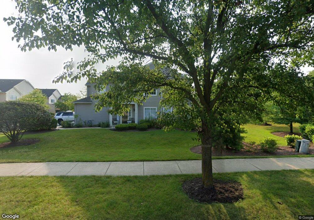
17555 Gilbert Dr Lockport, IL 60441
Estimated Value: $281,971 - $300,000
Studio
--
Bath
1,393
Sq Ft
$209/Sq Ft
Est. Value
About This Home
This home is located at 17555 Gilbert Dr, Lockport, IL 60441 and is currently estimated at $290,743, approximately $208 per square foot. 17555 Gilbert Dr is a home located in Will County with nearby schools including William J. Butler, Hadley Middle School, and Homer Jr High School.
Ownership History
Date
Name
Owned For
Owner Type
Purchase Details
Closed on
Mar 31, 2017
Sold by
Wortel Mark E and Wortel Elizabeth
Bought by
Leslie Alexis
Current Estimated Value
Purchase Details
Closed on
Feb 26, 2003
Sold by
The Ryland Group Inc
Bought by
Wortel Mark E
Home Financials for this Owner
Home Financials are based on the most recent Mortgage that was taken out on this home.
Original Mortgage
$128,712
Interest Rate
6%
Mortgage Type
Purchase Money Mortgage
Create a Home Valuation Report for This Property
The Home Valuation Report is an in-depth analysis detailing your home's value as well as a comparison with similar homes in the area
Home Values in the Area
Average Home Value in this Area
Purchase History
| Date | Buyer | Sale Price | Title Company |
|---|---|---|---|
| Leslie Alexis | $155,000 | Citywide Title Corporation | |
| Wortel Mark E | $154,000 | -- |
Source: Public Records
Mortgage History
| Date | Status | Borrower | Loan Amount |
|---|---|---|---|
| Previous Owner | Wortel Mark E | $128,712 |
Source: Public Records
Tax History
| Year | Tax Paid | Tax Assessment Tax Assessment Total Assessment is a certain percentage of the fair market value that is determined by local assessors to be the total taxable value of land and additions on the property. | Land | Improvement |
|---|---|---|---|---|
| 2024 | $3,405 | $76,601 | $12,038 | $64,563 |
| 2023 | $3,405 | $69,435 | $10,912 | $58,523 |
| 2022 | $5,065 | $64,832 | $10,189 | $54,643 |
| 2021 | $4,797 | $61,423 | $9,653 | $51,770 |
| 2020 | $4,749 | $59,163 | $9,298 | $49,865 |
| 2019 | $4,540 | $56,915 | $8,945 | $47,970 |
| 2018 | $4,409 | $54,881 | $8,842 | $46,039 |
| 2017 | $4,442 | $53,344 | $8,594 | $44,750 |
| 2016 | $4,713 | $51,565 | $8,307 | $43,258 |
| 2015 | $4,578 | $49,629 | $7,995 | $41,634 |
| 2014 | $4,578 | $48,604 | $7,830 | $40,774 |
| 2013 | $4,578 | $48,604 | $7,830 | $40,774 |
Source: Public Records
Map
Nearby Homes
- 17543 S Gilbert Dr
- 17656 S Gilbert Dr
- 15880 W Bruce Rd
- 16414 Willow Walk Dr
- 17437 Yakima Dr
- 17440 Yakima Dr
- 16125-45 Bruce Rd
- 16510 Teton Dr
- 17259 Long Bow Dr
- 16007 W Bruce Rd
- 16704 W Natoma Dr
- 14847 S Hillside Dr
- 14845 S Hillside Dr
- 14805 S Hillside Dr
- 14801 S Hillside Dr
- 16731 W Natoma Dr
- 15959 Prairie View Ct Unit T6
- 15949 Prairie View Ct Unit T5
- 16738 W Natoma Dr
- 16440 W Cottonwood Dr
- 17549 Gilbert Dr
- 17547 Gilbert Dr Unit 2106L
- 17553 Gilbert Dr
- 17551 Gilbert Dr
- 17557 Gilbert Dr Unit 21013
- 17555 Gilbert Dr Unit 17555
- 17535 S Gilbert Dr
- 17543 Gilbert Dr Unit 2202D
- 17537 Gilbert Dr
- 17545 Gilbert Dr
- 17541 Gilbert Dr Unit 2008K
- 17539 Gilbert Dr
- 17535 S Gilbert Dr
- 17535 S Gilbert Dr Unit 1753
- 17535 S Gilbert Dr Unit 17535
- 17563 Gilbert Dr Unit 2204K
- 17559 Gilbert Dr
- 17567 Gilbert Dr Unit 2202D
- 17569 Gilbert Dr Unit 2201L
- 17561 Gilbert Dr Unit 2205D
Your Personal Tour Guide
Ask me questions while you tour the home.