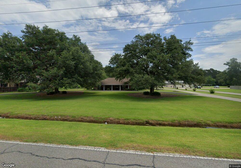
17555 S Harrell's Ferry Rd Baton Rouge, LA 70816
Shenandoah NeighborhoodEstimated Value: $403,000 - $650,000
4
Beds
4
Baths
4,410
Sq Ft
$120/Sq Ft
Est. Value
About This Home
This home is located at 17555 S Harrell's Ferry Rd, Baton Rouge, LA 70816 and is currently estimated at $527,496, approximately $119 per square foot. 17555 S Harrell's Ferry Rd is a home located in East Baton Rouge Parish with nearby schools including Wedgewood Elementary School, Southeast Middle School, and Tara High School.
Ownership History
Date
Name
Owned For
Owner Type
Purchase Details
Closed on
Jul 21, 2000
Sold by
Daspit Daspit Laurence C
Bought by
Edwards Richard Lee and Edwards Dale Karen
Current Estimated Value
Home Financials for this Owner
Home Financials are based on the most recent Mortgage that was taken out on this home.
Original Mortgage
$200,000
Interest Rate
8.36%
Mortgage Type
Purchase Money Mortgage
Create a Home Valuation Report for This Property
The Home Valuation Report is an in-depth analysis detailing your home's value as well as a comparison with similar homes in the area
Home Values in the Area
Average Home Value in this Area
Purchase History
| Date | Buyer | Sale Price | Title Company |
|---|---|---|---|
| Edwards Richard Lee | $255,000 | -- |
Source: Public Records
Mortgage History
| Date | Status | Borrower | Loan Amount |
|---|---|---|---|
| Closed | Edwards Richard Lee | $200,000 |
Source: Public Records
Tax History Compared to Growth
Tax History
| Year | Tax Paid | Tax Assessment Tax Assessment Total Assessment is a certain percentage of the fair market value that is determined by local assessors to be the total taxable value of land and additions on the property. | Land | Improvement |
|---|---|---|---|---|
| 2024 | $2,596 | $28,250 | $2,100 | $26,150 |
| 2023 | $2,596 | $28,250 | $2,100 | $26,150 |
| 2022 | $3,568 | $28,250 | $2,100 | $26,150 |
| 2021 | $3,506 | $28,250 | $2,100 | $26,150 |
| 2020 | $3,547 | $28,250 | $2,100 | $26,150 |
| 2019 | $3,493 | $28,250 | $2,100 | $26,150 |
| 2018 | $2,344 | $19,100 | $2,100 | $17,000 |
| 2017 | $2,343 | $19,098 | $2,100 | $16,998 |
| 2016 | $1,401 | $19,098 | $2,100 | $16,998 |
| 2015 | $2,392 | $27,500 | $2,100 | $25,400 |
| 2014 | $2,384 | $27,500 | $2,100 | $25,400 |
| 2013 | -- | $27,500 | $2,100 | $25,400 |
Source: Public Records
Map
Nearby Homes
- 17561 Martin Lake Dr
- 3112 Grassy Lake Dr
- 3306 Grassy Lake Dr
- 3246 Pine Grove Dr
- 18107 Ferry Lane Ave
- 3439 Timber Grove Dr
- 3146 Silver Sand Dr
- 18403 Shadow Creek Ave
- 18526 Shadow Creek Ave
- 2929 Palatine Place
- 17440 Beachwood Ave
- 2909 Palatine Place
- 3801 Villa Michel Dr
- 16570 Spiller's
- 16222 Thorncrown Ln
- 4036 Copperridge Dr
- 16123 Magnolia Trace Pkwy
- 3421 Oneal Ln Unit A
- 3421 O'Neal Ln Unit D
- 3305 Oneal Ln Unit D
- 17645 W Purple Martin Ct
- 17635 W Purple Martin Ct
- 17555 S Harrells Ferry Rd
- 135 Purple Martin Ct
- 17707 E Purple Martin Ct
- 17625 W Purple Martin Ct
- 17615 W Purple Martin Ct
- 17717 E Purple Martin Ct
- 17708 E Purple Martin Ct
- 17636 W Purple Martin Ct
- 17646 W Purple Martin Ct
- 17605 W Purple Martin Ct
- 17616 W Purple Martin Ct
- 17626 W Purple Martin Ct
- LOT 118 E Purple Martin Ct
- 0 W Purple Martin Ct Unit 201001513
- 17727 E Purple Martin Ct
- 17718 E Purple Martin Ct
- 17689 S Harrells Ferry Rd
- 17606 W Purple Martin Ct