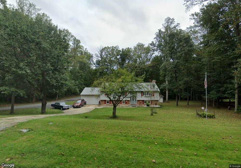
1757 Arrowood Dr Gambrills, MD 21054
Davidsonville NeighborhoodEstimated Value: $550,028 - $702,000
--
Bed
2
Baths
1,480
Sq Ft
$446/Sq Ft
Est. Value
About This Home
This home is located at 1757 Arrowood Dr, Gambrills, MD 21054 and is currently estimated at $659,757, approximately $445 per square foot. 1757 Arrowood Dr is a home located in Anne Arundel County with nearby schools including Crofton Woods Elementary School, Crofton Middle School, and Crofton High School.
Ownership History
Date
Name
Owned For
Owner Type
Purchase Details
Closed on
Apr 24, 2018
Sold by
Wilson Frederick M and Wilson Crolyn E
Bought by
Wilson Frederick M and Wilson Carolyn E
Current Estimated Value
Purchase Details
Closed on
Feb 9, 1987
Sold by
Smith Frederick D
Bought by
Wilson Frederick M and Wilson Carolyn E
Home Financials for this Owner
Home Financials are based on the most recent Mortgage that was taken out on this home.
Original Mortgage
$82,000
Interest Rate
9.06%
Create a Home Valuation Report for This Property
The Home Valuation Report is an in-depth analysis detailing your home's value as well as a comparison with similar homes in the area
Home Values in the Area
Average Home Value in this Area
Purchase History
| Date | Buyer | Sale Price | Title Company |
|---|---|---|---|
| Wilson Frederick M | -- | None Available | |
| Wilson Frederick M | $117,000 | -- |
Source: Public Records
Mortgage History
| Date | Status | Borrower | Loan Amount |
|---|---|---|---|
| Closed | Wilson Frederick M | $82,000 |
Source: Public Records
Tax History Compared to Growth
Tax History
| Year | Tax Paid | Tax Assessment Tax Assessment Total Assessment is a certain percentage of the fair market value that is determined by local assessors to be the total taxable value of land and additions on the property. | Land | Improvement |
|---|---|---|---|---|
| 2025 | $3,929 | $537,333 | -- | -- |
| 2024 | $3,929 | $512,967 | $0 | $0 |
| 2023 | $3,807 | $488,600 | $266,000 | $222,600 |
| 2022 | $3,566 | $473,067 | $0 | $0 |
| 2021 | $7,002 | $457,533 | $0 | $0 |
| 2020 | $3,396 | $442,000 | $226,000 | $216,000 |
| 2019 | $3,336 | $428,300 | $0 | $0 |
| 2018 | $4,204 | $414,600 | $0 | $0 |
| 2017 | $3,140 | $400,900 | $0 | $0 |
| 2016 | -- | $397,233 | $0 | $0 |
| 2015 | -- | $393,567 | $0 | $0 |
| 2014 | -- | $389,900 | $0 | $0 |
Source: Public Records
Map
Nearby Homes
- 2033 Huntwood Dr
- 2057 Liza Way
- 1816 Whites Ferry Place Unit 6
- 1822 Foxdale Ct
- 1745 Leisure Way
- 1764 Sharwood Place
- 1603 Huntcliff Way
- 1804 Aberdeen Cir
- 2103 Higher Ct
- 1677 Hart Ct
- 2241 Aberdeen Dr
- 1782 Shaftsbury Ave
- 2173 Johns Hopkins Rd
- 2508 Stow Ct
- 1521 Fenway Rd
- 1160 Saint Stephens Church Rd
- 1557 Farlow Ave
- 1722 Tedbury St
- 930 Truro Ln
- 1508 Cornerstone Ct
- 1761 Arrowood Dr
- 1753 Arrowood Dr
- 1745 Arrowood Dr
- 1760 Arrowood Dr
- 1756 Arrowood Dr
- 1749 Arrowood Dr
- 1756 Mayapple Way
- 1760 Mayapple Way
- 2347 Mount Tabor Rd
- 2339 Mount Tabor Rd
- 1752 Mayapple Way
- 2351 Mount Tabor Rd
- 0 Mt Tabor Rd Unit 1005439476
- 0 Mt Tabor Rd Unit AA7121547
- Byfield Ct
- 2335 Mount Tabor Rd
- 1744 Mayapple Way
- 1748 Mayapple Way
- 1761 Mayapple Way
- 2331 Mount Tabor Rd