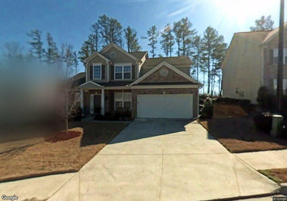
1757 Brandemere Dr Unit 1 Austell, GA 30168
Estimated Value: $352,029 - $389,000
4
Beds
3
Baths
2,443
Sq Ft
$149/Sq Ft
Est. Value
About This Home
This home is located at 1757 Brandemere Dr Unit 1, Austell, GA 30168 and is currently estimated at $363,757, approximately $148 per square foot. 1757 Brandemere Dr Unit 1 is a home located in Cobb County with nearby schools including Bryant Elementary School, Lindley Middle School, and Pebblebrook High School.
Ownership History
Date
Name
Owned For
Owner Type
Purchase Details
Closed on
Apr 5, 2016
Sold by
Archer Robert B
Bought by
Ih6 Property Georgia Lp
Current Estimated Value
Purchase Details
Closed on
Mar 28, 2006
Sold by
Mccrorey Anthony D
Bought by
Archer Robert B
Home Financials for this Owner
Home Financials are based on the most recent Mortgage that was taken out on this home.
Original Mortgage
$212,287
Interest Rate
6.29%
Mortgage Type
New Conventional
Purchase Details
Closed on
Jun 30, 2003
Sold by
Mccar Dev Corp
Bought by
Mccrorey Anthony D
Home Financials for this Owner
Home Financials are based on the most recent Mortgage that was taken out on this home.
Original Mortgage
$194,450
Interest Rate
5.2%
Mortgage Type
New Conventional
Create a Home Valuation Report for This Property
The Home Valuation Report is an in-depth analysis detailing your home's value as well as a comparison with similar homes in the area
Home Values in the Area
Average Home Value in this Area
Purchase History
| Date | Buyer | Sale Price | Title Company |
|---|---|---|---|
| Ih6 Property Georgia Lp | $149,000 | -- | |
| Archer Robert B | $214,000 | -- | |
| Mccrorey Anthony D | $194,500 | -- |
Source: Public Records
Mortgage History
| Date | Status | Borrower | Loan Amount |
|---|---|---|---|
| Previous Owner | Archer Robert B | $212,287 | |
| Previous Owner | Mccrorey Anthony D | $194,450 |
Source: Public Records
Tax History Compared to Growth
Tax History
| Year | Tax Paid | Tax Assessment Tax Assessment Total Assessment is a certain percentage of the fair market value that is determined by local assessors to be the total taxable value of land and additions on the property. | Land | Improvement |
|---|---|---|---|---|
| 2025 | $4,279 | $142,032 | $28,000 | $114,032 |
| 2024 | $3,639 | $120,708 | $20,000 | $100,708 |
| 2023 | $3,639 | $120,708 | $20,000 | $100,708 |
| 2022 | $3,663 | $120,708 | $20,000 | $100,708 |
| 2021 | $2,708 | $89,216 | $18,000 | $71,216 |
| 2020 | $2,564 | $84,468 | $18,000 | $66,468 |
| 2019 | $1,809 | $59,600 | $7,880 | $51,720 |
| 2018 | $1,809 | $59,600 | $7,880 | $51,720 |
| 2017 | $1,714 | $59,600 | $7,880 | $51,720 |
| 2016 | $1,910 | $66,444 | $8,800 | $57,644 |
| 2015 | $1,255 | $51,428 | $6,000 | $45,428 |
| 2014 | $1,266 | $51,428 | $0 | $0 |
Source: Public Records
Map
Nearby Homes
- 1784 Brandemere Dr Unit 3
- 6651 Malvin Dr
- 1151 S Gordon Rd
- 6445 Sherwood Trail
- 1576 S Gordon Rd
- 6992 Ivy Pointe Row
- 6718 Roscommon Dr
- 6627 Coventry Point
- 6581 Coventry Point Unit 1
- 6736 Ivy Log Dr
- 1972 Cox Dr Unit 5
- 1507 Locust Log Way
- 6854 Panda Ct Unit A
- 6811 Panda Dr Unit A
- 6810 Panda Dr Unit B
- 1395 Ling Dr Unit 2
- 1736 Walton Reserve Way
- 1757 Brandemere Dr SW
- 1753 Brandemere Dr
- 1765 Brandemere Dr
- 1749 Brandemere Dr
- 1748 Brandemere Dr Unit 1
- 1741 Brandemere Dr
- 1769 Brandemere Dr Unit 2
- 6575 Brandemere Way
- 0 Brandemere Dr SW Unit 3254595
- 0 Brandemere Dr SW Unit 8064942
- 0 Brandemere Dr SW Unit 8545147
- 0 Brandemere Dr SW Unit 7253722
- 0 Brandemere Dr SW Unit 8989009
- 1736 Brandemere Dr
- 1737 Brandemere Dr Unit 1
- 1773 Brandemere Dr
- 1733 Brandemere Dr Unit 1
- 6571 Brandemere Way
- 6567 Brandemere Way
- 1777 Brandemere Dr