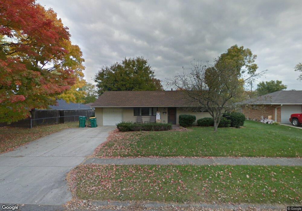
1757 Lanbury Dr Dayton, OH 45439
Estimated Value: $158,000 - $179,000
2
Beds
1
Bath
936
Sq Ft
$182/Sq Ft
Est. Value
About This Home
This home is located at 1757 Lanbury Dr, Dayton, OH 45439 and is currently estimated at $170,265, approximately $181 per square foot. 1757 Lanbury Dr is a home located in Montgomery County with nearby schools including Southdale Elementary School, Van Buren Middle School, and Kettering Fairmont High School.
Ownership History
Date
Name
Owned For
Owner Type
Purchase Details
Closed on
Oct 5, 2001
Sold by
Oswald Robert S
Bought by
Wysong Joan E
Current Estimated Value
Home Financials for this Owner
Home Financials are based on the most recent Mortgage that was taken out on this home.
Original Mortgage
$79,068
Outstanding Balance
$30,927
Interest Rate
6.88%
Mortgage Type
FHA
Estimated Equity
$139,338
Purchase Details
Closed on
Dec 19, 1996
Sold by
Patton Gregory L
Bought by
Oswald Robert S
Create a Home Valuation Report for This Property
The Home Valuation Report is an in-depth analysis detailing your home's value as well as a comparison with similar homes in the area
Home Values in the Area
Average Home Value in this Area
Purchase History
| Date | Buyer | Sale Price | Title Company |
|---|---|---|---|
| Wysong Joan E | $82,000 | -- | |
| Oswald Robert S | $68,500 | Lawyers Title Insurance Corp |
Source: Public Records
Mortgage History
| Date | Status | Borrower | Loan Amount |
|---|---|---|---|
| Open | Wysong Joan E | $79,068 | |
| Closed | Wysong Joan E | $2,500 |
Source: Public Records
Tax History Compared to Growth
Tax History
| Year | Tax Paid | Tax Assessment Tax Assessment Total Assessment is a certain percentage of the fair market value that is determined by local assessors to be the total taxable value of land and additions on the property. | Land | Improvement |
|---|---|---|---|---|
| 2024 | $2,852 | $45,160 | $10,850 | $34,310 |
| 2023 | $2,852 | $45,160 | $10,850 | $34,310 |
| 2022 | $2,345 | $29,190 | $7,000 | $22,190 |
| 2021 | $2,309 | $29,190 | $7,000 | $22,190 |
| 2020 | $2,179 | $29,190 | $7,000 | $22,190 |
| 2019 | $2,038 | $24,080 | $7,000 | $17,080 |
| 2018 | $2,048 | $24,080 | $7,000 | $17,080 |
| 2017 | $1,891 | $24,080 | $7,000 | $17,080 |
| 2016 | $2,019 | $24,220 | $7,000 | $17,220 |
| 2015 | $1,931 | $24,220 | $7,000 | $17,220 |
| 2014 | $1,931 | $24,220 | $7,000 | $17,220 |
| 2012 | -- | $27,000 | $8,400 | $18,600 |
Source: Public Records
Map
Nearby Homes
- 1692 Hillwood Dr
- 2090 Mattis Dr
- 4051 Ellery Ave
- 4207 S Dixie Dr
- 4301 Tait Rd
- 1905 Tait Circle Rd
- 1952 Tait Circle Rd
- 3720 Ridgeleigh Rd Unit D
- 2639 Blanchard Ave
- 1349 Tamerlane Rd
- 3225 Southdale Dr Unit 1
- 4629 Richwood Dr
- 4661 Richwood Dr
- 2050 William Ln
- 1314 Ridgeview Ave
- 2571 Cluster Ave
- 4792 Loxley Dr
- 1125 Laurelwood Rd
- 3464 Southern Blvd
- 5084 Mays Ave
- 1749 Lanbury Dr
- 3872 Elmira Dr
- 3858 Elmira Dr
- 1741 Lanbury Dr
- 3846 Elmira Dr
- 1756 Lanbury Dr
- 1748 Lanbury Dr
- 1772 Lanbury Dr
- 3891 Endover Rd
- 3865 Endover Rd
- 3861 Elmira Dr
- 3873 Elmira Dr
- 3836 Elmira Dr
- 3849 Elmira Dr
- 3883 Elmira Dr
- 3910 Elmira Dr
- 3855 Endover Rd
- 3837 Elmira Dr
- 1757 Hillwood Dr
- 1732 Lanbury Dr