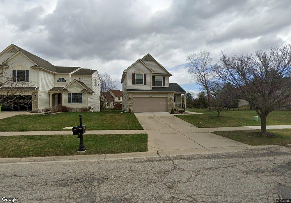
1757 Scio Ridge Rd Ann Arbor, MI 48103
Estimated Value: $406,000 - $502,000
3
Beds
3
Baths
1,626
Sq Ft
$285/Sq Ft
Est. Value
About This Home
This home is located at 1757 Scio Ridge Rd, Ann Arbor, MI 48103 and is currently estimated at $463,147, approximately $284 per square foot. 1757 Scio Ridge Rd is a home located in Washtenaw County with nearby schools including Dicken Elementary School, Slauson Middle School, and Pioneer High School.
Ownership History
Date
Name
Owned For
Owner Type
Purchase Details
Closed on
Jul 18, 1997
Sold by
Richards John and Wexford Ho
Bought by
Glima Gray
Current Estimated Value
Home Financials for this Owner
Home Financials are based on the most recent Mortgage that was taken out on this home.
Original Mortgage
$106,000
Interest Rate
7.81%
Mortgage Type
New Conventional
Purchase Details
Closed on
Mar 17, 1997
Sold by
Chase Co
Bought by
Bldg Co John Richards Homes & Wexford Homes
Create a Home Valuation Report for This Property
The Home Valuation Report is an in-depth analysis detailing your home's value as well as a comparison with similar homes in the area
Home Values in the Area
Average Home Value in this Area
Purchase History
| Date | Buyer | Sale Price | Title Company |
|---|---|---|---|
| Glima Gray | $182,656 | -- | |
| Bldg Co John Richards Homes & Wexford Homes | $45,500 | -- |
Source: Public Records
Mortgage History
| Date | Status | Borrower | Loan Amount |
|---|---|---|---|
| Closed | Glima Gray | $106,000 |
Source: Public Records
Tax History Compared to Growth
Tax History
| Year | Tax Paid | Tax Assessment Tax Assessment Total Assessment is a certain percentage of the fair market value that is determined by local assessors to be the total taxable value of land and additions on the property. | Land | Improvement |
|---|---|---|---|---|
| 2025 | $3,392 | $192,300 | $0 | $0 |
| 2024 | $3,311 | $195,600 | $0 | $0 |
| 2023 | $3,181 | $174,200 | $0 | $0 |
| 2022 | $4,481 | $154,700 | $0 | $0 |
| 2021 | $4,262 | $151,800 | $0 | $0 |
| 2020 | $4,363 | $149,000 | $0 | $0 |
| 2019 | $4,033 | $141,800 | $141,800 | $0 |
| 2018 | $3,927 | $131,500 | $0 | $0 |
| 2017 | $3,787 | $129,800 | $0 | $0 |
| 2016 | $2,644 | $103,975 | $0 | $0 |
| 2015 | -- | $103,665 | $0 | $0 |
| 2014 | -- | $100,427 | $0 | $0 |
| 2013 | -- | $100,427 | $0 | $0 |
Source: Public Records
Map
Nearby Homes
- 1929 Harley Dr
- 1860 Chicory Ridge
- 1599 Scio Ridge Rd
- 1419 N Bay Dr Unit 73
- 1343 Timmins Dr Unit 8
- 1261 Joyce Ln Unit 4
- 1255 Joyce Ln Unit 1
- 2126 Pauline Blvd Unit 104
- 2124 Pauline Blvd Unit 307
- 1225 S Maple Rd Unit 307
- 1235 S Maple Rd Unit 101
- 1235 S Maple Rd Unit 302
- 2120 Pauline Blvd Unit 305
- 2155 Pauline Ct
- 1265 S Maple Rd Unit 207
- 1041 E Summerfield Glen Cir
- 2127 Pauline Ct
- 1008 W Summerfield Glen Cir
- 922 W Summerfield Glen Cir Unit 110
- 921 E Summerfield Glen Cir Unit 29
- 1751 Scio Ridge Rd
- 1745 Scio Ridge Rd
- 1739 Scio Ridge Rd
- 2857 Windside Ct
- 2865 Windside Ct
- 1974 Harley Ct
- 1748 Scio Ridge Rd
- 2849 Windside Ct
- 1980 Harley Ct
- 1733 Scio Ridge Rd
- 1968 Harley Ct
- 2873 Windside Ct
- 1756 Reserve Way
- 2841 Windside Ct
- 1725 Scio Ridge Rd
- 1962 Harley Ct
- 1977 Harley Ct
- 1736 Scio Ridge Rd
- 1750 Reserve Way
- 2835 Windside Ct