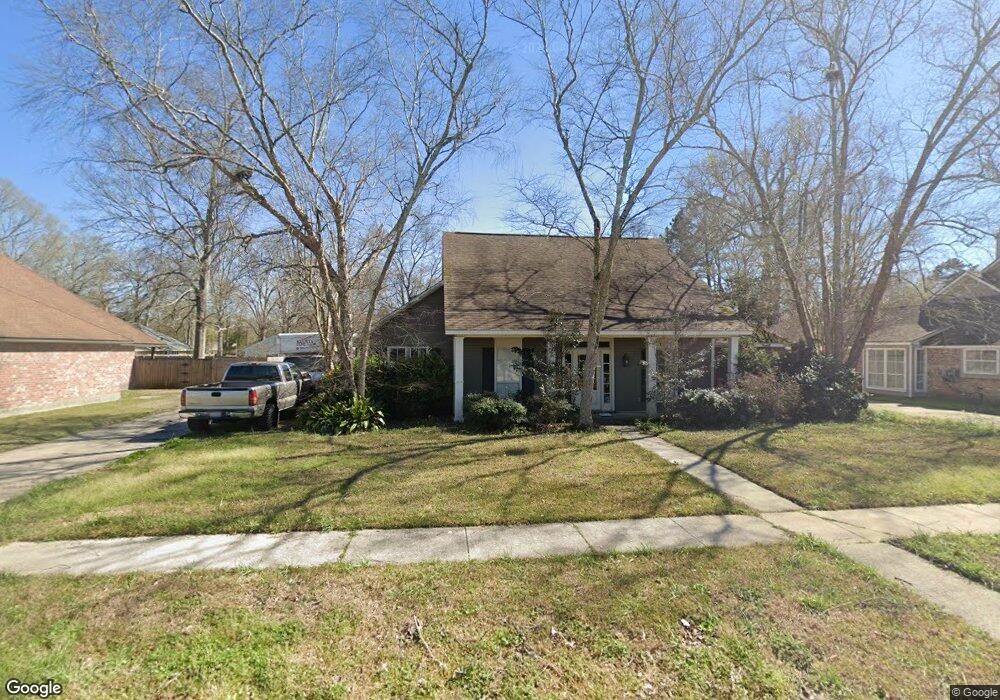
17574 General Forrest Ave Baton Rouge, LA 70817
Shenandoah NeighborhoodEstimated Value: $292,000 - $317,000
--
Bed
--
Bath
2,171
Sq Ft
$140/Sq Ft
Est. Value
About This Home
This home is located at 17574 General Forrest Ave, Baton Rouge, LA 70817 and is currently estimated at $304,972, approximately $140 per square foot. 17574 General Forrest Ave is a home located in East Baton Rouge Parish with nearby schools including Shenandoah Elementary School, Woodlawn Middle School, and Woodlawn High School.
Ownership History
Date
Name
Owned For
Owner Type
Purchase Details
Closed on
Feb 2, 2007
Sold by
Magee Ronald B
Bought by
Watson Bobby C
Current Estimated Value
Home Financials for this Owner
Home Financials are based on the most recent Mortgage that was taken out on this home.
Original Mortgage
$154,400
Outstanding Balance
$92,222
Interest Rate
6.11%
Mortgage Type
New Conventional
Estimated Equity
$212,750
Create a Home Valuation Report for This Property
The Home Valuation Report is an in-depth analysis detailing your home's value as well as a comparison with similar homes in the area
Home Values in the Area
Average Home Value in this Area
Purchase History
| Date | Buyer | Sale Price | Title Company |
|---|---|---|---|
| Watson Bobby C | $193,000 | -- |
Source: Public Records
Mortgage History
| Date | Status | Borrower | Loan Amount |
|---|---|---|---|
| Open | Watson Bobby C | $154,400 |
Source: Public Records
Tax History Compared to Growth
Tax History
| Year | Tax Paid | Tax Assessment Tax Assessment Total Assessment is a certain percentage of the fair market value that is determined by local assessors to be the total taxable value of land and additions on the property. | Land | Improvement |
|---|---|---|---|---|
| 2024 | $2,308 | $26,710 | $2,500 | $24,210 |
| 2023 | $2,308 | $21,710 | $2,500 | $19,210 |
| 2022 | $2,543 | $21,710 | $2,500 | $19,210 |
| 2021 | $2,495 | $21,710 | $2,500 | $19,210 |
| 2020 | $2,526 | $21,710 | $2,500 | $19,210 |
| 2019 | $2,375 | $19,550 | $2,500 | $17,050 |
| 2018 | $2,346 | $19,550 | $2,500 | $17,050 |
| 2017 | $2,346 | $19,550 | $2,500 | $17,050 |
| 2016 | $1,426 | $19,550 | $2,500 | $17,050 |
| 2015 | $1,426 | $19,550 | $2,500 | $17,050 |
| 2014 | $1,397 | $19,550 | $2,500 | $17,050 |
| 2013 | -- | $19,550 | $2,500 | $17,050 |
Source: Public Records
Map
Nearby Homes
- 17845 Coffee Rd
- 17630 Creek Hollow Rd
- 17633 E Fort Pickens Ave
- 5487 Hagerstown Dr
- 5821 Fort Sumpter Dr
- 16817 Ticonderoga Ave
- 5730 N Shore Dr
- 6041 Cottage Row Dr
- 5211 Fort Gregg Dr
- 16825 Chadsford Ave
- 6130 Wildlife Way Ct
- 16756 Merrimac Ave
- 18343 Wildlife Way Dr
- 6813 Garden Hill Dr
- 17237 Monitor Ave
- 6819 Garden Hill Dr
- 6046 Hagerstown Dr
- 6831 Garden Hill Dr
- 5532 Summer Lake Dr
- 6855 Garden Hill Dr
- 17564 General Forrest Ave
- 17584 General Forrest Ave
- 17584 E General Forest
- 17616 E General Forest
- 17554 General Forrest Ave
- 17616 General Forrest Ave
- 17511 Chancellorsville Ave
- 18013 Creek Hollow Rd
- 18033 Creek Hollow Rd
- 5747 Stones River Ave
- 17534 General Forrest Ave
- 17626 General Forrest Ave
- 17617 General Forrest Ave
- 17521 Chancellorsville Ave
- 17941 Creek Hollow Rd
- 5737 Stones River Ave
- 18053 Creek Hollow Rd
- 17627 General Forrest Ave
- 17524 General Forrest Ave
- 17636 General Forrest Ave