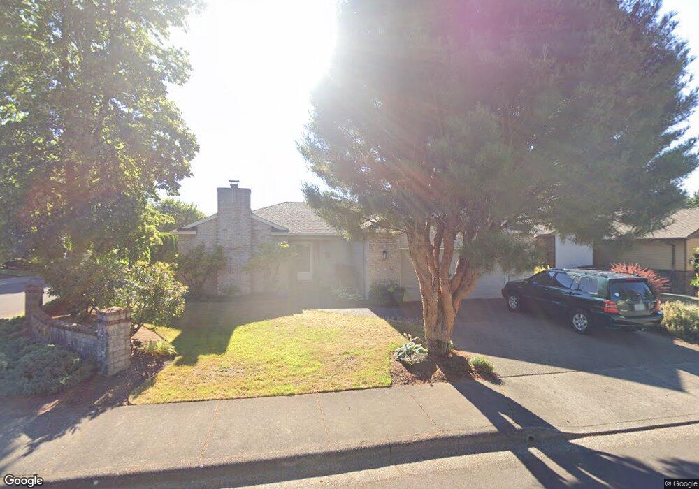
17580 SW 131st Ave Portland, OR 97224
Estimated Value: $465,000 - $577,065
3
Beds
2
Baths
1,741
Sq Ft
$313/Sq Ft
Est. Value
About This Home
This home is located at 17580 SW 131st Ave, Portland, OR 97224 and is currently estimated at $545,766, approximately $313 per square foot. 17580 SW 131st Ave is a home located in Washington County with nearby schools including Deer Creek Elementary School, Twality Middle School, and Tualatin High School.
Ownership History
Date
Name
Owned For
Owner Type
Purchase Details
Closed on
Jul 29, 2014
Sold by
Bennett Virginnia L and Guyette Thomas L
Bought by
The Bennett/Guyette Revocable Living Tru
Current Estimated Value
Purchase Details
Closed on
Apr 4, 2003
Sold by
Guyette Thomas L
Bought by
Guyette Thomas L and Bennett Virginnia L
Home Financials for this Owner
Home Financials are based on the most recent Mortgage that was taken out on this home.
Original Mortgage
$109,309
Interest Rate
5.78%
Create a Home Valuation Report for This Property
The Home Valuation Report is an in-depth analysis detailing your home's value as well as a comparison with similar homes in the area
Home Values in the Area
Average Home Value in this Area
Purchase History
| Date | Buyer | Sale Price | Title Company |
|---|---|---|---|
| The Bennett/Guyette Revocable Living Tru | -- | None Available | |
| Guyette Thomas L | -- | Chicago Title Insurance Comp |
Source: Public Records
Mortgage History
| Date | Status | Borrower | Loan Amount |
|---|---|---|---|
| Closed | Guyette Thomas L | $109,309 |
Source: Public Records
Tax History Compared to Growth
Tax History
| Year | Tax Paid | Tax Assessment Tax Assessment Total Assessment is a certain percentage of the fair market value that is determined by local assessors to be the total taxable value of land and additions on the property. | Land | Improvement |
|---|---|---|---|---|
| 2025 | $5,487 | $346,450 | -- | -- |
| 2024 | $5,341 | $336,360 | -- | -- |
| 2023 | $5,341 | $326,570 | $0 | $0 |
| 2022 | $5,124 | $326,570 | $0 | $0 |
| 2021 | $4,996 | $307,830 | $0 | $0 |
| 2020 | $4,848 | $298,870 | $0 | $0 |
| 2019 | $4,718 | $290,170 | $0 | $0 |
| 2018 | $4,521 | $281,720 | $0 | $0 |
| 2017 | $4,353 | $273,520 | $0 | $0 |
| 2016 | $4,144 | $265,560 | $0 | $0 |
| 2015 | $3,868 | $257,830 | $0 | $0 |
| 2014 | $3,769 | $250,330 | $0 | $0 |
Source: Public Records
Map
Nearby Homes
- 17445 SW 131st Ave
- 13254 SW Bradley Ln
- 13368 SW Bradley Ln Unit 9 &10
- 13326 SW Bradley Ln
- 13278 SW Bradley Ln
- 13290 SW Bradley Ln
- 12909 SW Jacob Ct
- 17041 SW Eldorado Dr Unit 25
- 17201 SW Eldorado Dr
- 17091 SW Eldorado Dr
- 12450 SW Fischer Rd Unit 270
- 12450 SW Fischer Rd Unit 277
- 17095 SW Eldorado Dr Unit 61
- 17453 SW 135th Place
- 17234 SW Eldorado Dr
- 13080 SW Carmel St
- 17292 SW Montague Way
- 17054 SW Eldorado Dr Unit 35
- 17246 SW Montague Way
- 13135 SW Carmel St
- 17590 SW 131st Ave
- 13066 SW Bedford St
- 13038 SW Bedford St
- 13093 SW Bedford St
- 13075 SW Bedford St
- 13120 SW Bedford St
- 17620 SW 131st Ave
- 13053 SW Bedford St
- 17597 SW 131st Ave
- 13024 SW Bedford St
- 13105 SW Bedford St
- 13031 SW Bedford St
- 13144 SW Bedford St
- 13129 SW Bedford St
- 13006 SW Bedford St
- 13098 SW Bradley Ln
- 13082 SW Bradley Ln
- 13015 SW Bedford St
- 13064 SW Bradley Ln
- 13151 SW Bedford St