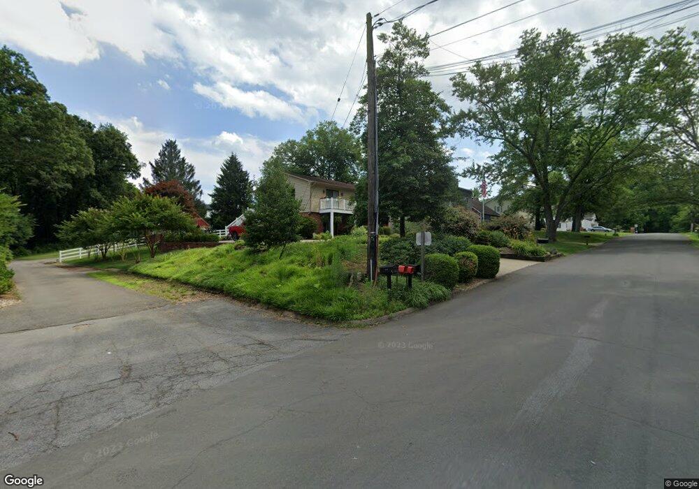
1759 Dunton Rd Annapolis, MD 21401
Estimated Value: $616,000 - $983,000
5
Beds
3
Baths
2,788
Sq Ft
$293/Sq Ft
Est. Value
About This Home
This home is located at 1759 Dunton Rd, Annapolis, MD 21401 and is currently estimated at $816,150, approximately $292 per square foot. 1759 Dunton Rd is a home located in Anne Arundel County with nearby schools including Rolling Knolls Elementary School, Wiley H. Bates Middle School, and Annapolis High School.
Ownership History
Date
Name
Owned For
Owner Type
Purchase Details
Closed on
Jul 29, 2025
Sold by
Curtis Jami L
Bought by
Curtis Jami L and Sanders Kenneth S
Current Estimated Value
Purchase Details
Closed on
Mar 29, 2010
Sold by
Baerga Manuel A
Bought by
First Horizon Home Loans
Purchase Details
Closed on
Sep 29, 2008
Sold by
Rudd William T
Bought by
Connell Richard S
Purchase Details
Closed on
Aug 25, 2005
Sold by
Danko Becky
Bought by
Baerga Manuel A and Baerga Laura J
Home Financials for this Owner
Home Financials are based on the most recent Mortgage that was taken out on this home.
Original Mortgage
$460,000
Interest Rate
5.81%
Mortgage Type
New Conventional
Purchase Details
Closed on
Dec 9, 2004
Sold by
Curran William D
Bought by
Toton Jeremy L and Toton Dana C
Purchase Details
Closed on
Oct 20, 2004
Sold by
Brown Jeffrey S
Bought by
Danko Becky
Purchase Details
Closed on
Aug 20, 2002
Sold by
Ragan Brian P
Bought by
Brown Jeffrey S
Create a Home Valuation Report for This Property
The Home Valuation Report is an in-depth analysis detailing your home's value as well as a comparison with similar homes in the area
Home Values in the Area
Average Home Value in this Area
Purchase History
| Date | Buyer | Sale Price | Title Company |
|---|---|---|---|
| Curtis Jami L | -- | None Listed On Document | |
| First Horizon Home Loans | $402,900 | -- | |
| Connell Richard S | $400,000 | -- | |
| Baerga Manuel A | $575,000 | -- | |
| Toton Jeremy L | $618,000 | -- | |
| Danko Becky | $485,000 | -- | |
| Brown Jeffrey S | $279,000 | -- |
Source: Public Records
Mortgage History
| Date | Status | Borrower | Loan Amount |
|---|---|---|---|
| Previous Owner | Baerga Manuel A | $460,000 | |
| Closed | Brown Jeffrey S | -- |
Source: Public Records
Tax History
| Year | Tax Paid | Tax Assessment Tax Assessment Total Assessment is a certain percentage of the fair market value that is determined by local assessors to be the total taxable value of land and additions on the property. | Land | Improvement |
|---|---|---|---|---|
| 2025 | $5,729 | $654,400 | $402,300 | $252,100 |
| 2024 | $5,729 | $599,033 | $0 | $0 |
| 2023 | $5,539 | $543,667 | $0 | $0 |
| 2022 | $5,147 | $488,300 | $318,500 | $169,800 |
| 2020 | $4,914 | $456,900 | $0 | $0 |
| 2019 | $9,448 | $441,200 | $248,000 | $193,200 |
| 2018 | $4,474 | $441,200 | $248,000 | $193,200 |
| 2017 | $4,556 | $441,200 | $0 | $0 |
| 2016 | -- | $460,500 | $0 | $0 |
| 2015 | -- | $429,867 | $0 | $0 |
| 2014 | -- | $399,233 | $0 | $0 |
Source: Public Records
Map
Nearby Homes
- 1002 Covington Way
- 900 Coachway
- 553 Choptank Cove Ct
- 524 Ridge Rd
- 1620 Wyatts Ridge Rd
- 1486 Downham Market
- 856 St Edmonds Place
- 1930 Severn Grove Rd
- 357 Overlook Trail
- 1976 Scotts Crossing Way Unit 1
- 1727 Broadlee Trail
- 1909 Eleanor Ct
- 38 Harbour Heights Dr
- 34 Harbour Heights Dr
- 812 Coachway
- 12 Harbour Heights Dr
- 769 Robinhood Rd
- 1753 Ebling Trail
- 633 Admiral Dr Unit 308
- 629 Admiral Dr Unit U206
- 1759 Dunton Rd
- 1759A Dunton Rd
- 1757 Dunton Rd
- 1755 Dunton Rd
- 1761 Dunton Rd
- 1753 Dunton Rd
- 1763 Dunton Rd
- 1756 Dunton Rd
- 1758 Dunton Rd
- 1751 Dunton Rd
- 1754 Dunton Rd
- 1759B Dunton Rd
- 1760 Dunton Rd
- 1752 Dunton Rd
- 1765 Dunton Rd
- 1080 Carriage Hill Pkwy
- 1811 Generals Hwy
- 1082 Carriage Hill Pkwy
- 1762 Dunton Rd
- 1750 Dunton Rd
Your Personal Tour Guide
Ask me questions while you tour the home.