1759 Kimsbrough Rd Sandy, UT 84092
Sandy AreaEstimated Value: $629,000 - $644,421
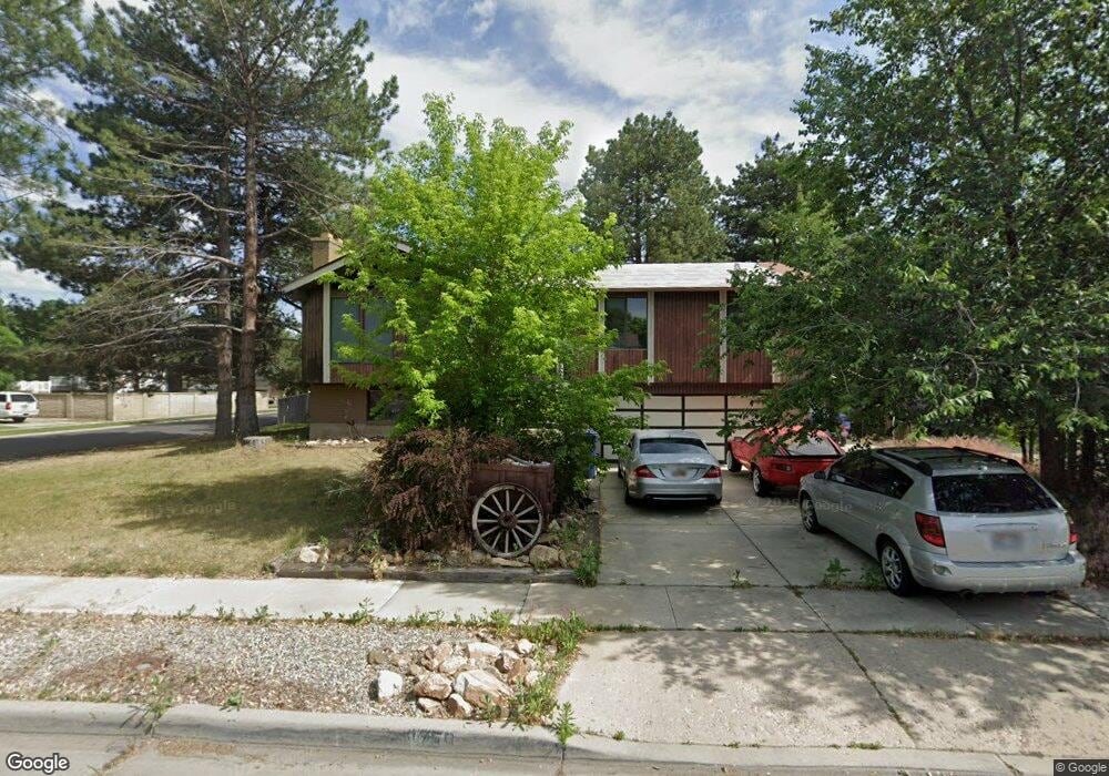
About This Home
This home is located at 1759 Kimsbrough Rd, Sandy, UT 84092 and is currently estimated at $639,355, approximately $295 per square foot. 1759 Kimsbrough Rd is a home located in Salt Lake County with nearby schools including Willow Canyon Elementary School, Eastmont Middle School, and Jordan High.
Ownership History
We collect this data history from publicly available records. To have your information removed, we recommend requesting removal directly through your county’s website.
Purchase Details
Purchase Details
Home Financials for this Owner
Home Financials are based on the most recent Mortgage that was taken out on this home.Purchase Details
Home Values in the Area
Average Home Value in this Area
Purchase History
We collect this data history from publicly available records. To have your information removed, we recommend requesting removal directly through your county’s website.
| Date | Buyer | Sale Price | Title Company |
|---|---|---|---|
| -- | None Listed On Document | ||
| -- | Guardian Title | ||
| -- | -- |
Mortgage History
We collect this data history from publicly available records. To have your information removed, we recommend requesting removal directly through your county’s website.
| Date | Status | Borrower | Loan Amount |
|---|---|---|---|
| Previous Owner | $140,000 |
Tax History
We collect this data history from publicly available records. To have your information removed, we recommend requesting removal directly through your county’s website.
| Year | Tax Paid | Tax Assessment Tax Assessment Total Assessment is a certain percentage of the fair market value that is determined by local assessors to be the total taxable value of land and additions on the property. | Land | Improvement |
|---|---|---|---|---|
| 2025 | $2,556 | $498,600 | $240,100 | $258,500 |
| 2024 | $2,552 | $496,300 | $231,100 | $265,200 |
| 2023 | $2,552 | $453,500 | $222,200 | $231,300 |
| 2022 | $2,434 | $458,300 | $217,800 | $240,500 |
| 2021 | $2,325 | $373,200 | $174,200 | $199,000 |
| 2020 | $1,997 | $302,700 | $174,200 | $128,500 |
| 2019 | $1,952 | $288,800 | $164,300 | $124,500 |
| 2018 | $1,771 | $274,600 | $164,300 | $110,300 |
| 2017 | $1,645 | $244,200 | $164,300 | $79,900 |
| 2016 | $1,565 | $224,800 | $148,100 | $76,700 |
| 2015 | $1,739 | $231,600 | $161,400 | $70,200 |
| 2014 | $1,634 | $213,900 | $152,500 | $61,400 |
Map
- 1722 Kimsbrough Rd
- 1725 E Faunsdale Cir
- 9979 S Albury Rd
- 1819 E 9880 S
- 9892 S Roseboro Rd
- 10248 Buttercup Dr
- 1528 E Buttercup Dr
- 10240 Locksley Rd
- 1584 Petunia Way
- 10183 S Hickory Point Dr
- 10313 S Countrywood Dr
- 9709 S Camberley Cir
- 10238 Snow Iris Way
- 9629 S 1835 E
- 2014 Quartzridge Dr
- 10032 S Blossom Dr
- 2035 E Quartzridge Dr
- 1929 E Rocklin Dr
- 9926 S Lannae Dr
- 9750 S Indian Ridge Dr
- 1742 Abbedale Ln
- 1732 Abbedale Ln
- 1741 Kimsbrough Rd
- 1743 Abbedale Ln
- 1758 Abbedale Ln
- 1733 Kimsbrough Rd
- 1733 Abbedale Ln
- 1733 E Abbedale Ln
- 1724 Abbedale Ln
- 1757 Abbedale Ln
- 1723 E Kimsbrough Rd
- 1723 Kimsbrough Rd
- 1768 E Abbedale Ln
- 1768 Abbedale Ln
- 9988 S Heytesbury Ln
- 1723 Abbedale Ln
- 1767 Kimsbrough Rd
- 1767 E Abbedale Ln
- 1767 Abbedale Ln
- 1716 Abbedale Ln
Ask me questions while you tour the home.