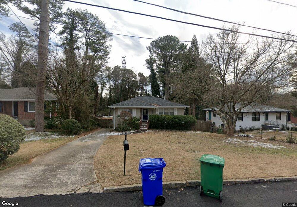
1759 Mckenzie Dr Decatur, GA 30032
Estimated Value: $243,096 - $307,000
3
Beds
2
Baths
1,125
Sq Ft
$243/Sq Ft
Est. Value
About This Home
This home is located at 1759 Mckenzie Dr, Decatur, GA 30032 and is currently estimated at $273,274, approximately $242 per square foot. 1759 Mckenzie Dr is a home located in DeKalb County with nearby schools including Peachcrest Elementary School, Mary McLeod Bethune Middle School, and Towers High School.
Ownership History
Date
Name
Owned For
Owner Type
Purchase Details
Closed on
Aug 16, 2012
Sold by
Colletta Adam
Bought by
1759 Mckenzie Llc
Current Estimated Value
Purchase Details
Closed on
Sep 21, 2010
Sold by
Benanti Deborah L
Bought by
Coletta Adam and Coletta Rocco
Purchase Details
Closed on
Apr 25, 2007
Sold by
Cater Holly
Bought by
Benanti Deborah L
Home Financials for this Owner
Home Financials are based on the most recent Mortgage that was taken out on this home.
Original Mortgage
$166,000
Interest Rate
6.1%
Mortgage Type
New Conventional
Purchase Details
Closed on
Jan 31, 2001
Sold by
Bledsoe Carl E
Bought by
Cater Holly
Home Financials for this Owner
Home Financials are based on the most recent Mortgage that was taken out on this home.
Original Mortgage
$100,700
Interest Rate
6.91%
Mortgage Type
New Conventional
Create a Home Valuation Report for This Property
The Home Valuation Report is an in-depth analysis detailing your home's value as well as a comparison with similar homes in the area
Home Values in the Area
Average Home Value in this Area
Purchase History
| Date | Buyer | Sale Price | Title Company |
|---|---|---|---|
| 1759 Mckenzie Llc | -- | -- | |
| Coletta Adam | $48,000 | -- | |
| Benanti Deborah L | $166,000 | -- | |
| Cater Holly | $106,000 | -- |
Source: Public Records
Mortgage History
| Date | Status | Borrower | Loan Amount |
|---|---|---|---|
| Previous Owner | Benanti Deborah L | $166,000 | |
| Previous Owner | Cater Holly | $100,700 |
Source: Public Records
Tax History Compared to Growth
Tax History
| Year | Tax Paid | Tax Assessment Tax Assessment Total Assessment is a certain percentage of the fair market value that is determined by local assessors to be the total taxable value of land and additions on the property. | Land | Improvement |
|---|---|---|---|---|
| 2025 | $5,411 | $113,520 | $31,040 | $82,480 |
| 2024 | $4,949 | $102,960 | $21,622 | $81,338 |
| 2023 | $4,949 | $102,960 | $21,622 | $81,338 |
| 2022 | $3,185 | $102,960 | $21,160 | $81,800 |
| 2021 | $3,185 | $64,800 | $12,800 | $52,000 |
| 2020 | $3,185 | $64,800 | $12,800 | $52,000 |
| 2019 | $2,722 | $68,960 | $12,800 | $56,160 |
| 2018 | $2,412 | $54,240 | $12,800 | $41,440 |
| 2017 | $2,547 | $50,040 | $4,240 | $45,800 |
| 2016 | $1,709 | $30,960 | $4,240 | $26,720 |
| 2014 | $944 | $13,320 | $4,240 | $9,080 |
Source: Public Records
Map
Nearby Homes
- 1737 Mckenzie Dr
- 1761 Derrill Dr
- 1743 Thomas Terrace
- 2361 Lynn Lris Dr
- 1764 Thomas Terrace
- 1846 Shamrock Dr
- 1853 Pinedale Place
- 3351 Phillip Cir
- 3367 Misty Valley Rd
- 1870 S Columbia Place
- 1542 Columbia Dr
- 3260 Glenco Dr
- 3314 Glenco Dr
- 3409 Glensford Dr
- 1529 N Columbia Place
- 1520 Columbia Dr
- 1908 S Columbia Place
- 1609 Tanager Cir
- 3089 Del Monico Dr
- 1914 Derrill Dr
- 1755 Mckenzie Dr
- 1765 Mckenzie Dr
- 1749 Mckenzie Dr
- 1771 Mckenzie Dr
- 1760 Mckenzie Dr
- 1743 Mckenzie Dr
- 1756 Mckenzie Dr
- 1777 Mckenzie Dr
- 1766 Mckenzie Dr
- 1730 Mckenzie Dr
- 1772 Mckenzie Dr
- 1755 S Columbia Place
- 1726 Mckenzie Dr
- 1776 Mckenzie Dr
- 1760 Lynn Ln
- 1720 Mckenzie Dr
- 1789 Mckenzie Dr
- 1782 Mckenzie Dr
- 1764 Lynn Ln
- 1714 Mckenzie Dr