Estimated Value: $763,000 - $1,039,000
4
Beds
3
Baths
2,949
Sq Ft
$302/Sq Ft
Est. Value
About This Home
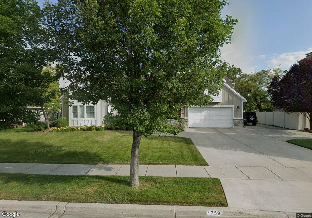
This home is located at 1759 Michael Way, Sandy, UT 84093 and is currently estimated at $891,219, approximately $302 per square foot. 1759 Michael Way is a home located in Salt Lake County with nearby schools including Silver Mesa Elementary School, Albion Middle School, and Hillcrest High School.
Ownership History
Date
Name
Owned For
Owner Type
Purchase Details
Closed on
Aug 30, 2002
Sold by
Heninger Marnie K
Bought by
Brown Darren S and Brown Sarah R
Current Estimated Value
Home Financials for this Owner
Home Financials are based on the most recent Mortgage that was taken out on this home.
Original Mortgage
$185,000
Outstanding Balance
$77,563
Interest Rate
6.29%
Estimated Equity
$813,656
Purchase Details
Closed on
Nov 14, 2001
Sold by
Heninger Robert Hall
Bought by
Heninger Kerri Ann and Peery Tracy Kathleen
Purchase Details
Closed on
Mar 5, 1997
Sold by
Heninger Robert H and Heninger Marnie K
Bought by
Heninger Marnie K and Heninger Robert H
Home Financials for this Owner
Home Financials are based on the most recent Mortgage that was taken out on this home.
Original Mortgage
$147,000
Interest Rate
7.81%
Create a Home Valuation Report for This Property
The Home Valuation Report is an in-depth analysis detailing your home's value as well as a comparison with similar homes in the area
Home Values in the Area
Average Home Value in this Area
Purchase History
| Date | Buyer | Sale Price | Title Company |
|---|---|---|---|
| Brown Darren S | -- | Brighton Title | |
| Heninger Marnie K | -- | Brighton Title | |
| Heninger Kerri Ann | -- | -- | |
| Heninger Marnie K | -- | -- |
Source: Public Records
Mortgage History
| Date | Status | Borrower | Loan Amount |
|---|---|---|---|
| Open | Brown Darren S | $185,000 | |
| Previous Owner | Heninger Marnie K | $147,000 |
Source: Public Records
Tax History Compared to Growth
Tax History
| Year | Tax Paid | Tax Assessment Tax Assessment Total Assessment is a certain percentage of the fair market value that is determined by local assessors to be the total taxable value of land and additions on the property. | Land | Improvement |
|---|---|---|---|---|
| 2025 | $4,202 | $817,400 | $337,200 | $480,200 |
| 2024 | $4,202 | $787,600 | $324,600 | $463,000 |
| 2023 | $3,639 | $680,900 | $312,100 | $368,800 |
| 2022 | $3,773 | $694,500 | $306,000 | $388,500 |
| 2021 | $3,437 | $538,500 | $242,800 | $295,700 |
| 2020 | $3,411 | $504,400 | $242,800 | $261,600 |
| 2019 | $3,389 | $489,000 | $229,000 | $260,000 |
| 2018 | $3,188 | $481,000 | $229,000 | $252,000 |
| 2017 | $3,039 | $438,600 | $229,000 | $209,600 |
| 2016 | $2,934 | $420,200 | $206,300 | $213,900 |
| 2015 | $2,972 | $384,500 | $218,700 | $165,800 |
| 2014 | $2,860 | $363,400 | $212,500 | $150,900 |
Source: Public Records
Map
Nearby Homes
- 9130 Maison Dr
- 1616 Waters Ln
- 1482 Waters Ln
- 9277 S 1520 E
- 8638 Piper Ln
- 1779 E Mombo Dr
- 1393 E Galaxie Dr
- 9460 S Tramway Dr
- 1492 E Sandy Hills Dr
- 1430 E 8685 S
- 1368 Silvercrest Dr
- 9171 Strasbourg Cir
- 1924 E Viscounti Cove
- 8492 S Mesa Dr
- 9595 S 1700 E
- 1990 E Terra Vista Way
- 8483 S Terrace Dr
- 8571 Monitor Dr
- 9123 Meadow Ct
- 8935 Quarry Stone Way
- 1769 Michael Way
- 1749 Michael Way
- 1752 E Misty Meadow
- 1752 E Misty Meadows Cir
- 1752 Misty Meadows Cir
- 1752 Misty Meadow Cir
- 1742 Misty Meadows Cir
- 1742 Misty Meadow Cir
- 1766 Cameo Way
- 1739 Michael Way
- 1768 Michael Way
- 1739 E Michael Way
- 9004 Cameo Way
- 1779 Michael Way
- 1751 Misty Meadows Cir
- 1744 E Michael Way
- 1744 Michael Way
- 1774 E Cameo Way
- 1774 Cameo Way
- 1732 Misty Meadows Cir