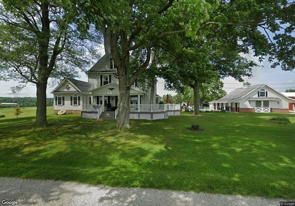
17596 Grill Rd Doylestown, OH 44230
Estimated Value: $649,000 - $851,038
4
Beds
3
Baths
2,401
Sq Ft
$312/Sq Ft
Est. Value
About This Home
This home is located at 17596 Grill Rd, Doylestown, OH 44230 and is currently estimated at $750,019, approximately $312 per square foot. 17596 Grill Rd is a home located in Wayne County with nearby schools including Hazel Harvey Elementary School, Chippewa Intermediate School, and Chippewa Jr./Sr. High School.
Ownership History
Date
Name
Owned For
Owner Type
Purchase Details
Closed on
Oct 22, 2018
Sold by
Crown Point Farms Inc
Bought by
Crown Point Farms Inc
Current Estimated Value
Purchase Details
Closed on
Oct 13, 2004
Sold by
Vannostran Thomas D and Vannostran Cathy L
Bought by
Crown Point Farms Inc
Create a Home Valuation Report for This Property
The Home Valuation Report is an in-depth analysis detailing your home's value as well as a comparison with similar homes in the area
Home Values in the Area
Average Home Value in this Area
Purchase History
| Date | Buyer | Sale Price | Title Company |
|---|---|---|---|
| Crown Point Farms Inc | -- | -- | |
| Crown Point Farms Inc | -- | -- |
Source: Public Records
Tax History Compared to Growth
Tax History
| Year | Tax Paid | Tax Assessment Tax Assessment Total Assessment is a certain percentage of the fair market value that is determined by local assessors to be the total taxable value of land and additions on the property. | Land | Improvement |
|---|---|---|---|---|
| 2024 | $3,261 | $227,970 | $174,080 | $53,890 |
| 2023 | $3,261 | $228,050 | $174,080 | $53,970 |
| 2022 | $2,940 | $228,050 | $174,080 | $53,970 |
| 2021 | $2,954 | $228,050 | $174,080 | $53,970 |
| 2020 | $2,970 | $228,050 | $174,080 | $53,970 |
| 2019 | $3,188 | $195,330 | $146,730 | $48,600 |
| 2018 | $3,219 | $195,330 | $146,730 | $48,600 |
| 2017 | $3,720 | $238,020 | $189,420 | $48,600 |
| 2016 | $3,953 | $168,070 | $124,930 | $43,140 |
| 2015 | $3,938 | $168,070 | $124,930 | $43,140 |
| 2014 | $3,633 | $172,820 | $124,930 | $47,890 |
| 2013 | $2,684 | $149,800 | $104,090 | $45,710 |
Source: Public Records
Map
Nearby Homes
- 14328 Calaboone Rd
- 580 Thorn Way
- 680 Thorn Way
- 620 Thorn Way
- 605 Vineyard Way
- VL 1067 Homan Dr
- 517 N Portage St
- V/L 1050 Melanie Ln
- 18592 Edwards Rd Unit 156
- 436 N Portage St
- 154 Circle Dr
- 100 Merlot Ct
- 325 Catawba Path
- 15562 Portage St
- 104 Homan Dr
- 12214 Vince Dr
- 77 Koehler Ave
- 340 Gates St
- 46 Hidden Pond Dr
- 5464 Taylor Rd
- 17955 Grill Rd
- 17489 Grill Rd
- 18033 Grill Rd
- 17465 Grill Rd
- 14101 Allison Dr
- 14081 Allison Dr
- 14057 Allison Dr
- 17424 Grill Rd
- 14035 Allison Dr
- 17423 Grill Rd
- 17423 Grill Rd
- 14000 Allison Dr
- 14009 Allison Dr
- 14034 Allison Dr
- 13987 Allison Dr
- 17860 Grill Rd
- 17876 Grill Rd
- 13963 Allison Dr
- 13992 Allison Dr
- 17930 Grill Rd