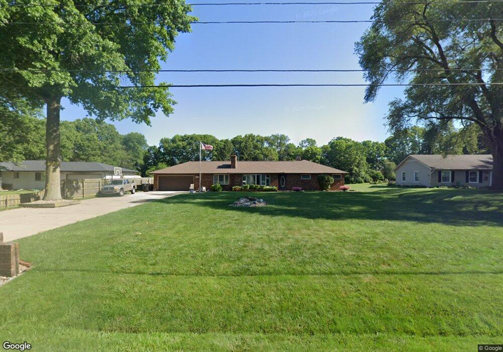
17599 Battles Rd South Bend, IN 46614
Estimated Value: $255,218 - $330,000
12
Beds
6
Baths
3,816
Sq Ft
$75/Sq Ft
Est. Value
About This Home
This home is located at 17599 Battles Rd, South Bend, IN 46614 and is currently estimated at $287,055, approximately $75 per square foot. 17599 Battles Rd is a home located in St. Joseph County with nearby schools including Meadow's Edge Elementary School, Virgil I. Grissom Middle School, and Penn High School.
Ownership History
Date
Name
Owned For
Owner Type
Purchase Details
Closed on
Nov 15, 2007
Sold by
Robertson Fawn and Robertson Young Fawn R
Bought by
Young Terry
Current Estimated Value
Purchase Details
Closed on
Jan 4, 2005
Sold by
Mercer Edward F and Mercer Irene
Bought by
Young Terry D and Robertson-Young Fawn R
Home Financials for this Owner
Home Financials are based on the most recent Mortgage that was taken out on this home.
Original Mortgage
$146,300
Interest Rate
5.9%
Mortgage Type
New Conventional
Create a Home Valuation Report for This Property
The Home Valuation Report is an in-depth analysis detailing your home's value as well as a comparison with similar homes in the area
Home Values in the Area
Average Home Value in this Area
Purchase History
| Date | Buyer | Sale Price | Title Company |
|---|---|---|---|
| Young Terry | -- | None Available | |
| Young Terry D | -- | Meridian Title Corp |
Source: Public Records
Mortgage History
| Date | Status | Borrower | Loan Amount |
|---|---|---|---|
| Previous Owner | Young Terry D | $146,300 |
Source: Public Records
Tax History Compared to Growth
Tax History
| Year | Tax Paid | Tax Assessment Tax Assessment Total Assessment is a certain percentage of the fair market value that is determined by local assessors to be the total taxable value of land and additions on the property. | Land | Improvement |
|---|---|---|---|---|
| 2024 | $1,874 | $209,200 | $39,300 | $169,900 |
| 2023 | $1,831 | $211,600 | $39,300 | $172,300 |
| 2022 | $1,843 | $198,200 | $39,300 | $158,900 |
| 2021 | $1,621 | $165,600 | $17,800 | $147,800 |
| 2020 | $1,616 | $168,200 | $17,800 | $150,400 |
| 2019 | $1,633 | $168,200 | $17,800 | $150,400 |
| 2018 | $1,597 | $188,900 | $17,800 | $171,100 |
| 2017 | $1,495 | $161,400 | $15,600 | $145,800 |
| 2016 | $1,511 | $161,400 | $15,600 | $145,800 |
| 2014 | $1,305 | $138,600 | $13,600 | $125,000 |
Source: Public Records
Map
Nearby Homes
- 3352 Topsfield Rd
- 1826 Overlook Ct
- 17746 Hartman St
- 4622 E Macgregor Rd
- 4210 Coral Dr
- 4555 Macdougall Ct
- 4039 Coral Dr
- 4015 Coral Dr
- 2500 Topsfield Rd Unit 805
- 2500 Topsfield Rd Unit 904
- 2500 Topsfield Rd Unit 703
- 2500 Topsfield Rd Unit 411
- 1957 Broadford Dr
- 2500 Topsfield #922 Rd
- 1619 Woodmont Dr
- 1951 Broadford Dr
- 1512 Oakdale Dr
- 1725 Thornhill Dr
- 1719 Thornhill Dr
- 3216 Weist Ln
- 17605 Battles Rd
- 17559 Battles Rd
- 17509 Battles Rd
- 17602 Battles Rd
- 17620 Battles Rd
- 17576 Battles Rd
- 17513 Battles Rd
- 17550 Battles Rd
- 17517 Battles Rd
- 17536 Battles Rd
- 17520 Battles Rd
- 17500 Battles Rd
- 17486 Battles Rd
- 17445 Battles Rd
- 17675 Ireland Rd
- 17699 Ireland Rd
- 17433 Battles Rd
- 17629 Ireland Rd
- 17432 Battles Rd
- 17607 Ireland Rd