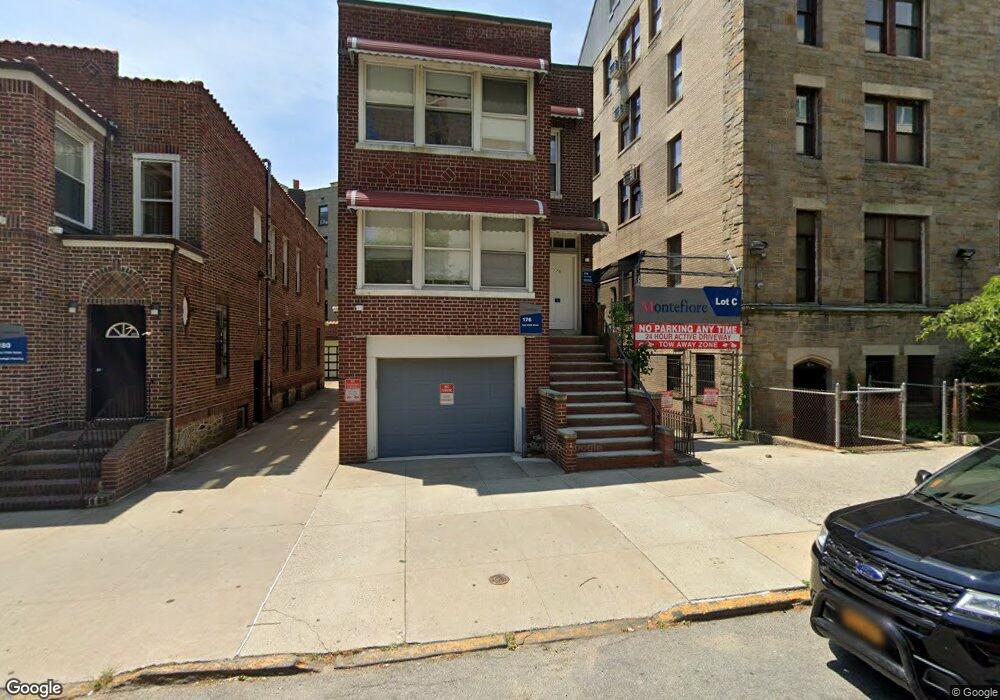
176 E 210th St Bronx, NY 10467
Norwood NeighborhoodEstimated Value: $990,350 - $1,499,000
Studio
--
Bath
4,438
Sq Ft
$275/Sq Ft
Est. Value
About This Home
This home is located at 176 E 210th St, Bronx, NY 10467 and is currently estimated at $1,222,338, approximately $275 per square foot. 176 E 210th St is a home located in Bronx County with nearby schools including P.S. 94 - Kings College School, J.H.S. 080 The Mosholu Parkway, and CANARSIE CHILDREN FIRST ACADEMY.
Ownership History
Date
Name
Owned For
Owner Type
Purchase Details
Closed on
Nov 30, 2010
Sold by
Campbell Odette and Reece Andrea J
Bought by
Mmc Corporation
Current Estimated Value
Purchase Details
Closed on
Aug 28, 1998
Sold by
Yarmie Michael S and Estate Of George Peltz
Bought by
Reece Andrea J and Campbell Odette
Home Financials for this Owner
Home Financials are based on the most recent Mortgage that was taken out on this home.
Original Mortgage
$215,600
Interest Rate
6.8%
Create a Home Valuation Report for This Property
The Home Valuation Report is an in-depth analysis detailing your home's value as well as a comparison with similar homes in the area
Home Values in the Area
Average Home Value in this Area
Purchase History
| Date | Buyer | Sale Price | Title Company |
|---|---|---|---|
| Mmc Corporation | $587,507 | -- | |
| Reece Andrea J | $227,000 | Chicago Title Insurance Co |
Source: Public Records
Mortgage History
| Date | Status | Borrower | Loan Amount |
|---|---|---|---|
| Previous Owner | Reece Andrea J | $215,600 |
Source: Public Records
Tax History
| Year | Tax Paid | Tax Assessment Tax Assessment Total Assessment is a certain percentage of the fair market value that is determined by local assessors to be the total taxable value of land and additions on the property. | Land | Improvement |
|---|---|---|---|---|
| 2025 | -- | $64,980 | $7,591 | $57,389 |
| 2024 | -- | $41,206 | $8,749 | $32,457 |
| 2023 | $0 | $63,060 | $11,580 | $51,480 |
| 2022 | $0 | $56,520 | $11,580 | $44,940 |
| 2021 | $0 | $50,700 | $11,580 | $39,120 |
| 2020 | $7,514 | $51,420 | $11,580 | $39,840 |
| 2019 | $7,183 | $42,660 | $11,580 | $31,080 |
| 2018 | $6,727 | $33,000 | $11,580 | $21,420 |
| 2017 | $6,425 | $31,518 | $10,728 | $20,790 |
| 2016 | $6,033 | $30,178 | $9,659 | $20,519 |
| 2015 | $3,586 | $29,582 | $8,326 | $21,256 |
| 2014 | $3,586 | $28,615 | $8,826 | $19,789 |
Source: Public Records
Map
Nearby Homes
- 3398 Wayne Ave Unit G61
- 3394 Wayne Ave Unit E23
- 3390 Wayne Ave Unit G61
- 3400 Wayne Ave Unit C63
- 3400 Wayne Ave Unit F22
- 3520 Tryon Ave Unit 603
- 3520 Tryon Ave Unit 502
- 3520 Tryon Ave Unit 405
- 282 Reservoir Place
- 3535 Kings College Place Unit 1E
- 3535 Kings College Place Unit 3F
- 3535 Kings College Place Unit 6G
- 3535 Kings College Place Unit 5A
- 3357 Perry Ave
- 3340 Perry Ave
- 91 E 208th St Unit 3K
- 3279 Hull Ave Unit 10
- 3245 Perry Ave Unit 4A
- 3245 Perry Ave Unit 1G
- 3245 Perry Ave Unit 1B
- 182 E 210th St
- 3397 Wayne Ave
- 3393 Wayne Ave
- 170 E 210th St
- 3391 Wayne Ave
- 3340 Bainbridge Ave
- 3342 Bainbridge Ave
- 3351 Reservoir Oval W
- 3341 Reservoir Oval W Unit 1C
- 3341 Reservoir Oval W Unit 3G
- 3341 Reservoir Oval W Unit 5B
- 3341 Reservoir Oval W Unit 3D
- 3341 Reservoir Oval W
- 3341 Reservoir Oval W Unit 5H
- 3389 Wayne Ave
- 3345 Reservoir Oval W
- 3343 Reservoir Oval W Unit 3H
- 3390 Wayne Ave Unit G31
- 3390 Wayne Ave Unit G-41
- 3390 Wayne Ave Unit G11
Your Personal Tour Guide
Ask me questions while you tour the home.