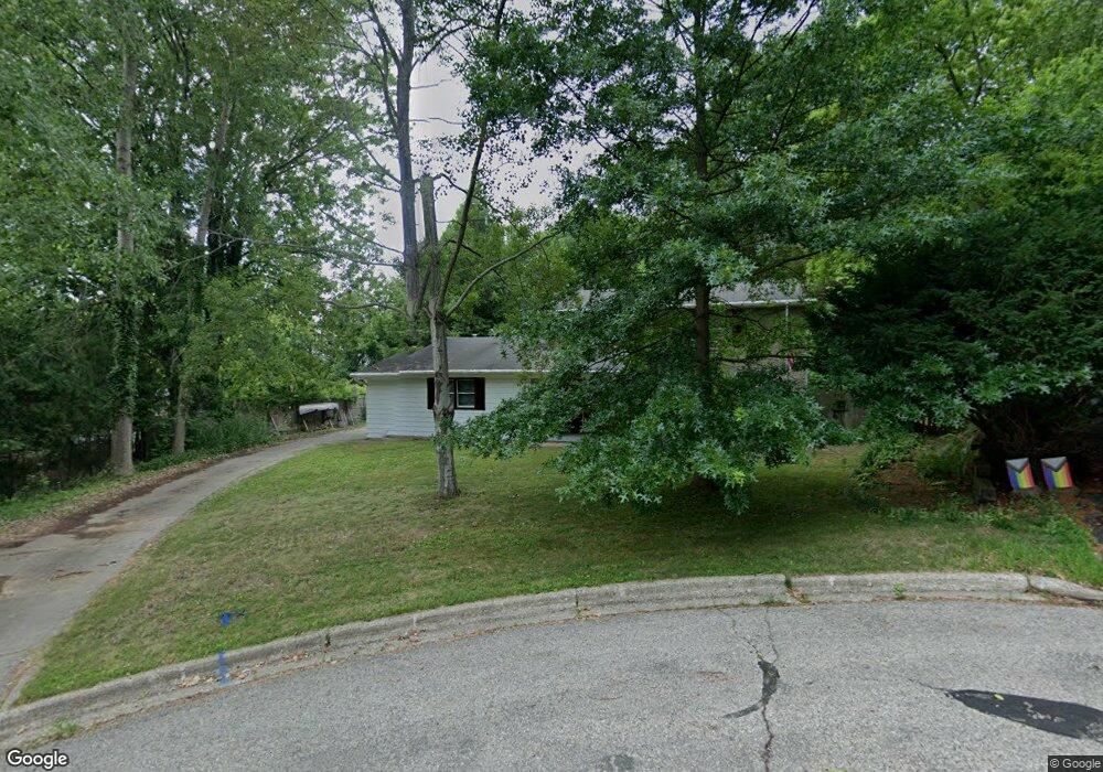
176 Krause St Rockford, MI 49341
Estimated Value: $383,971 - $489,000
4
Beds
3
Baths
2,000
Sq Ft
$214/Sq Ft
Est. Value
About This Home
This home is located at 176 Krause St, Rockford, MI 49341 and is currently estimated at $428,993, approximately $214 per square foot. 176 Krause St is a home located in Kent County with nearby schools including Meadow Ridge Elementary School, North Rockford Middle School, and Rockford High School Freshman Center.
Ownership History
Date
Name
Owned For
Owner Type
Purchase Details
Closed on
Apr 18, 2024
Sold by
Spalink James
Bought by
Spalink James P and Spalink Nathan J
Current Estimated Value
Purchase Details
Closed on
Jul 7, 2010
Sold by
Spalink Nancy
Bought by
Spalink James
Home Financials for this Owner
Home Financials are based on the most recent Mortgage that was taken out on this home.
Original Mortgage
$120,000
Interest Rate
4.74%
Mortgage Type
New Conventional
Purchase Details
Closed on
Jul 24, 1998
Sold by
Babcock Halden L
Bought by
Spalink James P and Spalink James P
Create a Home Valuation Report for This Property
The Home Valuation Report is an in-depth analysis detailing your home's value as well as a comparison with similar homes in the area
Home Values in the Area
Average Home Value in this Area
Purchase History
| Date | Buyer | Sale Price | Title Company |
|---|---|---|---|
| Spalink James P | -- | None Listed On Document | |
| Spalink James | -- | None Available | |
| Spalink James P | $154,000 | -- |
Source: Public Records
Mortgage History
| Date | Status | Borrower | Loan Amount |
|---|---|---|---|
| Previous Owner | Spalink James | $120,000 |
Source: Public Records
Tax History Compared to Growth
Tax History
| Year | Tax Paid | Tax Assessment Tax Assessment Total Assessment is a certain percentage of the fair market value that is determined by local assessors to be the total taxable value of land and additions on the property. | Land | Improvement |
|---|---|---|---|---|
| 2025 | $3,287 | $178,100 | $0 | $0 |
| 2024 | $3,287 | $155,800 | $0 | $0 |
| 2023 | $3,783 | $133,800 | $0 | $0 |
| 2022 | $3,633 | $119,800 | $0 | $0 |
| 2021 | $3,533 | $106,400 | $0 | $0 |
| 2020 | $2,877 | $97,900 | $0 | $0 |
| 2019 | $3,442 | $96,300 | $0 | $0 |
| 2018 | $3,449 | $87,400 | $0 | $0 |
| 2017 | $3,362 | $81,300 | $0 | $0 |
| 2016 | $3,112 | $82,300 | $0 | $0 |
| 2015 | -- | $82,300 | $0 | $0 |
| 2013 | -- | $74,600 | $0 | $0 |
Source: Public Records
Map
Nearby Homes
- 175 S Main St
- 131 S Monroe St NE
- 126 S Main St
- 142 E Division St NE
- 107 S Main St
- 153 Gaylord Dr
- 4286 Millpond Dr NE
- 7878 Northland Dr NE
- 8035 Jericho Ave NE
- 4749 Windcliff Dr NE Unit 9
- 205 Hunters Ln NE Unit 23
- 4985 Tiamo Ln NE
- 126 N Monroe St
- 4777 Windcliff Dr NE
- 5090 Natchez Ct NE
- 116 Kara Ct
- 8365 Atlanta Dr NE
- 8343 Atlanta Dr NE
- 8241 Courtland Dr NE
- 150 Glencarin Dr NE
- 250 S Monroe St
- 252 S Monroe St
- 160 Krause St
- 240 S Monroe St
- 261 S Fremont St NE
- 152 Krause St
- 269 S Fremont St NE
- 140 Krause St
- 220 S Monroe St
- 220 S Monroe St NE
- 257 S Monroe St
- 251 S Monroe St
- 279 S Fremont St NE
- 235 S Monroe St
- 156 Louise St
- 210 S Monroe St
- 225 S Monroe St
- 301 S Fremont St NE
- 245 S Fremont St NE
- 236 S Main St