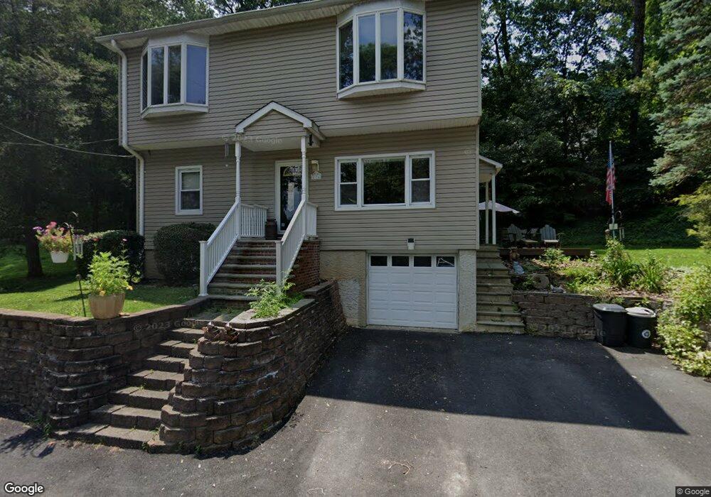
176 Lakeside Dr Rockaway, NJ 07866
Estimated Value: $552,000 - $618,000
--
Bed
--
Bath
1,696
Sq Ft
$339/Sq Ft
Est. Value
About This Home
This home is located at 176 Lakeside Dr, Rockaway, NJ 07866 and is currently estimated at $575,570, approximately $339 per square foot. 176 Lakeside Dr is a home located in Morris County with nearby schools including Dennis B O Brien School, Copeland Middle School, and Divine Mercy Academy.
Ownership History
Date
Name
Owned For
Owner Type
Purchase Details
Closed on
Sep 15, 1998
Sold by
Krozser David R and Krozser Linda
Bought by
Waliky Donna M and Rimac Lillianna
Current Estimated Value
Purchase Details
Closed on
Jun 17, 1994
Sold by
Newman Ethel
Bought by
Krozser Dave
Home Financials for this Owner
Home Financials are based on the most recent Mortgage that was taken out on this home.
Original Mortgage
$122,000
Interest Rate
8.74%
Mortgage Type
FHA
Create a Home Valuation Report for This Property
The Home Valuation Report is an in-depth analysis detailing your home's value as well as a comparison with similar homes in the area
Home Values in the Area
Average Home Value in this Area
Purchase History
| Date | Buyer | Sale Price | Title Company |
|---|---|---|---|
| Waliky Donna M | $145,000 | Fidelity National Title Ins | |
| Krozser Dave | $128,000 | -- |
Source: Public Records
Mortgage History
| Date | Status | Borrower | Loan Amount |
|---|---|---|---|
| Previous Owner | Krozser Dave | $122,000 |
Source: Public Records
Tax History Compared to Growth
Tax History
| Year | Tax Paid | Tax Assessment Tax Assessment Total Assessment is a certain percentage of the fair market value that is determined by local assessors to be the total taxable value of land and additions on the property. | Land | Improvement |
|---|---|---|---|---|
| 2025 | $10,664 | $445,000 | $196,500 | $248,500 |
| 2024 | $10,257 | $415,900 | $181,100 | $234,800 |
| 2023 | $10,257 | $390,900 | $168,700 | $222,200 |
| 2022 | $10,117 | $372,800 | $160,900 | $211,900 |
| 2021 | $10,117 | $356,500 | $153,800 | $202,700 |
| 2020 | $9,929 | $349,500 | $151,400 | $198,100 |
| 2019 | $9,740 | $341,400 | $146,700 | $194,700 |
| 2018 | $9,770 | $337,000 | $150,300 | $186,700 |
| 2017 | $9,725 | $311,500 | $139,700 | $171,800 |
| 2016 | $9,600 | $311,500 | $139,700 | $171,800 |
| 2015 | $9,532 | $311,500 | $139,700 | $171,800 |
| 2014 | $9,354 | $311,500 | $139,700 | $171,800 |
Source: Public Records
Map
Nearby Homes
- 15 Caruso Rd
- 49-51 Wall St
- 2 Church St
- 21 Easton Ave
- 31 Hyland Ave
- 33 Highland Ave
- 195 Mount Pleasant Ave
- 20 Jay St
- 10 Katherine Rd
- 50 White Meadow Ave
- 41 Seneca Ave
- 11 Oneida Ave
- 39 Lenox Rd
- 64 Franklin Ave
- 342 Mount Pleasant Ave
- 7 Oakland Ave
- 51 Sioux Ave
- 53 White Meadow Rd
- 8 Ellen Dr
- 155 Mount Pleasant Ave
- 153 Chestnut Terrace
- 151 Chestnut Terrace
- 172 Lakeside Dr
- 159 Chestnut Terrace
- 143 Chestnut Terrace
- 164 Lakeside Dr
- 163 Chestnut Terrace
- 150 Chestnut Terrace
- 158 Chestnut Terrace
- 158 Lakeside Dr
- 148 Chestnut Terrace
- 162 Chestnut Terrace
- 135 Chestnut Terrace
- 166 Chestnut Terrace
- 142 Chestnut Terrace
- 146 Lakeside Dr
- 169 Chestnut Terrace
- 131 Chestnut Terrace
- 170 Chestnut Terrace
- 124 Chestnut Terrace