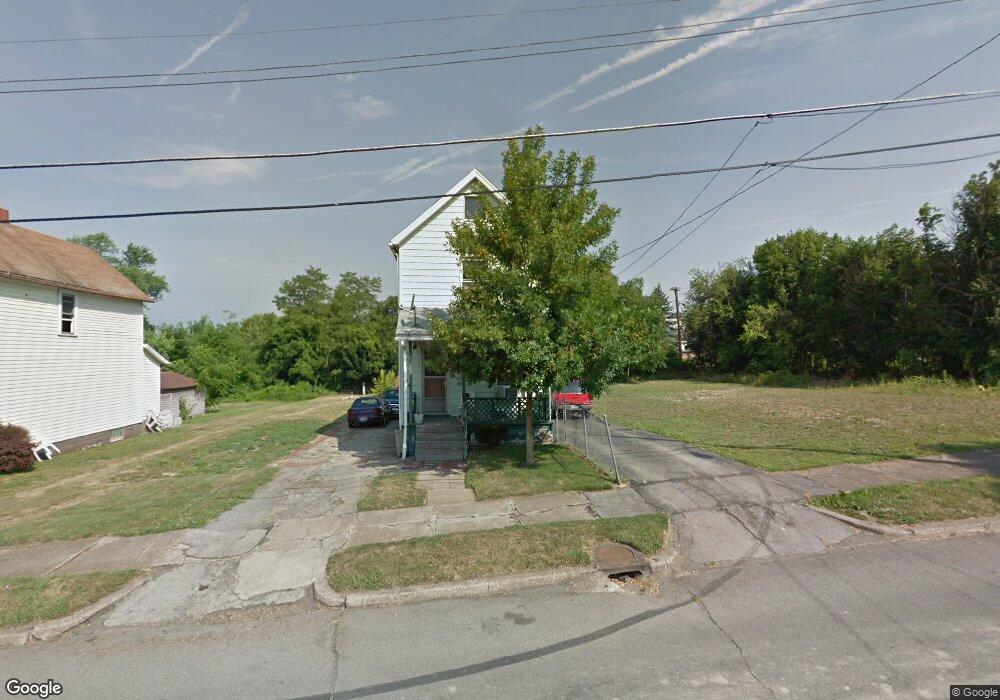
176 Madison St Campbell, OH 44405
Estimated Value: $61,000 - $67,000
--
Bed
2
Baths
--
Sq Ft
3,920
Sq Ft Lot
About This Home
This home is located at 176 Madison St, Campbell, OH 44405 and is currently estimated at $64,000. 176 Madison St is a home located in Mahoning County with nearby schools including Campbell Elementary School, Memorial High School, and Northeast Ohio Impact Academy.
Ownership History
Date
Name
Owned For
Owner Type
Purchase Details
Closed on
Dec 6, 2013
Sold by
Mahoning County Land Reutilization Corpo and Yemma Daniel R
Bought by
Vukovich Matthew K
Current Estimated Value
Purchase Details
Closed on
Mar 4, 2002
Sold by
Gabriel William E
Bought by
Wells Fargo Bank Minnesota Na
Purchase Details
Closed on
Jan 2, 2002
Sold by
Gabriel William E
Bought by
Wells Fargo Bank Minnesota Na
Purchase Details
Closed on
May 2, 2000
Sold by
Hood Joseph
Bought by
Gabriel William E
Purchase Details
Closed on
Jan 21, 1975
Bought by
Papalko George R
Create a Home Valuation Report for This Property
The Home Valuation Report is an in-depth analysis detailing your home's value as well as a comparison with similar homes in the area
Home Values in the Area
Average Home Value in this Area
Purchase History
| Date | Buyer | Sale Price | Title Company |
|---|---|---|---|
| Vukovich Matthew K | -- | Attorney | |
| Wells Fargo Bank Minnesota Na | $9,000 | -- | |
| Wells Fargo Bank Minnesota Na | $9,000 | -- | |
| Gabriel William E | $28,000 | -- | |
| Papalko George R | -- | -- |
Source: Public Records
Mortgage History
| Date | Status | Borrower | Loan Amount |
|---|---|---|---|
| Closed | Gabriel William E | $0 |
Source: Public Records
Tax History Compared to Growth
Tax History
| Year | Tax Paid | Tax Assessment Tax Assessment Total Assessment is a certain percentage of the fair market value that is determined by local assessors to be the total taxable value of land and additions on the property. | Land | Improvement |
|---|---|---|---|---|
| 2024 | $6 | $110 | $110 | -- |
| 2023 | $6 | $110 | $110 | $0 |
| 2022 | $7 | $110 | $110 | $0 |
| 2021 | $7 | $110 | $110 | $0 |
| 2020 | $7 | $110 | $110 | $0 |
| 2019 | $7 | $110 | $110 | $0 |
| 2018 | $8 | $110 | $110 | $0 |
| 2017 | $8 | $110 | $110 | $0 |
| 2016 | $7 | $110 | $110 | $0 |
| 2015 | $7 | $110 | $110 | $0 |
| 2014 | -- | $110 | $110 | $0 |
| 2013 | $91 | $110 | $110 | $0 |
Source: Public Records
Map
Nearby Homes
- 247 Reed Ave
- 115 Madison St
- 134 Chambers St
- 130 12th St
- 664 Tenney Ave
- 680 Tenney Ave
- 0 Penhale Ave
- 90 Frank St
- 97 Rosary Dr
- 684 Devitt Ave
- 650 Penhale Ave
- 528 Hyatt Ave
- 3307 Upland Ave
- 619 Robinson Rd
- 291 Struthers Liberty Rd
- 746 Whipple Ave
- 331 Sanderson Ave
- 519 Blossom Ave
- 853 Almasy Dr
- 296 Sanderson Ave
- 172 Madison St
- 178 Madison St
- 166 Madison St
- 229 Robinson Rd
- 162 Madison St
- 236 Robinson Rd
- 175 Madison St
- 173 Madison St
- 171 Madison St
- 240 Robinson Rd
- 152 Madison St
- 155 Jefferson St
- 159 Madison St
- 248 Robinson Rd
- 148 Madison St
- 157 Madison St
- 212 Robinson Rd
- 256 Robinson Rd
- 151 Jefferson St
- 195 Madison St