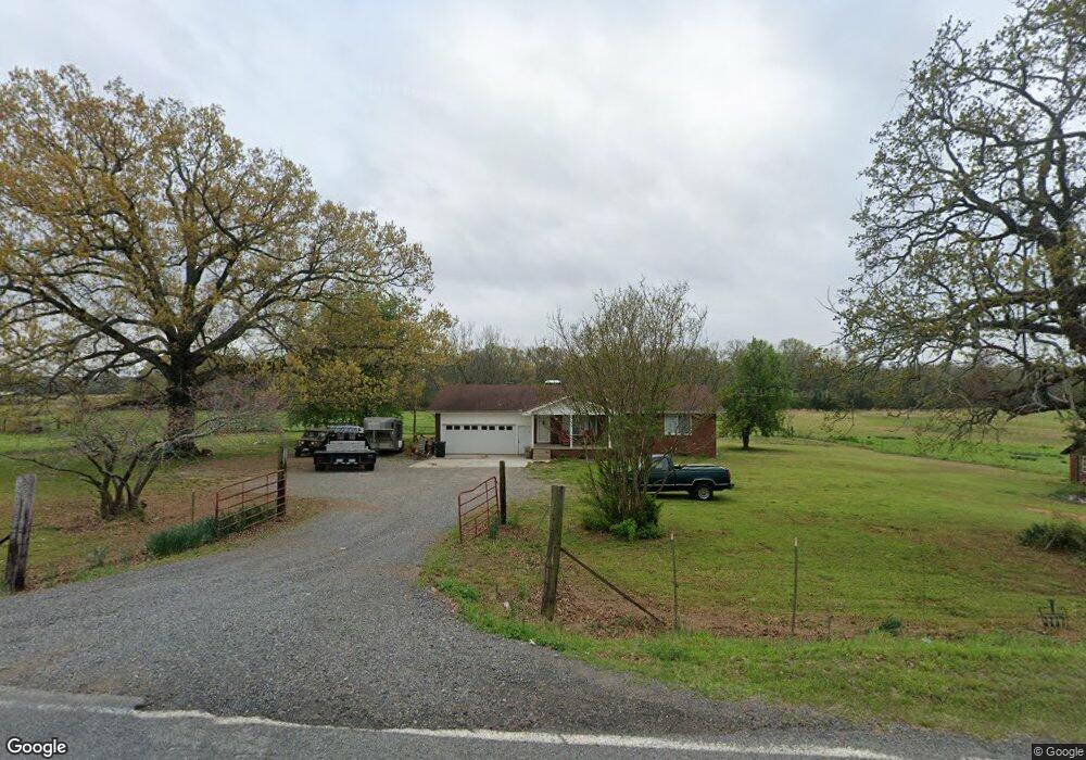
176 Mitchell Rd Sherwood, AR 72120
Estimated Value: $89,000 - $140,000
--
Bed
2
Baths
1,586
Sq Ft
$73/Sq Ft
Est. Value
About This Home
This home is located at 176 Mitchell Rd, Sherwood, AR 72120 and is currently estimated at $115,508, approximately $72 per square foot. 176 Mitchell Rd is a home located in Faulkner County with nearby schools including Mayflower Elementary School, Mayflower Middle School, and Mayflower High School.
Ownership History
Date
Name
Owned For
Owner Type
Purchase Details
Closed on
Dec 13, 2021
Sold by
Fortson John and Fortson Shanda L
Bought by
Fortson Lindsay Michelle and Fortson Justin L
Current Estimated Value
Home Financials for this Owner
Home Financials are based on the most recent Mortgage that was taken out on this home.
Original Mortgage
$79,000
Outstanding Balance
$61,777
Interest Rate
2.35%
Mortgage Type
New Conventional
Estimated Equity
$53,731
Purchase Details
Closed on
Jan 31, 2013
Sold by
Fortson Judy
Bought by
Fortson Justin Lee
Purchase Details
Closed on
May 11, 1999
Bought by
Ad Deed For Est Of Cleo Brooks
Create a Home Valuation Report for This Property
The Home Valuation Report is an in-depth analysis detailing your home's value as well as a comparison with similar homes in the area
Home Values in the Area
Average Home Value in this Area
Purchase History
| Date | Buyer | Sale Price | Title Company |
|---|---|---|---|
| Fortson Lindsay Michelle | $99,000 | Faulkner County Title Co | |
| Fortson Justin Lee | -- | None Available | |
| Ad Deed For Est Of Cleo Brooks | $51,000 | -- |
Source: Public Records
Mortgage History
| Date | Status | Borrower | Loan Amount |
|---|---|---|---|
| Open | Fortson Lindsay Michelle | $79,000 |
Source: Public Records
Tax History Compared to Growth
Tax History
| Year | Tax Paid | Tax Assessment Tax Assessment Total Assessment is a certain percentage of the fair market value that is determined by local assessors to be the total taxable value of land and additions on the property. | Land | Improvement |
|---|---|---|---|---|
| 2025 | $33 | $690 | $690 | -- |
| 2024 | $34 | $690 | $690 | $0 |
| 2023 | $32 | $660 | $660 | $0 |
| 2022 | $82 | $660 | $660 | $0 |
| 2021 | $67 | $26,780 | $2,670 | $24,110 |
| 2020 | $1,138 | $22,610 | $2,650 | $19,960 |
| 2019 | $1,138 | $22,610 | $2,650 | $19,960 |
| 2018 | $1,138 | $22,610 | $2,650 | $19,960 |
| 2017 | $1,138 | $22,610 | $2,650 | $19,960 |
| 2016 | $1,138 | $22,610 | $2,650 | $19,960 |
| 2015 | $1,079 | $22,120 | $2,490 | $19,630 |
| 2014 | $1,115 | $22,120 | $2,490 | $19,630 |
Source: Public Records
Map
Nearby Homes
- 1 Wesley Trail
- 00 Melissa Ln
- 11908 Melissa Ln
- 9604 Sayles Rd
- 000 Jones Rd Unit Schrewsbury Road
- 00 Moon Rd
- 29 Amber Oaks
- 8119 Dorsey Rd
- 41 Bridge Field Dr
- 48 Bridge Field Dr
- 14 Vista Trail
- 15 Buena Vista Dr
- 35 Friday Ln
- 6821 Haynie Rd
- 514 Beryl Rd S
- 00 Billy Goat Mountain Rd
- 14 Rose Ln
- 196 Stone Mountain Rd
- 0 Allen Dr
- 101 Quail Valley Rd
- 176 Mitchell
- 204 Mitchell Rd
- 130 Mitchell Rd
- 152 Mitchell Rd
- 26 Wesley Trail
- 40 Crow Ln
- 140 Mitchell Rd
- 140 Mitchell Rd
- 18 Haynie Hill Rd
- 2 Buck Trail
- 129 Mitchell Rd Unit 133
- 00 Faulkner Gap Rd
- 0 Wesley Trail
- Lot 21 S Buck Trail
- 67 Haynie Hill Rd
- 45 Crow Ln
- 23 Faulkner Gap Rd
- 75 Haynie Hill Rd
- 18 S Buck Trail
- 47 Faulkner Gap Rd