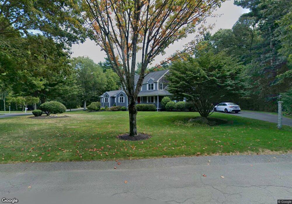
176 Rivers Edge Dr Middleboro, MA 02346
Estimated Value: $760,923 - $902,000
4
Beds
4
Baths
3,252
Sq Ft
$260/Sq Ft
Est. Value
About This Home
This home is located at 176 Rivers Edge Dr, Middleboro, MA 02346 and is currently estimated at $845,731, approximately $260 per square foot. 176 Rivers Edge Dr is a home located in Plymouth County with nearby schools including Mary K. Goode Elementary School and Chamberlain International School.
Ownership History
Date
Name
Owned For
Owner Type
Purchase Details
Closed on
Jun 27, 2023
Sold by
Ducharme Kris A and Ducharme Laureen J
Bought by
Ducharme Ft and Ducharme
Current Estimated Value
Purchase Details
Closed on
Mar 6, 1997
Sold by
Dnj Rt and Thiel
Bought by
Ducharme Kris A and Ducharme Laureen J
Purchase Details
Closed on
Oct 24, 1996
Sold by
Potenzo Rlty Corp
Bought by
Dnj Rt and Thiel
Create a Home Valuation Report for This Property
The Home Valuation Report is an in-depth analysis detailing your home's value as well as a comparison with similar homes in the area
Home Values in the Area
Average Home Value in this Area
Purchase History
| Date | Buyer | Sale Price | Title Company |
|---|---|---|---|
| Ducharme Ft | -- | None Available | |
| Ducharme Kris A | $203,584 | -- | |
| Dnj Rt | $72,000 | -- |
Source: Public Records
Mortgage History
| Date | Status | Borrower | Loan Amount |
|---|---|---|---|
| Previous Owner | Dnj Rt | $282,000 | |
| Previous Owner | Dnj Rt | $280,800 |
Source: Public Records
Tax History
| Year | Tax Paid | Tax Assessment Tax Assessment Total Assessment is a certain percentage of the fair market value that is determined by local assessors to be the total taxable value of land and additions on the property. | Land | Improvement |
|---|---|---|---|---|
| 2025 | $9,725 | $725,200 | $177,900 | $547,300 |
| 2024 | $9,623 | $710,700 | $169,700 | $541,000 |
| 2023 | $8,779 | $616,500 | $177,800 | $438,700 |
| 2022 | $8,351 | $543,000 | $168,700 | $374,300 |
| 2021 | $8,381 | $515,100 | $147,800 | $367,300 |
| 2020 | $8,231 | $518,300 | $147,800 | $370,500 |
| 2019 | $8,212 | $530,500 | $147,800 | $382,700 |
| 2018 | $7,143 | $457,900 | $129,300 | $328,600 |
| 2017 | $6,764 | $428,900 | $124,900 | $304,000 |
| 2016 | $7,002 | $439,800 | $136,900 | $302,900 |
| 2015 | $6,697 | $424,400 | $136,800 | $287,600 |
Source: Public Records
Map
Nearby Homes
- 0 Murdock St Unit 73473837
- 402 Hastings Rd Unit 402HAS
- 2602 Pheasant Ln
- 246 Everett St
- 4303 Oak Point Dr Unit 4303OAK
- 3402 Island Dr
- Lot 000 Summer St
- 3509 Fox Run Unit 3509FOX
- 2701 Simmons Rd Unit 2701SIM
- 2612 Oak Point Dr
- 1808 Oak Point Dr Unit 1808OAK
- 132 Everett St
- 80 Forest St
- 218 Old Center St
- 1 Bloomfield Ave
- 75 Oak St
- 87 Pearl St
- 81 Pratt Ave
- 28 School St
- 240 N Main St
- 136 River's Edge Dr
- 174 Rivers Edge Dr
- 5 Edgewater Ln
- 26 Rivers Edge Dr
- 166 Rivers Edge Dr
- 155 Rivers Edge Dr
- 18 Edgewater Ln
- 169 Rivers Edge Dr
- 163 Rivers Edge Dr
- 160 Rivers Edge Dr
- 152 Rivers Edge Dr
- 27 Murdock St
- 139 Rivers Edge Dr
- 142 Rivers Edge Dr
- 25 Murdock St
- 29 Murdock St
- 56 Summer St
- 31 Murdock St
- 125 Rivers Edge Dr
- 136 Rivers Edge Dr
Your Personal Tour Guide
Ask me questions while you tour the home.