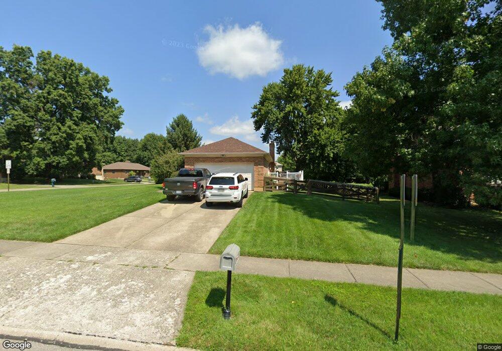
1760 Millspring Ct Cincinnati, OH 45231
New Burlington NeighborhoodEstimated Value: $297,671 - $337,000
3
Beds
2
Baths
1,634
Sq Ft
$196/Sq Ft
Est. Value
About This Home
This home is located at 1760 Millspring Ct, Cincinnati, OH 45231 and is currently estimated at $320,918, approximately $196 per square foot. 1760 Millspring Ct is a home located in Hamilton County with nearby schools including Mt Healthy High School, Hamilton County Mathematics and Science Academy, and Central Montessori Academy.
Ownership History
Date
Name
Owned For
Owner Type
Purchase Details
Closed on
May 14, 2007
Sold by
Kortas Regina
Bought by
Sunderman Kenneth J and Sunderman Denena
Current Estimated Value
Home Financials for this Owner
Home Financials are based on the most recent Mortgage that was taken out on this home.
Original Mortgage
$153,000
Outstanding Balance
$91,432
Interest Rate
6.21%
Mortgage Type
Unknown
Estimated Equity
$229,486
Purchase Details
Closed on
Aug 21, 1995
Sold by
Bender Gertrude T
Bought by
Bender Gertrude T and Kortas Regina
Home Financials for this Owner
Home Financials are based on the most recent Mortgage that was taken out on this home.
Original Mortgage
$108,000
Interest Rate
7.43%
Create a Home Valuation Report for This Property
The Home Valuation Report is an in-depth analysis detailing your home's value as well as a comparison with similar homes in the area
Home Values in the Area
Average Home Value in this Area
Purchase History
| Date | Buyer | Sale Price | Title Company |
|---|---|---|---|
| Sunderman Kenneth J | $170,000 | The Main Title Agency | |
| Bender Gertrude T | -- | -- | |
| Bender Gertrude T | -- | -- |
Source: Public Records
Mortgage History
| Date | Status | Borrower | Loan Amount |
|---|---|---|---|
| Open | Sunderman Kenneth J | $153,000 | |
| Closed | Bender Gertrude T | $108,000 |
Source: Public Records
Tax History
| Year | Tax Paid | Tax Assessment Tax Assessment Total Assessment is a certain percentage of the fair market value that is determined by local assessors to be the total taxable value of land and additions on the property. | Land | Improvement |
|---|---|---|---|---|
| 2025 | $4,309 | $83,052 | $13,892 | $69,160 |
| 2024 | $4,274 | $83,052 | $13,892 | $69,160 |
| 2023 | $4,109 | $83,052 | $13,892 | $69,160 |
| 2022 | $5,271 | $68,450 | $13,549 | $54,901 |
| 2021 | $5,131 | $68,450 | $13,549 | $54,901 |
| 2020 | $5,208 | $68,450 | $13,549 | $54,901 |
| 2019 | $4,398 | $53,897 | $10,668 | $43,229 |
| 2018 | $4,350 | $53,897 | $10,668 | $43,229 |
| 2017 | $4,127 | $53,897 | $10,668 | $43,229 |
| 2016 | $3,920 | $50,460 | $10,112 | $40,348 |
| 2015 | $3,951 | $50,460 | $10,112 | $40,348 |
| 2014 | $3,932 | $50,460 | $10,112 | $40,348 |
| 2013 | $4,229 | $55,451 | $11,113 | $44,338 |
Source: Public Records
Map
Nearby Homes
- 10453 Mill Rd
- 10493 Mill Rd
- 1858 Aspenhill Dr
- 10228 Springbeauty Ln
- 1887 Lotushill Dr
- 1958 Bluehill Dr
- 1854 Windmill Way
- 1931 Lotushill Dr
- 2192 Pinney Ln
- 10908 Tangleberry Ct
- 2071 Roosevelt Ave
- 1805 Miles Rd
- 10945 Crystalhill Ct
- 624 Brightview Dr
- 626 Brightview Dr
- 606 Brightview Dr
- 610 Brightview Dr
- 622 Brightview Dr
- 614 Brightview Dr
- 616 Brightview Dr
- 1760 Mill Spring Ct
- 1752 Mill Spring Ct
- 10426 Springrun Dr
- 1744 Mill Spring Ct
- 1744 Millspring Ct
- 10419 Springrun Dr
- 10415 Springrun Dr
- 10423 Springrun Dr
- 10430 Springrun Dr
- 10406 Springrun Dr
- 1751 Millspring Ct
- 1751 Mill Spring Ct
- 10409 Springrun Dr
- 10429 Springrun Dr
- 1736 Mill Spring Ct
- 1736 Millspring Ct
- 1743 Mill Spring Ct
- 10436 Springrun Dr
- 10405 Springrun Dr
- 1728 Mill Spring Ct
Your Personal Tour Guide
Ask me questions while you tour the home.