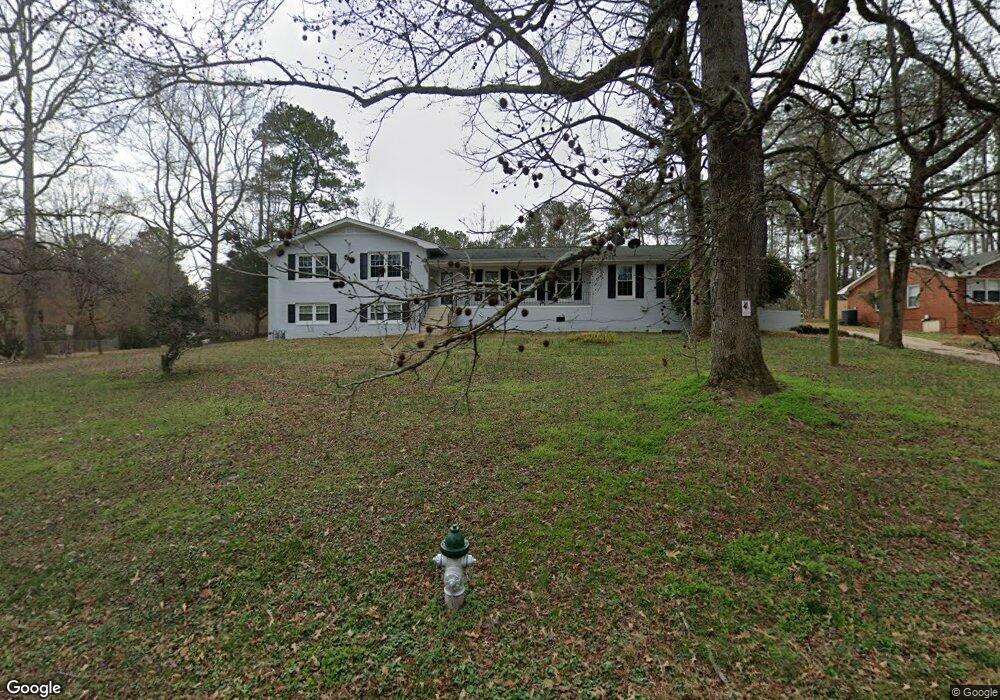
1760 Newton Bridge Rd Athens, GA 30607
Estimated Value: $328,000 - $440,000
4
Beds
3
Baths
2,304
Sq Ft
$167/Sq Ft
Est. Value
About This Home
This home is located at 1760 Newton Bridge Rd, Athens, GA 30607 and is currently estimated at $385,483, approximately $167 per square foot. 1760 Newton Bridge Rd is a home located in Clarke County with nearby schools including Fowler Drive Elementary School, Coile Middle School, and Cedar Shoals High School.
Ownership History
Date
Name
Owned For
Owner Type
Purchase Details
Closed on
Nov 12, 2024
Sold by
Lopez Adalberto
Bought by
Farmer Louise
Current Estimated Value
Purchase Details
Closed on
Aug 10, 2012
Sold by
Moore Leiland Kenneth
Bought by
Lopez Adalberto
Purchase Details
Closed on
Aug 1, 2012
Sold by
Coile Brantley
Bought by
Moore Leiland Kenneth and Moore James Steverson
Purchase Details
Closed on
Apr 19, 2012
Sold by
Parham Deena Coile
Bought by
Moore Leiland Kenneth and Moore James Steverson
Create a Home Valuation Report for This Property
The Home Valuation Report is an in-depth analysis detailing your home's value as well as a comparison with similar homes in the area
Home Values in the Area
Average Home Value in this Area
Purchase History
| Date | Buyer | Sale Price | Title Company |
|---|---|---|---|
| Farmer Louise | $380,000 | -- | |
| Lopez Adalberto | $100,000 | -- | |
| Moore Leiland Kenneth | -- | -- | |
| Moore Leiland Kenneth | -- | -- | |
| Moore Leiland Kenneth | -- | -- |
Source: Public Records
Tax History Compared to Growth
Tax History
| Year | Tax Paid | Tax Assessment Tax Assessment Total Assessment is a certain percentage of the fair market value that is determined by local assessors to be the total taxable value of land and additions on the property. | Land | Improvement |
|---|---|---|---|---|
| 2024 | $4,701 | $94,290 | $14,000 | $80,290 |
| 2023 | $1,695 | $89,245 | $12,000 | $77,245 |
| 2022 | $1,873 | $68,712 | $10,400 | $58,312 |
| 2021 | $1,539 | $55,672 | $8,000 | $47,672 |
| 2020 | $1,328 | $49,414 | $8,000 | $41,414 |
| 2019 | $1,160 | $44,178 | $8,000 | $36,178 |
| 2018 | $988 | $39,088 | $8,000 | $31,088 |
| 2017 | $0 | $37,247 | $8,000 | $29,247 |
| 2016 | $913 | $36,904 | $8,000 | $28,904 |
| 2015 | $930 | $37,342 | $8,000 | $29,342 |
| 2014 | $895 | $36,247 | $8,000 | $28,247 |
Source: Public Records
Map
Nearby Homes
- 2850 Commerce Rd
- 2680 Commerce Rd
- 425 Bob Holman Rd
- 170 Rocky Dr
- 221 Frederick Dr
- 224 Vineyard Dr
- 256 Frederick Dr
- The Rose Plan at Lantern Walk
- The Hudson Plan at Lantern Walk
- 105 Deupree Ct
- 0 Old Commerce Rd Unit 10617666
- 0 Nowhere Ln Unit 10544151
- 145 Noketchee Dr
- 607 W Vincent Dr
- 404 O'Conner Blvd
- 70 Curry Falls Trail
- 70 Curry Falls Trail Unit Lot 1
- 2A Curry Falls Trail
- 21 Curry Falls Trail
- 1750 Newton Bridge Rd
- 315 Fairlane Dr
- 1810 Newton Bridge Rd
- 1801 Newton Bridge Rd
- 1720 Newton Bridge Rd
- 305 Fairlane Dr
- 115 Almond Dr
- 125 Almond Dr
- 0 Almond Dr Unit 8723207
- 0 Almond Dr Unit 7581633
- 0 Almond Dr
- 300 Fairlane Dr
- 295 Fairlane Dr
- 1680 Newton Bridge Rd
- 100 Almond Dr
- 135 Almond Dr
- 290 Fairlane Dr
- 110 Almond Dr
- 120 Almond Dr
- 285 Fairlane Dr