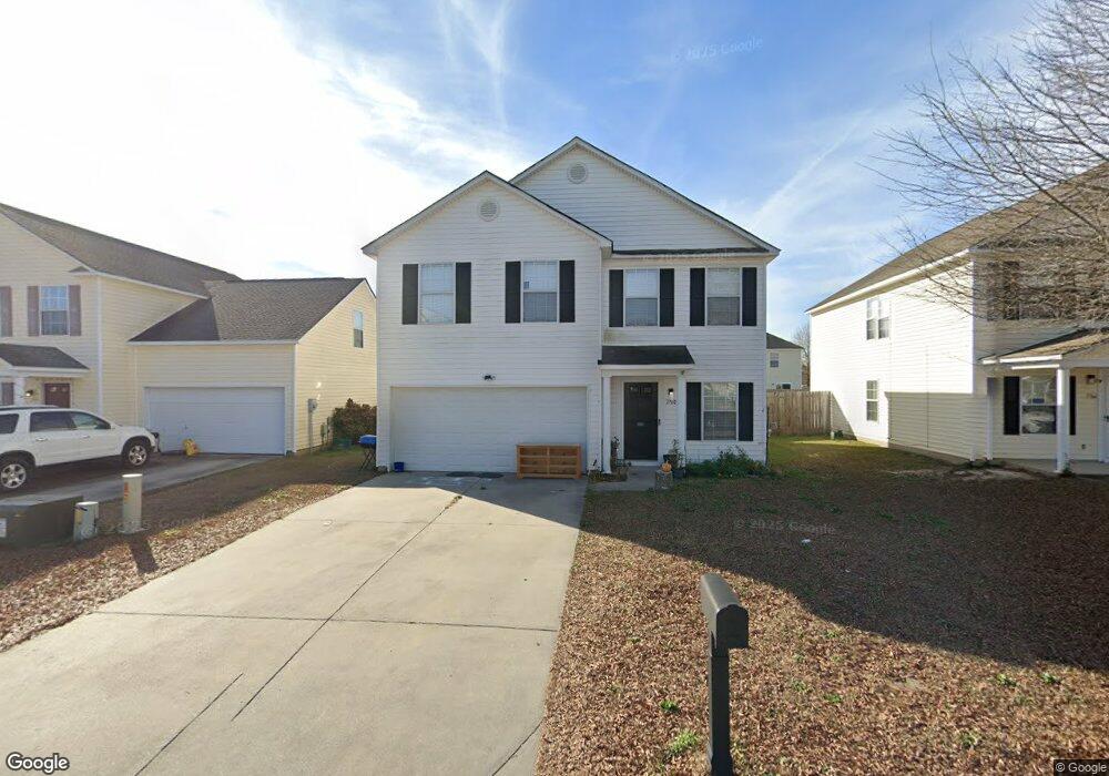
1760 Polaris Dr Sumter, SC 29150
Estimated Value: $225,000 - $255,000
4
Beds
3
Baths
1,841
Sq Ft
$128/Sq Ft
Est. Value
About This Home
This home is located at 1760 Polaris Dr, Sumter, SC 29150 and is currently estimated at $236,483, approximately $128 per square foot. 1760 Polaris Dr is a home located in Sumter County with nearby schools including Oakland Primary School, High Hills Elementary School, and Shaw Heights Elementary School.
Ownership History
Date
Name
Owned For
Owner Type
Purchase Details
Closed on
Apr 21, 2022
Sold by
Ragin Ida J
Bought by
Martin Bailey and Martin Scott Cloud
Current Estimated Value
Home Financials for this Owner
Home Financials are based on the most recent Mortgage that was taken out on this home.
Original Mortgage
$200,508
Outstanding Balance
$186,861
Interest Rate
4.16%
Mortgage Type
VA
Estimated Equity
$49,622
Purchase Details
Closed on
Dec 29, 2021
Sold by
Ragin Ida J and Estate Of Roger B Ragin
Bought by
Ragin Ida J and Ragin Mongomery Letuan
Purchase Details
Closed on
Oct 31, 2014
Sold by
Fannie Mae
Bought by
Ragin Roger B
Home Financials for this Owner
Home Financials are based on the most recent Mortgage that was taken out on this home.
Original Mortgage
$102,000
Interest Rate
4.26%
Mortgage Type
New Conventional
Purchase Details
Closed on
Jun 12, 2014
Sold by
Collins Maryann
Bought by
Federal National Mortgage Association
Purchase Details
Closed on
Apr 25, 2007
Sold by
Firstar Homes Inc
Bought by
Collins James L and Collins Maryann
Home Financials for this Owner
Home Financials are based on the most recent Mortgage that was taken out on this home.
Original Mortgage
$114,300
Interest Rate
6.5%
Mortgage Type
Purchase Money Mortgage
Create a Home Valuation Report for This Property
The Home Valuation Report is an in-depth analysis detailing your home's value as well as a comparison with similar homes in the area
Purchase History
We collect this data history from publicly available records. To have your information removed, we recommend requesting removal directly through your county’s website.
| Date | Buyer | Sale Price | Title Company |
|---|---|---|---|
| Martin Bailey | $196,000 | Mcangus Goudelock & Courie Llc | |
| Ragin Ida J | -- | None Available | |
| Ragin Roger B | $115,000 | -- | |
| Federal National Mortgage Association | $111,103 | -- | |
| Collins James L | $127,000 | None Available |
Source: Public Records
Mortgage History
We collect this data history from publicly available records. To have your information removed, we recommend requesting removal directly through your county’s website.
| Date | Status | Borrower | Loan Amount |
|---|---|---|---|
| Open | Martin Bailey | $200,508 | |
| Previous Owner | Ragin Roger B | $102,000 | |
| Previous Owner | Collins James L | $114,300 |
Source: Public Records
Tax History
| Year | Tax Paid | Tax Assessment Tax Assessment Total Assessment is a certain percentage of the fair market value that is determined by local assessors to be the total taxable value of land and additions on the property. | Land | Improvement |
|---|---|---|---|---|
| 2025 | $4,226 | $7,480 | $1,400 | $6,080 |
| 2024 | $4,226 | $7,480 | $1,400 | $6,080 |
| 2023 | $4,226 | $11,220 | $2,100 | $9,120 |
| 2022 | $3,711 | $9,910 | $1,200 | $8,710 |
| 2021 | $1,223 | $6,600 | $800 | $5,800 |
| 2020 | $1,228 | $6,220 | $1,000 | $5,220 |
| 2019 | $1,218 | $6,220 | $1,000 | $5,220 |
| 2018 | $1,173 | $6,220 | $1,000 | $5,220 |
| 2017 | $1,197 | $6,220 | $1,000 | $5,220 |
| 2016 | $1,215 | $6,220 | $1,000 | $5,220 |
| 2015 | $2,896 | $6,120 | $840 | $5,280 |
| 2014 | $2,896 | $7,690 | $1,140 | $6,550 |
| 2013 | -- | $7,690 | $1,140 | $6,550 |
Source: Public Records
Map
Nearby Homes
- 1749 Polaris Dr
- 1766 Polaris Dr
- 2766 Magnum Dr
- 1808 Polaris Dr
- 1727 Musket Trail
- 1776 Musket Trail
- 1775 Ruger Dr
- 1786 Ruger Dr
- 1816 Ruger Dr
- 1751 Canopy Dr
- 1763 Canopy Dr
- 1769 Canopy Dr
- 2895 Old Field Rd
- 1773 Camazay Dr
- 1754 Canopy Dr
- 1766 Canopy Dr
- 1853 Payne Dr
- 2801 Broad St
- 2943 Old Field Rd
- 1862 Gabriel Ln
- 1755 Polaris Dr
- 1743 Polaris Dr
- 1737 Polaris Dr
- 1740 Benelli St
- 1761 Polaris Dr
- 1732 Benelli St
- 1732 Benelli St
- 1748 Benelli St
- 1756 Benelli St
- 1756 Benelli St
- 1724 Benelli St
- 1756 Benelli St
- 1724 Benelli St
- 1731 Polaris Dr
- 1748 Polaris Dr
- 1767 Polaris Dr
- 1748 Polaris Dr
- 1754 Polaris Dr
- 1742 Polaris Dr
- 1764 Benelli St
Your Personal Tour Guide
Ask me questions while you tour the home.