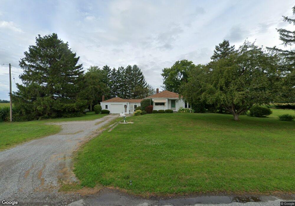
1760 S Airport Rd Saginaw, MI 48601
Estimated Value: $113,874 - $159,000
3
Beds
1
Bath
1,056
Sq Ft
$128/Sq Ft
Est. Value
About This Home
This home is located at 1760 S Airport Rd, Saginaw, MI 48601 and is currently estimated at $135,219, approximately $128 per square foot. 1760 S Airport Rd is a home located in Saginaw County with nearby schools including Thomas White School, Iuka Elementary School, and Martin G. Atkins Elementary School.
Ownership History
Date
Name
Owned For
Owner Type
Purchase Details
Closed on
Jul 17, 2013
Sold by
Miller Sandra
Bought by
Abraham Rachel
Current Estimated Value
Home Financials for this Owner
Home Financials are based on the most recent Mortgage that was taken out on this home.
Original Mortgage
$50,000
Outstanding Balance
$11,825
Interest Rate
3.93%
Mortgage Type
Purchase Money Mortgage
Estimated Equity
$123,394
Purchase Details
Closed on
Nov 4, 2011
Sold by
Schuler Margaret
Bought by
Schuler Margaret A and Margaret A Schuler Trust No 1 Dated Nove
Create a Home Valuation Report for This Property
The Home Valuation Report is an in-depth analysis detailing your home's value as well as a comparison with similar homes in the area
Home Values in the Area
Average Home Value in this Area
Purchase History
| Date | Buyer | Sale Price | Title Company |
|---|---|---|---|
| Abraham Rachel | $62,500 | Uaw Gm Legal Services Plan | |
| Schuler Margaret A | -- | -- | |
| Schuler Margaret | -- | -- | |
| Schuler Louis W | -- | -- |
Source: Public Records
Mortgage History
| Date | Status | Borrower | Loan Amount |
|---|---|---|---|
| Open | Abraham Rachel | $50,000 |
Source: Public Records
Tax History Compared to Growth
Tax History
| Year | Tax Paid | Tax Assessment Tax Assessment Total Assessment is a certain percentage of the fair market value that is determined by local assessors to be the total taxable value of land and additions on the property. | Land | Improvement |
|---|---|---|---|---|
| 2025 | $1,821 | $52,900 | $0 | $0 |
| 2024 | $649 | $49,300 | $0 | $0 |
| 2023 | $617 | $43,000 | $0 | $0 |
| 2022 | $1,588 | $37,200 | $0 | $0 |
| 2021 | $1,478 | $33,800 | $0 | $0 |
| 2020 | $1,454 | $33,800 | $0 | $0 |
| 2019 | $1,404 | $34,000 | $4,500 | $29,500 |
| 2018 | $460 | $32,600 | $0 | $0 |
| 2017 | $1,268 | $32,300 | $0 | $0 |
| 2016 | $1,158 | $29,700 | $0 | $0 |
| 2014 | -- | $30,400 | $0 | $25,900 |
| 2013 | -- | $29,600 | $0 | $0 |
Source: Public Records
Map
Nearby Homes
- 1579 Joy St
- 4694 King Rd
- 5050 Carnegie St
- 5032 Akron St
- 1765 Ribble St
- 1840 Ribble St
- 1815 Mack Rd
- 3299 Mysylvia Dr
- 3172 Mysylvia Dr
- 4051 Old King Rd
- 3780 Mack Rd
- 3289 Westbrook St
- 3524 Chalmers Rd
- 4764 Hess Rd
- 2950 Arlington Dr
- 1337 Woodside St
- 1380 Woodside St
- 3306 Burlington Dr
- 1932 S Outer Dr
- 4636 N Gregory St
- 5990 Hess Rd
- 1480 S Airport Rd
- 6064 Hess Rd
- 5985 Hess Rd
- 5929 Hess Rd
- 1460 S Airport Rd
- 5800 Hess Rd
- 1451 S Airport Rd
- 1446 S Airport Rd
- 5790 Hess Rd
- 1432 S Airport Rd
- 1431 S Airport Rd
- 1420 S Airport Rd
- 6100 Hess Rd
- 6100 Hess Rd
- 1408 S Airport Rd
- 1396 S Airport Rd
- 1395 S Airport Rd
- 1384 S Airport Rd
- 6134 Hess Rd