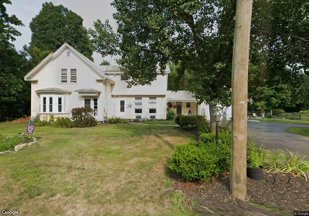
1760 West St Mansfield, MA 02048
Estimated Value: $646,000 - $718,000
5
Beds
2
Baths
2,360
Sq Ft
$293/Sq Ft
Est. Value
About This Home
This home is located at 1760 West St, Mansfield, MA 02048 and is currently estimated at $691,780, approximately $293 per square foot. 1760 West St is a home located in Bristol County with nearby schools including Everett W. Robinson Elementary School, Jordan/Jackson Elementary School, and Harold L. Qualters Middle School.
Ownership History
Date
Name
Owned For
Owner Type
Purchase Details
Closed on
Mar 19, 2004
Sold by
James-Scott Eunice M and Scott Michael D C
Bought by
Kellicker-Spagna Amy and Spagna Paul J
Current Estimated Value
Home Financials for this Owner
Home Financials are based on the most recent Mortgage that was taken out on this home.
Original Mortgage
$300,000
Outstanding Balance
$139,525
Interest Rate
5.71%
Mortgage Type
Purchase Money Mortgage
Estimated Equity
$552,255
Purchase Details
Closed on
May 25, 2000
Sold by
Chambers Anne M
Bought by
Scott Michael Dc and James-Scott Eunice M
Create a Home Valuation Report for This Property
The Home Valuation Report is an in-depth analysis detailing your home's value as well as a comparison with similar homes in the area
Home Values in the Area
Average Home Value in this Area
Purchase History
| Date | Buyer | Sale Price | Title Company |
|---|---|---|---|
| Kellicker-Spagna Amy | $375,000 | -- | |
| Scott Michael Dc | $220,000 | -- |
Source: Public Records
Mortgage History
| Date | Status | Borrower | Loan Amount |
|---|---|---|---|
| Open | Kellicker-Spagna Amy | $300,000 | |
| Previous Owner | Scott Michael Dc | $66,000 | |
| Previous Owner | Scott Michael Dc | $43,000 | |
| Previous Owner | Scott Michael Dc | $275,000 |
Source: Public Records
Tax History Compared to Growth
Tax History
| Year | Tax Paid | Tax Assessment Tax Assessment Total Assessment is a certain percentage of the fair market value that is determined by local assessors to be the total taxable value of land and additions on the property. | Land | Improvement |
|---|---|---|---|---|
| 2025 | $7,434 | $564,500 | $243,900 | $320,600 |
| 2024 | $7,482 | $554,200 | $243,900 | $310,300 |
| 2023 | $7,199 | $510,900 | $243,900 | $267,000 |
| 2022 | $7,110 | $468,700 | $225,800 | $242,900 |
| 2021 | $4,663 | $432,300 | $197,600 | $234,700 |
| 2020 | $6,020 | $391,900 | $188,200 | $203,700 |
| 2019 | $5,893 | $387,200 | $156,700 | $230,500 |
| 2018 | $5,361 | $369,700 | $149,500 | $220,200 |
| 2017 | $3,939 | $361,400 | $145,300 | $216,100 |
| 2016 | $5,284 | $342,900 | $138,300 | $204,600 |
| 2015 | $5,044 | $325,400 | $138,300 | $187,100 |
Source: Public Records
Map
Nearby Homes
- 150 Gilbert St
- 24 Maverick Dr
- 255 Mckeon Dr
- 196 Donald Tennant Cir
- 4 Buckskin Dr
- 11 Landry Ave
- 115 Westfield Dr
- 116 George St
- 57 Vine St
- 11 Buckthorn Ln
- 5 Old Wood Rd
- 176 Elm St
- 451R Gilbert St
- Lot 5 Jeffrey Dr
- Lot 2 Jeffrey Dr
- 2 Oak St Unit 2D
- 2 Oak St Unit 2A
- 2 Oak St Unit 2C
- 2 Oak St Unit 2B
- 28 Messenger St