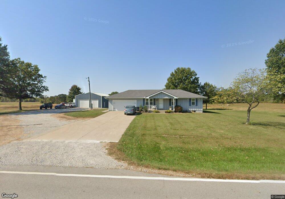
17600 S State Route E Pleasant Hill, MO 64080
Estimated Value: $233,000 - $337,026
3
Beds
2
Baths
1,008
Sq Ft
$293/Sq Ft
Est. Value
About This Home
This home is located at 17600 S State Route E, Pleasant Hill, MO 64080 and is currently estimated at $295,009, approximately $292 per square foot. 17600 S State Route E is a home located in Cass County.
Ownership History
Date
Name
Owned For
Owner Type
Purchase Details
Closed on
Aug 28, 2014
Sold by
Stanley Robert P
Bought by
Brammer Rhett
Current Estimated Value
Home Financials for this Owner
Home Financials are based on the most recent Mortgage that was taken out on this home.
Original Mortgage
$165,306
Outstanding Balance
$126,693
Interest Rate
4.17%
Mortgage Type
New Conventional
Estimated Equity
$168,316
Purchase Details
Closed on
Jan 10, 2006
Sold by
Stanley Charlotte A
Bought by
Stanley Robert P
Create a Home Valuation Report for This Property
The Home Valuation Report is an in-depth analysis detailing your home's value as well as a comparison with similar homes in the area
Home Values in the Area
Average Home Value in this Area
Purchase History
| Date | Buyer | Sale Price | Title Company |
|---|---|---|---|
| Brammer Rhett | -- | Kansas City Title Inc | |
| Stanley Robert P | -- | -- |
Source: Public Records
Mortgage History
| Date | Status | Borrower | Loan Amount |
|---|---|---|---|
| Open | Brammer Rhett | $165,306 |
Source: Public Records
Tax History Compared to Growth
Tax History
| Year | Tax Paid | Tax Assessment Tax Assessment Total Assessment is a certain percentage of the fair market value that is determined by local assessors to be the total taxable value of land and additions on the property. | Land | Improvement |
|---|---|---|---|---|
| 2024 | $1,694 | $24,470 | $4,700 | $19,770 |
| 2023 | $1,689 | $24,470 | $4,700 | $19,770 |
| 2022 | $1,492 | $21,360 | $4,700 | $16,660 |
| 2021 | $1,472 | $21,360 | $4,700 | $16,660 |
| 2020 | $1,460 | $21,740 | $4,700 | $17,040 |
| 2019 | $1,439 | $21,740 | $4,700 | $17,040 |
| 2018 | $1,298 | $19,420 | $3,760 | $15,660 |
| 2017 | $1,245 | $19,420 | $3,760 | $15,660 |
| 2016 | $1,245 | $18,600 | $3,760 | $14,840 |
| 2015 | $1,262 | $18,600 | $3,760 | $14,840 |
| 2014 | $1,268 | $18,600 | $3,760 | $14,840 |
| 2013 | -- | $18,600 | $3,760 | $14,840 |
Source: Public Records
Map
Nearby Homes
- 15800 S State Route 7
- 33701 E State Route 58
- 312 N East Hwy
- Lot 10 Snyder Rd
- Lot 9 Snyder Rd
- 36404 E County Line Rd
- Lot 8 Snyder Rd
- Lot 7 Snyder Rd
- Lot 4 Snyder Rd
- Lot 6 Snyder Rd
- Lot 5 Snyder Rd
- 0 E County Line Rd
- 17806 Red Bud Cir
- 32204 E County Line Rd
- 902 Buckeye Ln
- 35001 E Stringtown Rd
- 1809 Alpine Dr
- 1604 Fairway Ct
- 33604 E Stringtown Rd
- 1528 Champion Dr Unit 1530
- 17508 S State Route E
- 17322 S State Route E
- 17321 S State Route E Rural Route
- 17321 S State Route East Rural Route
- 35504 E 179th St
- 17512 S Reynolds Rd
- 35407 E 179th St
- 17324 S Reynolds Rd
- 17925 E State Route E
- 34800 E 179th St
- 17501 S Reynolds Rd
- 31809 B E State Rt 2 Hwy
- 31809 A E State Rt 2 Hwy
- 17923 E State Route E
- 0 E 179th St Unit 2078472
- 0 E 179th St Unit 1757621
- 0 E 179th St Unit 1769310
- 0 E 179th St Unit 1850516
- 0 E 179 St Unit 1906884
- 00 E 179th St