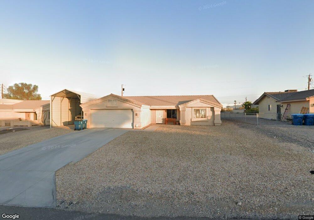
1761 Beavertail Dr Lake Havasu City, AZ 86403
Estimated Value: $449,000 - $534,000
3
Beds
1
Bath
1,469
Sq Ft
$331/Sq Ft
Est. Value
About This Home
This home is located at 1761 Beavertail Dr, Lake Havasu City, AZ 86403 and is currently estimated at $486,529, approximately $331 per square foot. 1761 Beavertail Dr is a home located in Mohave County with nearby schools including Smoketree Elementary School, Thunderbolt Middle School, and Lake Havasu High School.
Ownership History
Date
Name
Owned For
Owner Type
Purchase Details
Closed on
Feb 22, 2007
Sold by
Lockwood Dale A and Morlan Rella N
Bought by
Lockwood Dale A and Morlan Rella N
Current Estimated Value
Purchase Details
Closed on
May 25, 2001
Sold by
Bolten J P and Bolten Vivian
Bought by
Lockwood Dale A and Morlan Rella N
Home Financials for this Owner
Home Financials are based on the most recent Mortgage that was taken out on this home.
Original Mortgage
$9,900
Outstanding Balance
$3,729
Interest Rate
7.15%
Mortgage Type
Seller Take Back
Estimated Equity
$482,800
Create a Home Valuation Report for This Property
The Home Valuation Report is an in-depth analysis detailing your home's value as well as a comparison with similar homes in the area
Home Values in the Area
Average Home Value in this Area
Purchase History
| Date | Buyer | Sale Price | Title Company |
|---|---|---|---|
| Lockwood Dale A | -- | None Available | |
| Lockwood Dale A | $14,900 | First American Title |
Source: Public Records
Mortgage History
| Date | Status | Borrower | Loan Amount |
|---|---|---|---|
| Open | Lockwood Dale A | $9,900 |
Source: Public Records
Tax History Compared to Growth
Tax History
| Year | Tax Paid | Tax Assessment Tax Assessment Total Assessment is a certain percentage of the fair market value that is determined by local assessors to be the total taxable value of land and additions on the property. | Land | Improvement |
|---|---|---|---|---|
| 2026 | -- | -- | -- | -- |
| 2025 | $1,566 | $34,430 | $0 | $0 |
| 2024 | $1,566 | $48,178 | $0 | $0 |
| 2023 | $1,566 | $35,443 | $0 | $0 |
| 2022 | $1,508 | $29,701 | $0 | $0 |
| 2021 | $1,709 | $26,274 | $0 | $0 |
| 2019 | $1,624 | $24,082 | $0 | $0 |
| 2018 | $1,570 | $22,467 | $0 | $0 |
| 2017 | $1,543 | $22,273 | $0 | $0 |
| 2016 | $1,367 | $20,531 | $0 | $0 |
| 2015 | $1,331 | $18,171 | $0 | $0 |
Source: Public Records
Map
Nearby Homes
- 1760/1776 Swanson
- 1760 Swanson Ave
- 1776 Swanson Ave
- 1661 Magnolia Dr Unit 2
- 1660 Swanson Ave Unit 3-1
- 1806 Swanson Ave Unit 205
- 1806 Swanson Ave Unit 103
- 1806 Swanson Ave Unit 226
- 1806 Swanson Ave Unit 108
- 189 Sunflower Dr
- 0000 Horizon Plan On Your Lot
- 211 Columbine Dr
- 1910 Swanson Ave Unit A22
- 1910 Swanson Ave Unit B11
- 1910 Swanson Ave Unit B19
- 256 Lake Havasu Ave S Unit B75
- 256 Lake Havasu Ave S Unit C57
- 256 Lake Havasu Ave S Unit C44
- 256 Lake Havasu Ave S Unit B67
- 256 Lake Havasu Ave S Unit A42
- 1755 Beavertail Dr
- 1767 Beavertail Dr
- 1694 Magnolia Dr
- 1694 Magnolia Dr
- 1751 Beavertail Dr
- 1773 Beavertail Dr
- 1682 Magnolia
- 1718 Magnolia Dr
- 1758 Beavertail Dr
- 1750 Beavertail Dr
- 21213 Magnolia Dr
- 1779 Beavertail Dr
- 1747 Beavertail Dr
- 1776 Beavertail Dr
- 1740 Magnolia Dr
- 1746 Beavertail Dr
- 1785 Beavertail Dr
- 1755 Cliffrose Dr
- 1707 Magnolia Dr
- 1707 Magnolia Dr