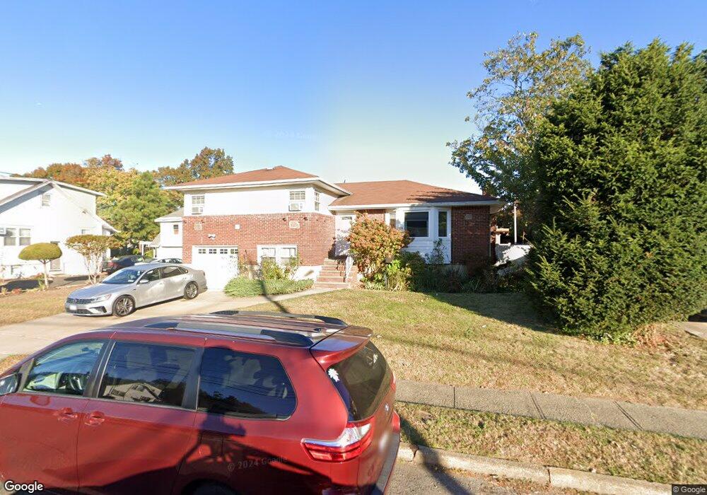
1761 E Berkshire Rd Merrick, NY 11566
Estimated Value: $743,725 - $820,000
--
Bed
3
Baths
1,442
Sq Ft
$542/Sq Ft
Est. Value
About This Home
This home is located at 1761 E Berkshire Rd, Merrick, NY 11566 and is currently estimated at $781,863, approximately $542 per square foot. 1761 E Berkshire Rd is a home located in Nassau County with nearby schools including Merrick Avenue Middle School, Sanford H Calhoun High School, and Grace Christian Academy.
Ownership History
Date
Name
Owned For
Owner Type
Purchase Details
Closed on
Jun 19, 1998
Sold by
Bankers Trust Company Of Calif
Bought by
Rodriguez Ralph and Rodriguez Iris
Current Estimated Value
Purchase Details
Closed on
Mar 4, 1997
Purchase Details
Closed on
Jun 20, 1995
Sold by
Mims Christopher Est
Bought by
Mims Carl
Home Financials for this Owner
Home Financials are based on the most recent Mortgage that was taken out on this home.
Original Mortgage
$136,500
Interest Rate
7.7%
Create a Home Valuation Report for This Property
The Home Valuation Report is an in-depth analysis detailing your home's value as well as a comparison with similar homes in the area
Home Values in the Area
Average Home Value in this Area
Purchase History
| Date | Buyer | Sale Price | Title Company |
|---|---|---|---|
| Rodriguez Ralph | $175,000 | -- | |
| -- | $167,740 | -- | |
| Mims Carl | -- | -- |
Source: Public Records
Mortgage History
| Date | Status | Borrower | Loan Amount |
|---|---|---|---|
| Previous Owner | Mims Carl | $136,500 |
Source: Public Records
Tax History Compared to Growth
Tax History
| Year | Tax Paid | Tax Assessment Tax Assessment Total Assessment is a certain percentage of the fair market value that is determined by local assessors to be the total taxable value of land and additions on the property. | Land | Improvement |
|---|---|---|---|---|
| 2025 | $14,266 | $506 | $184 | $322 |
| 2024 | $3,398 | $485 | $177 | $308 |
| 2023 | $12,651 | $500 | $182 | $318 |
| 2022 | $12,651 | $516 | $188 | $328 |
| 2021 | $17,962 | $522 | $190 | $332 |
| 2020 | $13,970 | $804 | $509 | $295 |
| 2019 | $13,810 | $804 | $509 | $295 |
| 2018 | $12,880 | $1,005 | $0 | $0 |
| 2017 | $10,138 | $1,005 | $636 | $369 |
| 2016 | $14,439 | $1,005 | $636 | $369 |
| 2015 | $3,988 | $1,005 | $636 | $369 |
| 2014 | $3,988 | $1,005 | $636 | $369 |
| 2013 | $3,774 | $1,005 | $636 | $369 |
Source: Public Records
Map
Nearby Homes
- 1674 Birch Dr
- 131 Gregory Ave
- 49 Princeton Place
- 174 Babylon Turnpike
- 1690 Argyle Rd
- 2991 Girard Place
- 54 Beverly Rd
- 1825 Alice St
- 31 Alice St
- 2291 Girard Place
- 2608 Montauk Ave
- 160 Bedford Ave
- 25 Babylon Turnpike
- 96 Beach Dr
- 2 Dorothy Ct
- 10 Dorothy Ct
- 1859 George Ct
- 45 Lakeview Ave
- 2729 Shore Dr
- 204 Hewlett Ave
- 1763 E Berkshire Rd
- 10 E Berkshire Rd
- 1775 E Berkshire Rd
- 115 Dobson Ave
- 1770 E Berkshire Rd
- 11 E Berkshire Rd
- 1 Lee Ct
- 6 Lee Ct
- 2421 Dobson Ave
- 2 Berkshire Rd
- 2 Lee Ct
- 1 Rugby Rd
- 2385 Dobson Ave
- 6 Berkshire Rd
- 1 Berkshire Rd
- 2379 Dobson Ave
- 1733 Rugby Rd
- 108 Dobson Ave
- 1719 Berkshire Rd
- 1719 Berkshire Rd