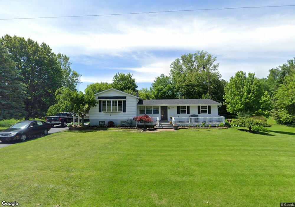
1761 Gady Rd Adrian, MI 49221
Estimated Value: $178,000 - $270,477
5
Beds
3
Baths
1,962
Sq Ft
$118/Sq Ft
Est. Value
About This Home
This home is located at 1761 Gady Rd, Adrian, MI 49221 and is currently estimated at $231,369, approximately $117 per square foot. 1761 Gady Rd is a home located in Lenawee County with nearby schools including Adrian High School.
Ownership History
Date
Name
Owned For
Owner Type
Purchase Details
Closed on
Jul 13, 2018
Sold by
Renner Margette and Reener Kenneth D
Bought by
Debruyne Ryan L
Current Estimated Value
Home Financials for this Owner
Home Financials are based on the most recent Mortgage that was taken out on this home.
Original Mortgage
$127,500
Outstanding Balance
$110,742
Interest Rate
4.6%
Mortgage Type
Unknown
Estimated Equity
$120,627
Purchase Details
Closed on
Apr 8, 2004
Bought by
Renner Kenneth D and Renner Margaret
Create a Home Valuation Report for This Property
The Home Valuation Report is an in-depth analysis detailing your home's value as well as a comparison with similar homes in the area
Home Values in the Area
Average Home Value in this Area
Purchase History
| Date | Buyer | Sale Price | Title Company |
|---|---|---|---|
| Debruyne Ryan L | $150,000 | -- | |
| Renner Margrette | $130,000 | -- | |
| Renner Kenneth D | -- | -- |
Source: Public Records
Mortgage History
| Date | Status | Borrower | Loan Amount |
|---|---|---|---|
| Open | Renner Margrette | $127,500 | |
| Closed | Renner Margrette | $127,500 |
Source: Public Records
Tax History
| Year | Tax Paid | Tax Assessment Tax Assessment Total Assessment is a certain percentage of the fair market value that is determined by local assessors to be the total taxable value of land and additions on the property. | Land | Improvement |
|---|---|---|---|---|
| 2025 | $2,094 | $117,300 | $0 | $0 |
| 2024 | $13 | $112,400 | $0 | $0 |
| 2022 | $1,898 | $91,700 | $0 | $0 |
| 2021 | $1,877 | $84,700 | $0 | $0 |
| 2020 | $1,877 | $78,500 | $0 | $0 |
| 2019 | $171,388 | $73,500 | $0 | $0 |
| 2018 | $1,916 | $73,462 | $0 | $0 |
| 2017 | $1,850 | $70,237 | $0 | $0 |
| 2016 | $1,837 | $64,301 | $0 | $0 |
| 2014 | -- | $58,299 | $0 | $0 |
Source: Public Records
Map
Nearby Homes
- 2082 Friar Tuck Cir
- 4126 Mckenna Dr
- 5679 Catawba Dr
- 4729 Basin St
- 4194 Sauk Trail
- 4329 Mohawk Trail
- 2000 blk Sutton Rd Unit Parcel B
- 2600 Blk Sutton Rd Unit Parcel C
- 4259 Haviland Dr
- 2771 Gady Rd
- 2775 Gady Rd
- 2901 Gady Rd
- 6000 Occidental Hwy Unit 6000 Blk Occidental
- 2829 Sutton Rd
- 1084 Loren Rd
- 2571 E Valley Rd
- 2573 E Valley Rd
- 2577 E Valley Rd
- 3811 Torin Ln Unit Parcel G
- 3311 N Adrian Hwy
Your Personal Tour Guide
Ask me questions while you tour the home.